Best time to go
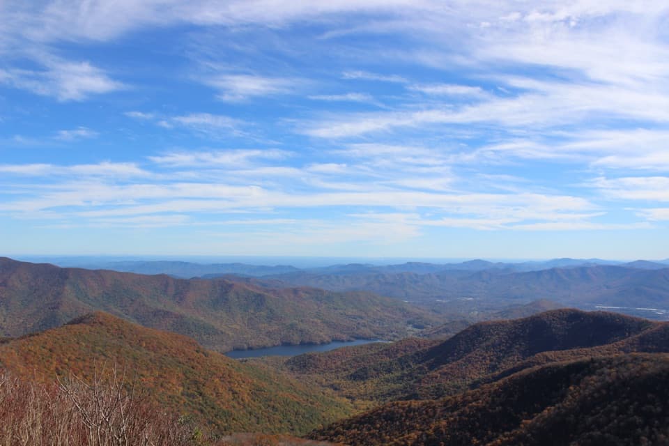
The route starts in northern red oak forest with a thick shrub understory, then opens onto the heath bald. Spring and early summer bring rich birdsong. Summer wildflowers and fall color are two of the mountain’s seasonal highlights.

Sight · Blue Ridge Parkway
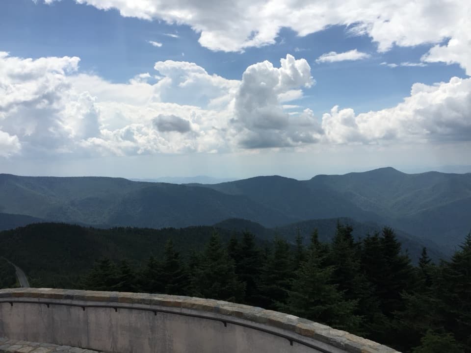
Steep 1.6-mile climb, wide summit views over the French Broad Valley.
Photo: NPS Photo


Overview
Map
Plan your stop

The highest, rockiest slopes around here are a summer buffet for grizzly bears.
Blue Ridge Parkway Tour Guide
Parkwolf is a GPS audio tour guide for Blue Ridge Parkway. As you drive, it chimes in with what’s ahead: hidden gems, upcoming stops, history, geology, and wildlife, right through your car’s speakers.
See the Blue Ridge Parkway audio tourRecorded for this place
Mount Pisgah and Buck Spring Gap: Summit or Lodge Site“You're approaching the Mount Pisgah trailhead, with Buck Spring Gap nearby.”
Plays as you drive up to Mount Pisgah Summit in the Parkwolf Blue Ridge Parkway Tour Guide.
More stories near here in the app
“…We knew we wanted to drive the Blue Ridge Parkway. The narration was impeccably timed. The facts and info provided were meaningful. Without it, the trip would not have been near as awesome.”
Guide
Mount Pisgah is a high Blue Ridge Parkway summit reached by a steep trail, not a roadside pullout. Turn off at milepost 407.6, pass Buck Spring Gap Overlook and continue to the Mount Pisgah Parking Area; the trail starts at the far end of the lot. It is 1.6 miles to the summit with 712 feet of gain, or about 3.2 miles out and back. The second half is steep and rocky. If you do not want the climb, the sidewalk at the lot still gives you a view across rolling mountains.
The larger Mount Pisgah recreation area has a country store, Pisgah Inn and Restaurant, picnic facilities, seasonal restrooms and drinking water. Those are down in the developed area, not at the summit.
The trail ends on a deciduous heath bald. Look across the French Broad River Valley and toward Shining Rock Wilderness; Asheville is visible on clear days. This area often sits under clouds or fog, so a long-range panorama is not guaranteed. For a photo, use the open summit to frame the valley and the darker ridges beyond.
Pisgah takes its name from the biblical mountain from which Moses saw the Promised Land. The earliest recorded use of the name in this area dates to 1808. A local legend credits Rev. James Hall with naming it during Rutherford’s 1776 expedition into the Cherokee Nation.
There is more history nearby on a separate trail. The Buck Spring section of the Mountains-to-Sea Trail runs between the Inn and Buck Spring Gap Parking Area, passing the site of George Vanderbilt’s mountain cabin, Buck Spring Lodge. It is a different walk from the summit route.
Wildlife
 1,214 sightingsBlack BearMost seen around 7 AMSighting map
 1,021 sightingsElkMost seen around 7 AMSighting map
 2,266 sightingsWhite-tailed DeerMost seen around 6 PMSighting map
 200 sightingsCoyoteMost seen around 6 PMSighting map
 1,130 sightingsWild TurkeyMost seen around 7 AMSighting map
 255 sightingsRed-tailed HawkMost seen around 11 AMSighting map
Sighting maps show where each species has been reported across Blue Ridge Parkway. Wildlife moves, so no sighting is guaranteed.
Keep exploring
 ModerateMount Pisgah Trail2.6 mi · 2 hr · 0.7 mi awayRocky final steps earn a broad view over the French Broad Valley.
 ChallengingShut-In Trail16.3 mi · 9 hr · 0.8 mi awayA full-day ridge descent with carriage-road history and valley views.
 ModerateLaurel Mountain Trail7.4 mi · 4.5 hr · 1.1 mi awayA long forest descent through mossy gaps to Yellow Gap Road.
 EasyBuck Spring Trail2.2 mi · 1.3 hr · 1.6 mi awayA gentle forest walk to Vanderbilt’s former lodge site and valley views.
 ModerateFrying Pan Mountain Trail1.5 mi · 1.3 hr · 2.2 mi awayA steady climb to a historic fire tower with broad ridge views.
 ChallengingPilot Rock Trail3.6 mi · 4 hr · 3.1 mi awayA demanding climb to Pilot Rock’s broad mountain view.
 Sight · 0.9 mi awayMount Pisgah OverlookRolling Blue Ridge views from a roadside parking lot.
 Sight · 0.9 mi awayBuck Spring Gap Overlook and Buck Spring Lodge SiteMountain views and a quick walk through Vanderbilt’s old retreat grounds.
 Picnic area · 1 mi awayMount Pisgah Picnic AreaOak-shaded tables, shared grills, and a rhododendron loop.
 Campground · 1.5 mi awayMount Pisgah CampgroundA cool, wooded high-country base beside Parkway trails.
 Lodging · 1.6 mi awayPisgah InnMountain-view dining and lodging above 5,000 feet.
 Scenic pullout · 2.1 mi awayFunnel Top OverlookA quick pull-off for a wide sweep of Blue Ridge ridges.
 Scenic pullout · 2.4 mi awayMills River Valley OverlookTwo valley views and a rocky trail in one roadside stop.
 Sight · 2.5 mi awayFrying Pan Fire TowerA 70-foot lookout caps a steady climb to broad mountain views.
Parkwolf’s Blue Ridge Parkway ranking

The audio tour guide for the drive, plus offline maps, trails, and wildlife heatmaps for when the signal drops.