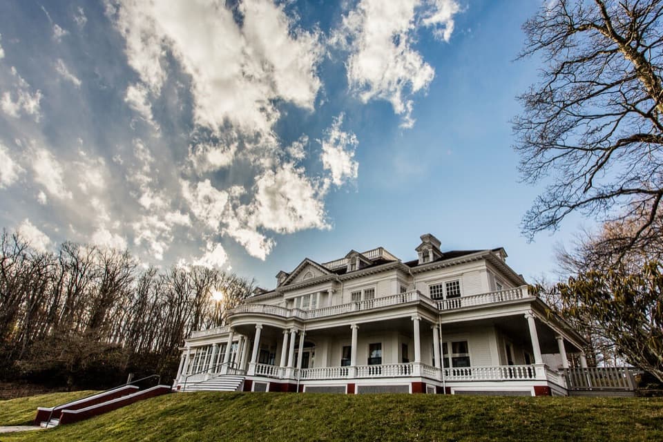
Black Bottom Carriage Trail in Blue Ridge Parkway

Blue Ridge Parkway, NC · VA

Black Bottom Carriage Trail

An easy gravel carriage road through Moses Cone’s mountain estate.

Length
1mi
Time
30min
Elev. change
125ft
Difficulty
Easy
  • Dogs allowed
  • High point 3,734 ft

Hear the audio tour

Moses Cone Manor: House, Crafts and Carriage Roads

Overview

About Black Bottom Carriage Trail

Why go

  • Easy, short walk on a historic gravel carriage road
  • Dogs allowed on leash

Heads up

  • No dedicated Black Bottom parking or confirmed approach distance

Map & elevation

The route

Loading the Blue Ridge Parkway map
Full map
Elevation3,609–3,734 ft
TrailheadBlack Bottom Road at Watkins Road junction (mapped start)36.14651, -81.67857
Keep this map with you offline in the Parkwolf app

Plan your hike

Before you go

Parking

Moses Cone Manor is a main access point for the estate carriage-road network. No dedicated Black Bottom parking point was found. Follow estate wayfinding toward the Watkins Road junction; the approach from general estate parking is additional to the listed mile and its distance is not established.

Safety

Horses share the gravel carriage road with hikers.

7 active Blue Ridge Parkway alerts

  • ClosureWeather closures near Craggy Gardens and southern ParkwayWeather closures block Parkway sections near Craggy Gardens and south of Beech Gap, as well as Mount Mitchell State Park and Heintooga Spur Road; do not enter closed roads. - MP 355.3–375.Official details
  • ClosureHurricane Helene closures and hazards in North CarolinaDo not enter closed Parkway sections, trails, facilities, or adjacent NPS lands in North Carolina; recreation is prohibited in the closed NC Highway 80–Mount Mitchell section. - The MP 344.2–355.Official details
See all 7 alerts
A park ranger sits on a dash-mounted phone, talking, as Parkwolf’s Tour Guide plays “Army Cutworm Moths: A Grizzly Bear Buffet” on Grand Loop Road below Dunraven Pass in Yellowstone
Parkwolf Tour GuideThe highest, rockiest slopes around here are a summer buffet for grizzly bears.

Blue Ridge Parkway Tour Guide

Your drive to Black Bottom Carriage Trail, narrated.

Parkwolf is a GPS audio tour guide for Blue Ridge Parkway. As you drive, it chimes in with what’s ahead: hidden gems, upcoming stops, history, geology, and wildlife, right through your car’s speakers.

See the Blue Ridge Parkway audio tour

Recorded for this trailhead

Moses Cone Manor: House, Crafts and Carriage Roads
0:00 / 0:33
“You're nearing Moses Cone Memorial Park, home to the white, twenty-room Flat Top Manor. Moses and Bertha Cone built it as their summer home in nineteen oh one.”

Plays as you drive up to this trailhead in the Parkwolf Blue Ridge Parkway Tour Guide.

More stories near here in the app

  • Bertha Cone Kept the Estate Running
  • Thunder Hill: Two Sides of the View
  • Sims Pond: A Short Pause or Green Knob Loop
  • Yadkin Valley: A Quick Panorama
  • 298 audio storiesacross Blue Ridge Parkway’s roads, triggered by GPS as you drive
  • Wildlife heatmapsfor Black Bear, Elk, White-tailed Deer, and 13 more
  • Works offlinemaps, 145 trails, 251 places, and audio download before you lose signal
  • CarPlay readysimple controls built for the drive
★★★★★
“…We knew we wanted to drive the Blue Ridge Parkway. The narration was impeccably timed. The facts and info provided were meaningful. Without it, the trip would not have been near as awesome.”
Ashl GApp Store review
Download Parkwolf on the App StoreGet Parkwolf on Google Play

4.7 from 8,600+ ratings

Trail guide

Hiking Black Bottom Carriage Trail

The walkThis easy outing follows the named Black Bottom Road for about 0.5 mile one way.

This easy outing follows the named Black Bottom Road for about 0.5 mile one way. Retrace the section for the listed 1 mile round trip; allow about 30 minutes on this named route. The mapped corridor runs from the Watkins Road junction to the Maze/Apple Barn side.

Getting thereThe saved route starts at the Watkins Road junction and ends at the Maze/Apple Barn-side…

The saved route starts at the Watkins Road junction and ends at the Maze/Apple Barn-side junction. These endpoints follow the estate map and mapped road; route descriptions do not establish a single canonical turnaround. Moses Cone Manor is a main access point for the wider carriage-road network, but any walk from estate parking adds distance not included in the 1-mile figure. No dedicated Black Bottom parking or exact approach distance was found, so use estate wayfinding and confirm the section on the on-site map.

Surface and settingExpect a gravel carriage road through the wooded Moses Cone estate.

Expect a gravel carriage road through the wooded Moses Cone estate. Hikers share the roads with horses and joggers; the wider network also supports cross-country skiing in winter. Dogs are allowed on leash. Moses and Bertha Cone began developing their mountain estate in the mid-1890s, and its carriage-road network spans 25 miles.

Wildlife

Wildlife in Blue Ridge Parkway

All Blue Ridge Parkway wildlife maps

Sighting maps show where each species has been reported across Blue Ridge Parkway. Wildlife moves, so no sighting is guaranteed.

Keep exploring

Near Black Bottom Carriage Trail

See it all on the map

Trails that start nearby

Places near the trailhead

Parkwolf’s Blue Ridge Parkway ranking

Top-rated trails in Blue Ridge Parkway

All 145 trails
  1. 1Sharp Top TrailChallenging · 3 mi
  2. 2Craggy Pinnacle TrailModerate · 0.8 mi
  3. 3Black Balsam Knob TrailModerate · 1.5 mi
  4. 4Humpback Rocks TrailChallenging · 2 mi
  5. 5Rough Ridge TrailModerate · 1.2 mi
  6. 6Erwins View TrailModerate · 1.6 mi

Take Parkwolf to Blue Ridge Parkway.

The audio tour guide for the drive, plus offline maps, trails, and wildlife heatmaps for when the signal drops.

4.7 from 8,600+ ratings

Download Parkwolf on the App StoreGet Parkwolf on Google Play