Horseshoe Canyon West Rim Camping Area in Canyonlands National Park

Campground · Canyonlands National Park

Horseshoe Canyon West Rim Camping Area

A primitive base for the long Great Gallery hike from the rim.

Type
Campground
Nearest trail
Right here
Audio stories
2 nearby
  • Parking
  • Restrooms
  • Trailhead

Hear the audio tour

Horseshoe Canyon and the Great Gallery

Overview

About Horseshoe Canyon West Rim Camping Area

Why stop

  • Start the Great Gallery hike from the west rim.

Heads up

  • No water, and the long dirt-road approach can become impassable when wet.

Map

Where it is

Loading the Canyonlands map
Full map
CampgroundHorseshoe Canyon West Rim Camping Area38.47383, -110.20040
Keep this map with you offline in the Parkwolf app

Plan your stop

Before you go

2 active Canyonlands alerts

  • ClosureRain-damaged Needles backcountry roads impassableRecent rains have made several Needles backcountry roads impassable; do not drive these routes.Official details
  • CautionMaze access roads require high-clearance 4WDOnly use high-clearance 4WD to reach Hans Flat or Horseshoe Canyon in The Maze; low-clearance vehicles are not recommended on these damaged, rutted, muddy routes.Official details

Canyonlands alerts
A park ranger sits on a dash-mounted phone, talking, as Parkwolf’s Tour Guide plays “Army Cutworm Moths: A Grizzly Bear Buffet” on Grand Loop Road below Dunraven Pass in Yellowstone
Parkwolf Tour GuideThe highest, rockiest slopes around here are a summer buffet for grizzly bears.

Canyonlands Tour Guide

Your drive to Horseshoe Canyon West Rim Camping Area, narrated.

Parkwolf is a GPS audio tour guide for Canyonlands National Park. As you drive, it chimes in with what’s ahead: hidden gems, upcoming stops, history, geology, and wildlife, right through your car’s speakers.

See the Canyonlands audio tour

Recorded for this place

Horseshoe Canyon and the Great Gallery
0:00 / 0:28
“You're approaching the west-rim trailhead for Horseshoe Canyon, where the Great Gallery's life-size painted figures are reached on foot.”

Plays as you drive up to Horseshoe Canyon West Rim Camping Area in the Parkwolf Canyonlands Tour Guide.

More stories near here in the app

  • Food and Tools in a Leather Bag
  • 43 audio storiesacross Canyonlands’s roads, triggered by GPS as you drive
  • Wildlife heatmapsfor Bighorn Sheep, Mule Deer, Coyote, and 13 more
  • Works offlinemaps, 63 trails, 65 places, and audio download before you lose signal
  • CarPlay readysimple controls built for the drive
★★★★★
“Fantastic app with many points of information… It’s great to just turn on while you’re driving and it gives you an audio tour of the national Park. We love it!!!!”
JMJamesApp Store review
Download Parkwolf on the App StoreGet Parkwolf on Google Play

4.7 from 8,600+ ratings

Guide

More about Horseshoe Canyon West Rim Camping Area

Camp on the west rimThis is primitive camping on BLM public land at Horseshoe Canyon's west-rim trailhead, just…

This is primitive camping on BLM public land at Horseshoe Canyon's west-rim trailhead, just outside Canyonlands National Park. Use it as a base for the Great Gallery hike: the round trip is about seven miles and takes at least five hours, with a steep 780-foot drop from the rim and a climb back out. A vault toilet is provided, but there's no water; bring your own, with about a gallon per person for the hike.

Plan the driveTwo long dirt approaches reach the trailhead: about 30 miles from UT 24 near Goblin Valley, or…

Two long dirt approaches reach the trailhead: about 30 miles from UT 24 near Goblin Valley, or 47 miles south from Green River. Both can become impassable when wet. Check current road conditions before leaving and use a map rather than trusting GPS.

What lies belowThe trail descends through sheer sandstone walls to cottonwoods along an intermittent stream,…

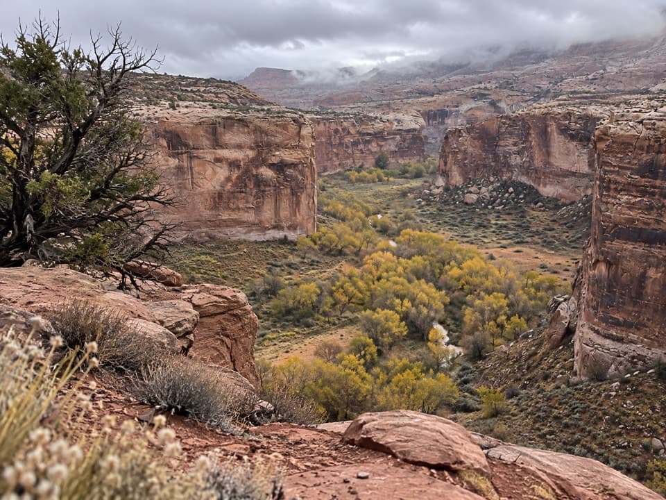
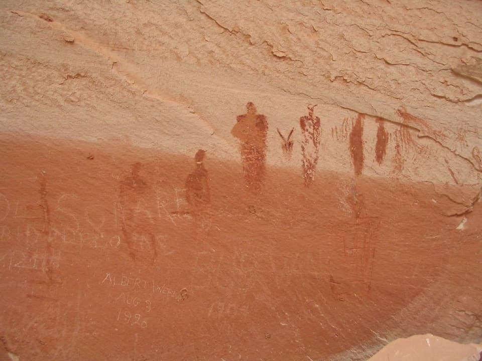
The trail descends through sheer sandstone walls to cottonwoods along an intermittent stream, passing three other significant rock-art panels before the Great Gallery. The Gallery holds painted pictographs and etched petroglyphs, including life-size tapered figures with intricate designs. NPS dates the oldest recovered artifacts to 9000–7000 BCE, places the Barrier Canyon art style around 2000 BCE–500 CE, and says the canyon was abandoned by about 1300 CE.

Wildlife

Wildlife in Canyonlands

All Canyonlands wildlife maps

Sighting maps show where each species has been reported across Canyonlands. Wildlife moves, so no sighting is guaranteed.

Parkwolf’s Canyonlands ranking

Top sights in Canyonlands

All 65 places
  1. 1Mesa ArchSight
  2. 2Grand View PointSight
  3. 3Green River OverlookSight
  4. 4Great GallerySight
  5. 5Upheaval DomeSight
  6. 6Druid ArchSight

Take Parkwolf to Canyonlands.

The audio tour guide for the drive, plus offline maps, trails, and wildlife heatmaps for when the signal drops.

4.7 from 8,600+ ratings

Download Parkwolf on the App StoreGet Parkwolf on Google Play