Halls Creek Overlook in Capitol Reef National Park

Sight · Capitol Reef National Park

Halls Creek Overlook

A far-flung view above a 22-mile backcountry route.

Photo: Flickr
Type
Sight
Nearest trail
Right here
  • Scenic viewpoint
  • Trailhead
Parkwolf audio tour116 stories across Capitol Reef’s roads

Overview

About Halls Creek Overlook

Why stop

  • A wide view into the remote Halls Creek drainage.

Heads up

  • The final approach needs a high-clearance 4WD vehicle.
Halls Creek Overlook is a remote rim viewpoint and trailhead above the Halls Creek drainage in Capitol Reef’s southern Waterpocket District. The park’s listed route from the visitor center is 56.1 miles, and the final roughly 3 miles to the overlook are rough and require high-clearance four-wheel drive. Make it a destination if you want the far-south view or a serious backcountry start; skip the spur if your vehicle isn’t suited to rough roads. Weather can make the unpaved roads impassable, so check conditions before heading out.
Parkwolf’s verdictIs the long drive for you?

Map

Where it is

Loading the Capitol Reef map
Full map
SightHalls Creek Overlook37.71787, -110.93027
Keep this map with you offline in the Parkwolf app

Plan your stop

Before you go

2 active Capitol Reef alerts

  • CautionFlash-flood hazard in canyons and washesHeavy rains can cause sudden flooding in Capitol Reef’s canyons and washes; do not hike or drive through floodwater.Official details
  • CautionE. coli advisory for Fremont River and Sulphur CreekDo not swim in the Fremont River or Sulphur Creek or get water in your mouth: NPS reports elevated E. coli in both waterways, and Utah DEQ has issued a warning advisory. - DEQ reports Sulphur Creek E.Official details

Capitol Reef alerts
A park ranger sits on a dash-mounted phone, talking, as Parkwolf’s Tour Guide plays “Army Cutworm Moths: A Grizzly Bear Buffet” on Grand Loop Road below Dunraven Pass in Yellowstone
Parkwolf Tour GuideThe highest, rockiest slopes around here are a summer buffet for grizzly bears.

Capitol Reef Tour Guide

Your drive to Halls Creek Overlook, narrated.

Parkwolf is a GPS audio tour guide for Capitol Reef National Park. As you drive, it chimes in with what’s ahead: hidden gems, upcoming stops, history, geology, and wildlife, right through your car’s speakers.

See the Capitol Reef audio tour
  • 116 audio storiesacross Capitol Reef’s roads, triggered by GPS as you drive
  • Wildlife heatmapsfor Bighorn Sheep, Mule Deer, Marmot, and 13 more
  • Works offlinemaps, 48 trails, 52 places, and audio download before you lose signal
  • CarPlay readysimple controls built for the drive
★★★★★
“Fantastic app with many points of information… It’s great to just turn on while you’re driving and it gives you an audio tour of the national Park. We love it!!!!”
JMJamesApp Store review
Download Parkwolf on the App StoreGet Parkwolf on Google Play

4.7 from 8,600+ ratings

Guide

More about Halls Creek Overlook

Look across the folded countryThe overlook sits above the Halls Creek drainage, with Hall Mesa to the east and the…

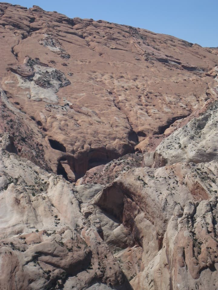
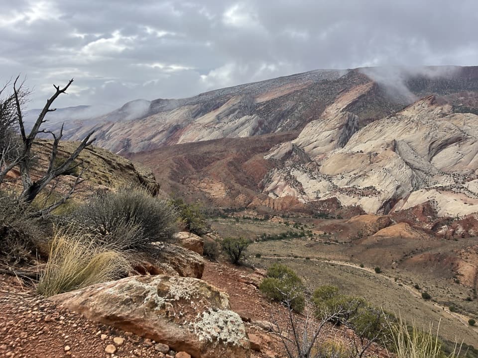
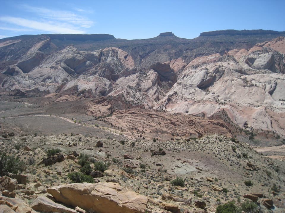
The overlook sits above the Halls Creek drainage, with Hall Mesa to the east and the Waterpocket Fold to the west. The broad view takes in pale, tilted rock layers and open desert between them. For a photo, keep some of the drainage in the foreground with the folded cliffs beyond; the basin gives those layers their scale and context.

The trail down is a separate undertakingA cairned trail drops 800 feet in 1.2 miles from the overlook to the canyon bottom.

A cairned trail drops 800 feet in 1.2 miles from the overlook to the canyon bottom. That steep descent begins the Halls Creek Narrows route, which is 22.4 miles round trip. It’s a substantial backcountry hike, not an easy walk down from the viewpoint. The route beyond is largely unmarked, and the point where it climbs out of the canyon isn’t signed, so note landmarks if you continue.

Plan for a remote stopBring the water, food, fuel, and supplies you need before driving into the southern district.

Bring the water, food, fuel, and supplies you need before driving into the southern district. Cell reception is usually poor or nonexistent, and help may take hours or days. Check current road conditions with the visitor center or by phone before setting out.

Wildlife

Wildlife in Capitol Reef

All Capitol Reef wildlife maps

Sighting maps show where each species has been reported across Capitol Reef. Wildlife moves, so no sighting is guaranteed.

Parkwolf’s Capitol Reef ranking

Top sights in Capitol Reef

All 52 places
  1. 1Hickman BridgeSight
  2. 2Gifford HomesteadSight
  3. 3Fremont PetroglyphsSight
  4. 4Cassidy ArchSight
  5. 5Temples of the Sun and MoonSight
  6. 6Fruita OrchardsSight

Take Parkwolf to Capitol Reef.

The audio tour guide for the drive, plus offline maps, trails, and wildlife heatmaps for when the signal drops.

4.7 from 8,600+ ratings

Download Parkwolf on the App StoreGet Parkwolf on Google Play