Parking
Start at Halls Creek Overlook, reached from the Burr Trail Road by the Halls Creek Overlook spur. The final 3 miles are rough and require high-clearance 4WD; check current road conditions with the park.
Capitol Reef National Park, UT
A 4.6-mile arch hike with a steep return and possible swim.
Overview
Map & elevation
Plan your hike

The highest, rockiest slopes around here are a summer buffet for grizzly bears.
Capitol Reef Tour Guide
Parkwolf is a GPS audio tour guide for Capitol Reef National Park. As you drive, it chimes in with what’s ahead: hidden gems, upcoming stops, history, geology, and wildlife, right through your car’s speakers.
See the Capitol Reef audio tour“Fantastic app with many points of information… It’s great to just turn on while you’re driving and it gives you an audio tour of the national Park. We love it!!!!”


Trail guide
Brimhall Natural Bridge is a 4.6-mile out-and-back, measured round trip from Halls Creek Overlook to the base of the double arch. Allow 3–5 hours; about four is a useful plan. I’d save it for hikers comfortable with a remote, unmarked route, steep climbing and technical moves. The destination is striking, but this is a serious day hike, not a casual walk to an arch. Reaching the bridge may involve a deep swim, and the return climb is hard.
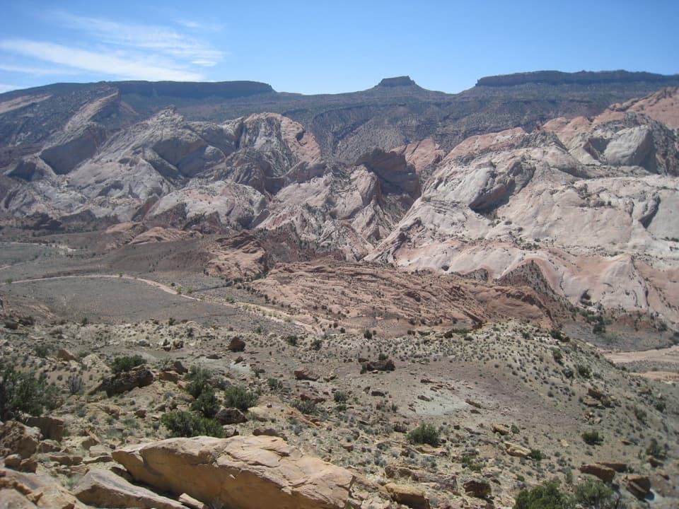
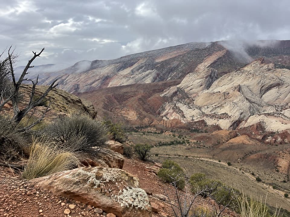
The first view opens from Halls Creek Overlook across the Waterpocket Fold; on a clear sightline, you may pick out the arch far below. A cairned path drops about 800 feet over 1.2 miles to Halls Creek. Mark the spot where you leave the drainage: the turn back up to the overlook isn’t signed, and it’s easy to walk past. Cross the creek and follow the wash downstream into Brimhall’s side canyon. Much of the route beyond the descent is unmarked. Return the same way, finishing with the steep climb to the overlook.
A rock stack is used to bypass a dryfall in the side canyon; it can be unstable, especially on the way down. Farther in, a deep pool may require swimming, followed by exposed, hands-on scrambling. Pool depth changes over time, and the water can be very cold. Don’t assume there’s a dry bypass. If the water, footing or scramble is beyond your ability, turn back. The route reaches the arch’s base and view; it doesn’t require climbing onto the formation.
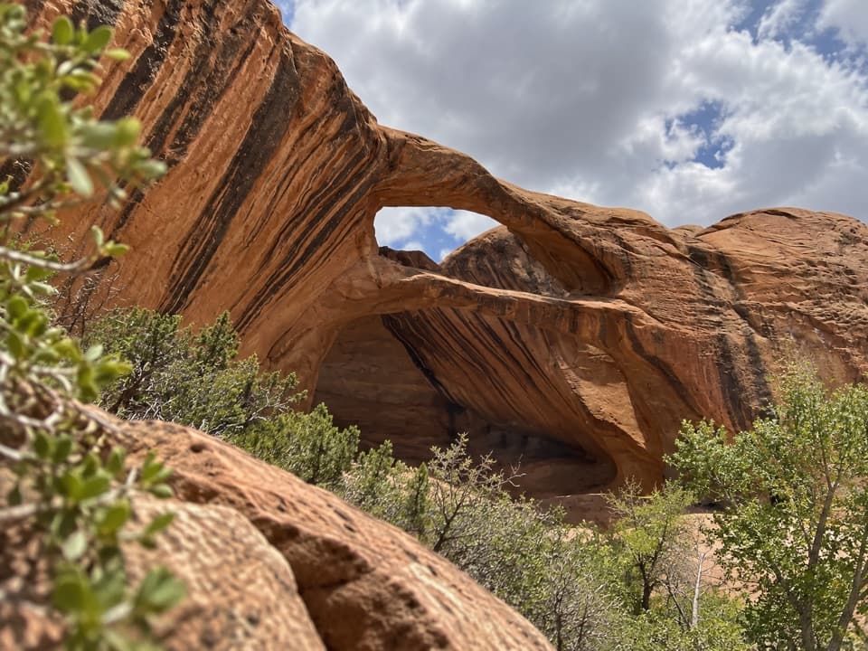
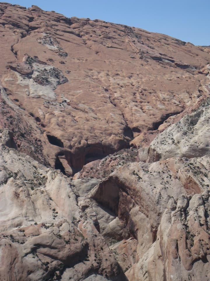
Brimhall is a pothole-style double arch in Navajo sandstone. From below, you see the paired openings set into the canyon wall. At Halls Creek Overlook, a telephoto view can pick out the arch beneath the much wider sweep of the Waterpocket Fold; it’s small from there, but that distance gives the scene its scale.
An old wagon road followed Halls Creek, and faint traces remain in parts of the drainage. Those lines help explain the broad wash, but they’re not maintained route markers. The walking route is remote and can be difficult to follow even where the old road is visible.
Wildlife
 50 sightingsBighorn SheepMost seen around 6 PMSighting map
 322 sightingsMule DeerMost seen around 6 PMSighting map
 70 sightingsMarmotMost seen around 7 AMSighting map
 13 sightingsCottontail RabbitMost seen around 7 PMSighting map
 33 sightingsTurkeyMost seen around 6 AMSighting map
 14 sightingsRavenMost seen around 9 AMSighting map
Sighting maps show where each species has been reported across Capitol Reef. Wildlife moves, so no sighting is guaranteed.
Keep exploring
 ChallengingHalls Creek Narrows22.4 mi · 3.5 days · At the trailheadA remote 22.4-mile backpack through a water-filled sandstone canyon.
 ChallengingHalls Creek Overlook Trail2.4 mi · 3 hr · At the trailheadA steep, cairned descent into Halls Creek’s quiet canyon floor.
 EasyCottonwood Tanks3.3 mi · 1.5 hr · 7.9 mi awayAn old wagon track winds to pools below pale sandstone cliffs.
 ChallengingLower Muley Twist Canyon — Post Loop15.4 mi · 10 hr · 8 mi awayA remote 15.4-mile loop of soaring alcoves and a severe exposed climb.
 ModerateHamburger Rocks and Muley Tanks11.7 mi · 6 hr · 8 mi awayLong, unmarked Halls Creek walk to red hoodoos and Muley Tanks.
 EasyHeadquarters Canyon Route2.6 mi · 2.5 hr · 8.4 mi awayA sandy approach opens into a short, striped slot canyon.
 EasySurprise Canyon Route2 mi · 1.5 hr · 8.9 mi awayA short desert walk into a narrow canyon and spiraling pour-off.ChallengingLower Muley Twist Canyon5.9 mi · 5 hr · 10.4 mi awayA remote canyon crossing with a steep exposed climb over the Fold.
Parkwolf’s Capitol Reef ranking

The audio tour guide for the drive, plus offline maps, trails, and wildlife heatmaps for when the signal drops.