East Point in Channel Islands National Park

Sight · Channel Islands National Park

East Point

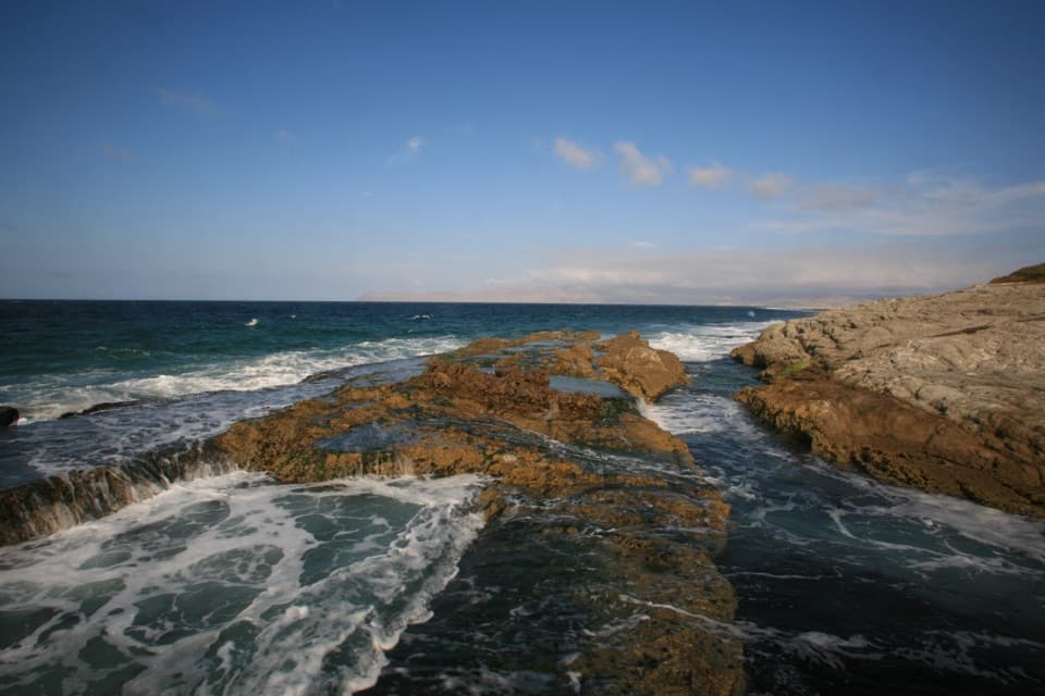
Sandy shore and tidepools at the end of a serious hike.

Type
Sight
Nearest trail
1.3 mi
  • Scenic viewpoint

Overview

About East Point

Why stop

  • Tidepools mixed with sandy shore

Heads up

  • A 16-mile strenuous round trip from Bechers Bay Pier
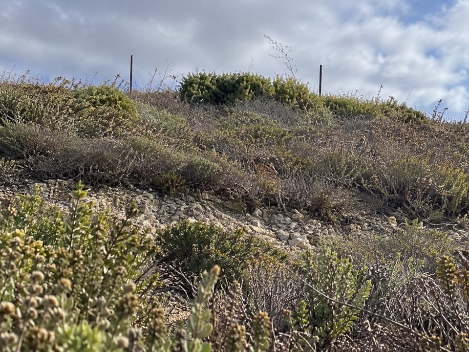
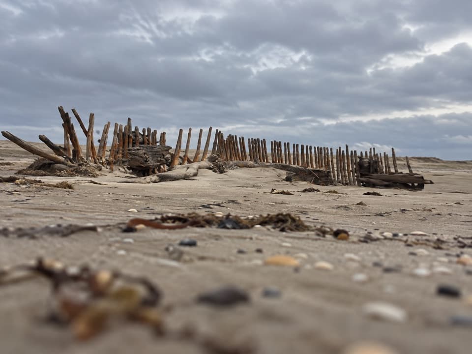
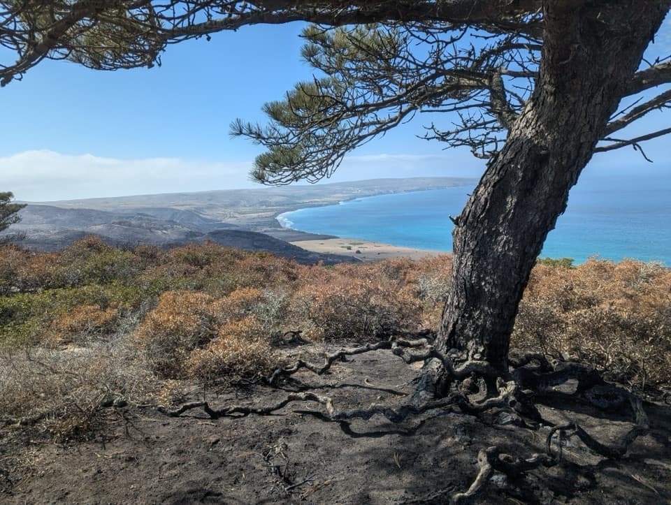
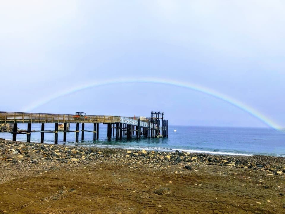
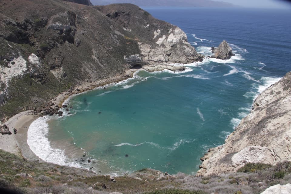
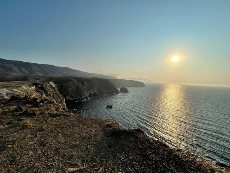
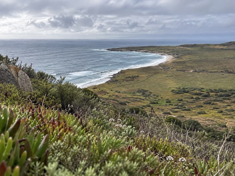
East Point is a headland and shoreline on Santa Rosa Island, known for sandy beaches and rich tidepools. It’s a distinctive coastal stop for visitors who have time for a serious outing: the East Point Hike is 16 miles round trip from Bechers Bay Pier. For photos, keep the curve of shore and low headland in the frame; a tight crop of surf loses what makes this stretch recognizable.
Parkwolf’s verdictA remote shore worth planning for

Map

Where it is

Loading the Channel Islands map
Full map
SightEast Point33.94274, -119.96836
Keep this map with you offline in the Parkwolf app

Plan your stop

Before you go

2 active Channel Islands alerts

  • ClosureSanta Rosa Island wildfire-recovery closuresMentions Santa Rosa Island, referenced in this guideBurned areas on Santa Rosa Island remain closed during wildfire recovery, and Southeast Quadrant backcountry beach camping is closed for the remainder of the 2026 recreation season.Official details
  • InfoSanta Barbara Island dock closed; landings restrictedThe Santa Barbara Island dock is closed; land only on the adjacent rocky ledge.Official details

Channel Islands alerts
A park ranger sits on a dash-mounted phone, talking, as Parkwolf’s Tour Guide plays “Army Cutworm Moths: A Grizzly Bear Buffet” on Grand Loop Road below Dunraven Pass in Yellowstone
Parkwolf Tour GuideThe highest, rockiest slopes around here are a summer buffet for grizzly bears.

Channel Islands Tour Guide

Your drive to East Point, narrated.

Parkwolf is a GPS audio tour guide for Channel Islands National Park. As you drive, it chimes in with what’s ahead: hidden gems, upcoming stops, history, geology, and wildlife, right through your car’s speakers.

See the Channel Islands audio tour
  • 16 audio storiesacross Channel Islands’s roads, triggered by GPS as you drive
  • Wildlife heatmapsfor Island Fox, Humpback Whale, Blue Whale, and 13 more
  • Works offlinemaps, 48 trails, 75 places, and audio download before you lose signal
  • CarPlay readysimple controls built for the drive
★★★★★
“Fantastic app with many points of information… It’s great to just turn on while you’re driving and it gives you an audio tour of the national Park. We love it!!!!”
JMJamesApp Store review
Download Parkwolf on the App StoreGet Parkwolf on Google Play

4.7 from 8,600+ ratings

Guide

More about East Point

Know the distanceThe park rates the route strenuous because of its length.

The park rates the route strenuous because of its length. You can follow the coast or Coastal Road, with beaches and Torrey pines along the way. Santa Rosa is exposed to wind throughout the year, and strong winds are not unusual, so plan around conditions and the time you have ashore.

Protect the back beachesFrom March 1 to September 15, the back beaches and dunes between Skunk Point and just north of…

From March 1 to September 15, the back beaches and dunes between Skunk Point and just north of East Point are closed to hiking while snowy plovers nest. Through that stretch, stay on wet sand below mean high tide or use the road.

A plant with a tiny rangeMunchkin dudleya, a rare succulent found only on Santa Rosa Island, grows in three small…

Munchkin dudleya, a rare succulent found only on Santa Rosa Island, grows in three small colonies near East Point. The island’s one population is about 3,200 plants; it was fenced to protect it from nonnative herbivores and remains under monitoring as it recovers.

A trace of ranching historyEast Point was an early ranch site.

East Point was an early ranch site. The old East Point ranch site was abandoned as ranch operations moved to Bechers Bay.

Wildlife

Wildlife in Channel Islands

All Channel Islands wildlife maps

Sighting maps show where each species has been reported across Channel Islands. Wildlife moves, so no sighting is guaranteed.

Parkwolf’s Channel Islands ranking

Top sights in Channel Islands

All 75 places
  1. 1Inspiration PointSight
  2. 2Scorpion Anchorage and BeachBeach
  3. 3Arch RockSight
  4. 4Potato Harbor OverlookSight
  5. 5Painted CaveSight
  6. 6Cavern PointSight

Take Parkwolf to Channel Islands.

The audio tour guide for the drive, plus offline maps, trails, and wildlife heatmaps for when the signal drops.

4.7 from 8,600+ ratings

Download Parkwolf on the App StoreGet Parkwolf on Google Play