Ballarat Ghost Town in Death Valley National Park

Sight · Death Valley National Park

Ballarat Ghost Town

See what’s left of a gold rush supply town below the Panamints.

Photo: The Greater Southwestern Exploration Company, CC BY 2.0, via Flickr

Type
Sight
  • Store
  • Restrooms

Overview

About Ballarat Ghost Town

Why stop

  • Mining-era ruins in a stark Panamint Valley setting

Heads up

  • Little of the historic town remains; private access is uncertain

Map

Where it is

Loading the Death Valley map
Full map
SightBallarat Ghost Town36.04780, -117.22489
Keep this map with you offline in the Parkwolf app

Plan your stop

Before you go

Getting there

Reach it from Trona-Wildrose Road (CA 178) by a few miles of unpaved road. Reports vary on how rough it is and whether a standard car is comfortable, so check current conditions before making the drive. The townsite is privately owned; confirm visitors are welcome and stay out of buildings and occupied areas unless access is clearly allowed.


4 active Death Valley alerts

  • ClosureRoad closures and hazardous conditionsSeveral park roads are closed or hazardous; follow closures and vehicle restrictions.Official details
  • ClosureSaline Valley Lower Springs closed after wildfireLower Springs pools at Saline Valley Warm Springs remain closed because the September 15 wildfire left safety hazards, including potential hazardous chemicals; do not enter the closed area.Official details
See all 4 alerts
A park ranger sits on a dash-mounted phone, talking, as Parkwolf’s Tour Guide plays “Army Cutworm Moths: A Grizzly Bear Buffet” on Grand Loop Road below Dunraven Pass in Yellowstone
Parkwolf Tour GuideThe highest, rockiest slopes around here are a summer buffet for grizzly bears.

Death Valley Tour Guide

Your drive to Ballarat Ghost Town, narrated.

Parkwolf is a GPS audio tour guide for Death Valley National Park. As you drive, it chimes in with what’s ahead: hidden gems, upcoming stops, history, geology, and wildlife, right through your car’s speakers.

See the Death Valley audio tour
  • 228 audio storiesacross Death Valley’s roads, triggered by GPS as you drive
  • Wildlife heatmapsfor Bighorn Sheep, Desert Tortoise, Coyote, and 13 more
  • Works offlinemaps, 57 trails, 81 places, and audio download before you lose signal
  • CarPlay readysimple controls built for the drive
★★★★★
“Fantastic app with many points of information… It’s great to just turn on while you’re driving and it gives you an audio tour of the national Park. We love it!!!!”
JMJamesApp Store review
Download Parkwolf on the App StoreGet Parkwolf on Google Play

4.7 from 8,600+ ratings

Guide

More about Ballarat Ghost Town

What remainsBallarat is a privately owned gold-rush supply townsite in Panamint Valley, west of Death…

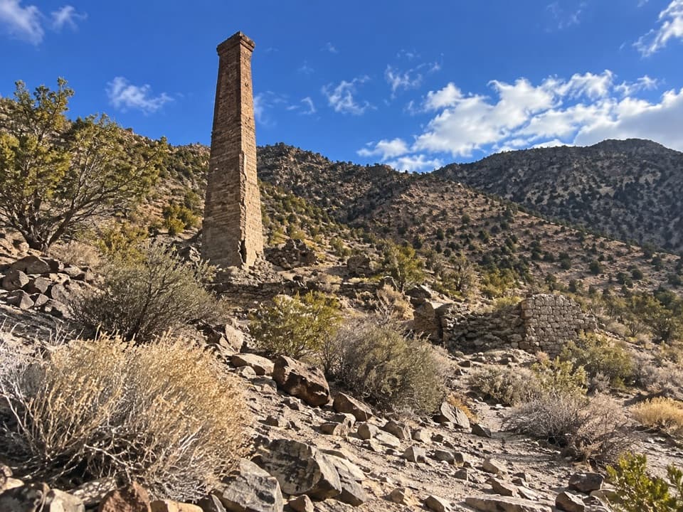
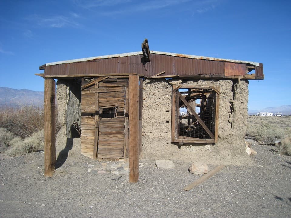
Ballarat is a privately owned gold-rush supply townsite in Panamint Valley, west of Death Valley proper. The surviving stop is a small scatter of weathered adobe and timber buildings and mining-era objects, with the Panamint Mountains rising behind it. I’d treat it as a brief detour if you’re already exploring the valley, not as a full ghost-town tour: visitors repeatedly say only a few structures remain.

What to expectThis is a sparse, informal cluster of ruins and abandoned vehicles, not an intact mining town.

This is a sparse, informal cluster of ruins and abandoned vehicles, not an intact mining town. Its appeal is looking closely at the adobe walls, wood framing, machinery and open valley around them. People looking for a preserved collection of buildings or a formal museum experience may find little to explore.

A gold-mining supply townNPS dates Ballarat’s start to 1897, after gold strikes in the Panamint Mountains.

NPS dates Ballarat’s start to 1897, after gold strikes in the Panamint Mountains. It had about 400 residents in 1898. The Radcliffe mine produced 15,000 tons of gold ore from 1898 to 1903, and the town took its name from the Australian gold town of Ballarat.

The valley settingBallarat sits beneath the Panamint Mountains, with the broad valley opening toward the Argus…

Ballarat sits beneath the Panamint Mountains, with the broad valley opening toward the Argus Range. Frame one of the surviving buildings against the mountains to bring out its rough adobe and timber; a wider view shows how isolated the settlement is.

Store and restroomVisitors report a small trading post and a restroom, but access is inconsistent and neither is…

Visitors report a small trading post and a restroom, but access is inconsistent and neither is assured. Treat them as a bonus rather than dependable food or facilities.

Wildlife

Wildlife in Death Valley

All Death Valley wildlife maps

Sighting maps show where each species has been reported across Death Valley. Wildlife moves, so no sighting is guaranteed.

Parkwolf’s Death Valley ranking

Top sights in Death Valley

All 81 places
  1. 1Badwater BasinSight
  2. 2Zabriskie PointSight
  3. 3Mesquite Flat Sand DunesSight
  4. 4Dantes ViewSight
  5. 5Artists PaletteSight
  6. 6Ubehebe CraterSight

Take Parkwolf to Death Valley.

The audio tour guide for the drive, plus offline maps, trails, and wildlife heatmaps for when the signal drops.

4.7 from 8,600+ ratings

Download Parkwolf on the App StoreGet Parkwolf on Google Play