Pros & cons
PROS
- Front-row views of Striped Butte from a historic stone shelter
- Well-kept, first-come refuge with a fireplace and simple comforts
CONS
- High-clearance 4x4 required on long, rough backcountry roads
- No services of any kind—no water or restrooms—and it may be occupied
Overview
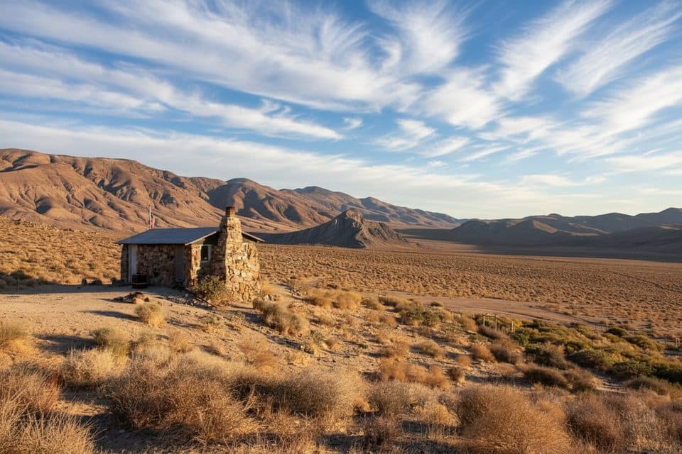
Tucked in Death Valley’s Butte Valley at Anvil Spring, Geologist’s Cabin is the backcountry shelter everyone talks about—a one-room stone cabin facing the banded slopes of Striped Butte. It’s simple and sturdy, with a fireplace, basic furnishings, and even reports of solar lights. Maintained by a community of respectful travelers, it’s one of the park’s best-kept public-use cabins.
Why it’s special
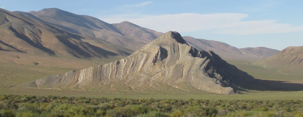
Location, location, location. Step onto the porch and you’re staring straight at Striped Butte with big-sky views across Butte Valley. The cabin’s stone construction gives it a historic feel and practical shelter from wind and weather, and the long-standing tradition is to fly a flag when you’re occupying it so others know it’s taken.
Getting there
This is true backcountry. Most visitors arrive via Goler Wash over Mengel Pass (rocky and steep) or up Warm Springs Canyon (still rough, but the gentler option). Either way, plan on slow going in a high‑clearance 4x4 and complete self‑reliance. The area is far from fuel and services; some trip reports describe this traverse as an all‑day, remote outing with extensive off‑highway mileage.
What you’ll see
Beyond the cabin itself, the star is Striped Butte—those multicolored bands are the valley’s signature view. Around Anvil Spring you may spot wild burros and other desert wildlife, especially near water. Nearby, you’ll find other historic cabin sites and ruins in the valley, adding context to the area’s mining past.
Using the cabin
It’s first‑come, first‑served. If a flag is flying, someone’s home. If you stay, ventilate the cabin before settling in (desert rodents live everywhere in the backcountry), use the fireplace responsibly, and follow Leave No Trace: clean up, pack out everything, and consider leaving a small, sealed, rodent‑proof supply (water, canned goods) for the next traveler. Do not rely on anything being there when you arrive.
What to bring
Bring all your own water, food, sleeping gear, and warmth for cold nights. Carry extra fuel, a first‑aid kit, maps/GPS, and an emergency communication device. A basic cleaning kit and trash bags help keep the cabin in good shape for the next visitor.
Best time to visit
October through April is prime—cooler temps make the roads and a night in the stone cabin far more comfortable. Summer heat makes travel here dangerous. Arrive earlier in the day if you’re hoping to snag the cabin; sunsets and early mornings offer the best light on Striped Butte and the valley.

Where it is
35.9230, -117.0852Tips for Geologist's Cabin
- 01Approach via high-clearance 4x4; Mengel Pass is steep and rocky, Warm Springs is rough but more moderate.
- 02Bring all your own water—do not rely on the spring or any supplies at the cabin.
- 03First-come, first-served; a flying flag signals someone is inside.
- 04Ventilate before use and avoid disturbing rodent nests; clean thoroughly when you leave.
- 05Travel in the cool season and carry extra fuel—there are no nearby services.
Amenities
Near Geologist's Cabin
All places →All trails →
1.9 mi awayStriped ButteBanded desert landmark in remote Butte Valley reached by true 4x4Scenic Viewpoint
9.1 mi awayWarm Springs CampRemote spring oasis with mining ruins on a 4x4 backroadExhibit · Parking
13.5 mi awayPanamint CityRemote ghost town ruins reached by a strenuous canyon hike
17.1 mi awayTelescope PeakDesert high point with sweeping views from Badwater to WhitneyTrailhead · Parking
21.4 mi awaySidewinder CanyonTwisty slot canyons with scrambles, solitude, and route-finding.Challenging · 5 mi · 4 hr
21.4 mi awayWillow Canyon TrailQuiet desert canyon to a rare seasonal waterfall and narrows.Moderate · 4.4 mi · 2.1 hr
22.4 mi awayWildrose Peak TrailShorter path to big Death Valley views from a historic trailheadChallenging · 8.4 mi · 5 hr
27.6 mi awayBadwater Basin Salt FlatsWalk the otherworldly salt polygons at North America’s lowest pointEasy · 1.9 mi · 33 min