Salt Creek Interpretive Site in Death Valley National Park

Trailhead · Death Valley National Park

Salt Creek Interpretive Site

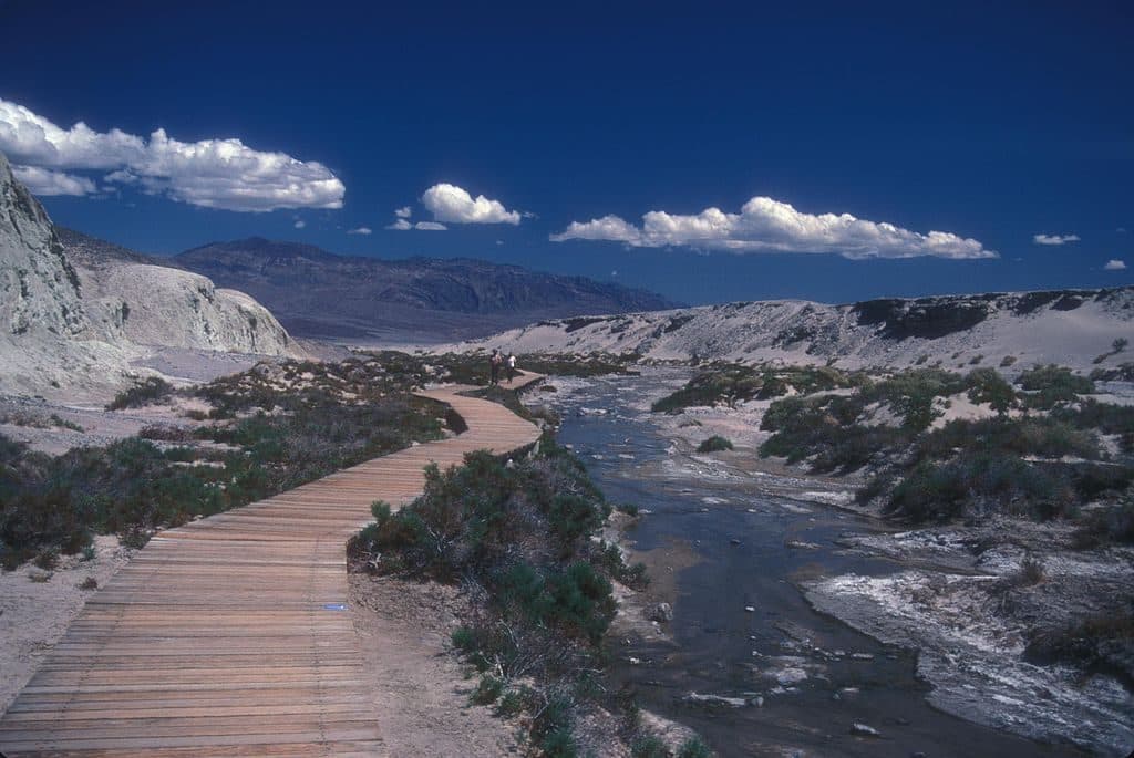
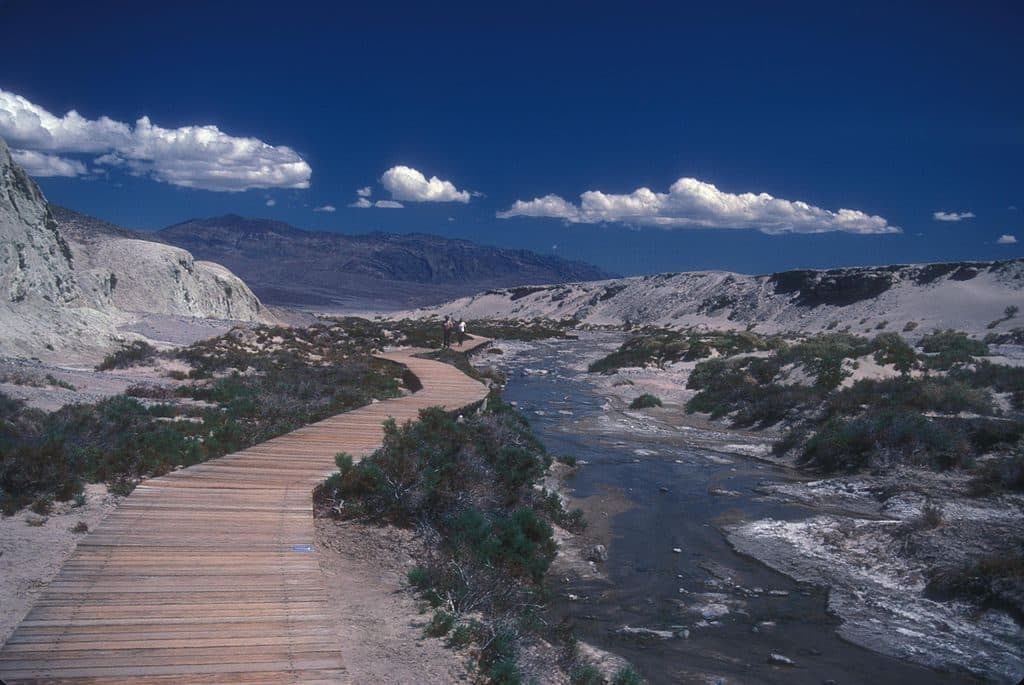
Short boardwalk to a rare desert creek with pupfish

Photo: Wikimedia Commons
Type
Trailhead
Nearest trail
Right here
  • Restrooms
  • Parking
  • Exhibit
Parkwolf audio tour130 stories across Death Valley’s roads

Overview

About Salt Creek Interpretive Site

Salt Creek is one of those gratifyingly low-effort, high-reward stops: a short wooden boardwalk looping through a salty desert creek where life clings on in surprising ways. The path is flat and straightforward, with benches and interpretive panels that make it a mellow wander rather than a hike.

Why stop

  • Rare chance to spot Death Valley pupfish
  • Short, easy boardwalk with informative signs

Heads up

  • Scorching, fully exposed in warm months
  • Water flow and fish activity can be underwhelming in late summer
Year-round water in the heart of this desert is unusual on its own. Add a fish species that survives in salty, hot, highly variable conditions, and you’ve got one of the park’s best quick lessons in adaptation. The boardwalk lets you observe without trampling a fragile habitat.
Parkwolf’s verdictWhy It’s Special

Map

Where it is

Loading the Death Valley map
Full map
TrailheadSalt Creek Interpretive Site36.59059, -116.99072
Keep this map with you offline in the Parkwolf app

Local know-how

Tips for visiting Salt Creek Interpretive Site

  1. Visit late winter through spring for more flow and active pupfish.

  2. Arrive in the morning to beat heat and intermittent crowds.

  3. Walk slowly and scan the shallows; look for quick silver flashes.

  4. Stay on the boardwalk to protect the fragile creek habitat.

  5. Expect a short dirt access road and basic vault toilet at the lot.

Plan your stop

Before you go

Best time to visit

Late winter through spring is the sweet spot: cooler air, more visible flow, and the pupfish’s springtime burst of activity. Midday heat can be punishing much of the year, so aim for mornings. This is a quick stop off Highway 190, so crowding ebbs and flows; early starts keep it peaceful.

3 active Death Valley alerts

  • ClosurePark roads closed or hazardousPlan around multiple closed roads and use extra caution on damaged routes. - Paved roads: North Highway and Beatty Cut-off are closed due to flooding and debris from the October 22 storm.Official details
  • ClosureSaline Valley Lower Springs closed after wildfireLower Springs at Saline Valley Warm Springs remains closed after the September 15 wildfire; stay out because the fire left safety hazards, including potential hazardous chemicals.Official details
See all 3 alerts
A park ranger sits on a dash-mounted phone, talking, as Parkwolf’s Tour Guide plays “Army Cutworm Moths: A Grizzly Bear Buffet” on Grand Loop Road below Dunraven Pass in Yellowstone
Parkwolf Tour GuideThe highest, rockiest slopes around here are a summer buffet for grizzly bears.

Death Valley Tour Guide

Your drive to Salt Creek Interpretive Site, narrated.

Parkwolf is a GPS audio tour guide for Death Valley National Park. As you drive, it chimes in with what’s ahead: hidden gems, upcoming stops, history, geology, and wildlife, right through your car’s speakers.

See the Death Valley audio tour

More stories near here in the app

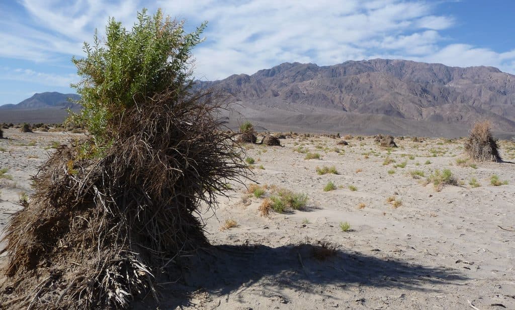
  • Devil's Cornfield: A Landscape Shaped by Wind
  • Illusions of Heat: Mirages and Dust Devils
  • Desert Pavement: The Park’s Fragile Stone Mosaic
  • 130 audio storiesacross Death Valley’s roads, triggered by GPS as you drive
  • Wildlife heatmapsfor Bighorn Sheep, Desert Tortoise, Coyote, and 13 more
  • Works offlinemaps, 36 trails, 114 places, and audio download before you lose signal
  • CarPlay readysimple controls built for the drive
★★★★★
“Fantastic app with many points of information… It’s great to just turn on while you’re driving and it gives you an audio tour of the national Park. We love it!!!!”
JMJamesApp Store review
Download Parkwolf on the App StoreGet Parkwolf on Google Play

4.7 from 8,600+ ratings

Guide

More about Salt Creek Interpretive Site

What You'll SeeExpect a shallow, briny stream threading through a scrubby marsh.

Expect a shallow, briny stream threading through a scrubby marsh. In cooler months the flow is more obvious; by peak summer it may shrink to a trickle. The headliner here is the tiny Death Valley pupfish—blink and you’ll miss them—darting in the shallows when conditions line up. You’ll also notice insects and birds using the narrow ribbon of water, plus wide open views across the basin to distant ranges.

Practicalities & EtiquetteStay on the boardwalk—this creek corridor is extremely fragile.
  • Stay on the boardwalk—this creek corridor is extremely fragile.
  • Bring water, a hat, and sunscreen; there’s no shade and the heat sneaks up on you.
  • Move slowly and scan the shallow channels for pupfish; patience pays off.
  • Expect simple facilities at the trailhead: parking, a vault toilet, benches, and signs.
Is It Worth Your Time?If you’re chasing dunes and overlooks only, you might skip it.

If you’re chasing dunes and overlooks only, you might skip it. But if the idea of a 20–30 minute stroll to see a living desert survival story appeals, Salt Creek is a smart, easy add to your day.

Wildlife

Wildlife in Death Valley

All Death Valley wildlife maps

Sighting maps show where each species has been reported across Death Valley. Wildlife moves, so no sighting is guaranteed.

Parkwolf’s Death Valley ranking

Top sights in Death Valley

All 114 places
  1. 1Badwater BasinSight
  2. 2Dante's ViewSight
  3. 3Mesquite Flat Sand DunesSight
  4. 4Zabriskie PointSight
  5. 5Golden CanyonSight
  6. 6Artists PaletteSight

Take Parkwolf to Death Valley.

The audio tour guide for the drive, plus offline maps, trails, and wildlife heatmaps for when the signal drops.

4.7 from 8,600+ ratings

Download Parkwolf on the App StoreGet Parkwolf on Google Play