Pros & cons
PROS
- Distinct multi‑colored volcanic rock scenery
- Dramatic cliffside vantage over braided river valleys
CONS
- Highly exposed and often windy
- Road access beyond mile 43 currently restricted by Pretty Rocks work
- No services or shelters at the stop
Overview
Polychrome Overlook sits near mile 46 of the park road and delivers one of the route’s most photogenic panoramas. The name says it all: polychrome—many colors—thanks to the vividly hued rock layers that stripe the surrounding ridges.
What You’ll See
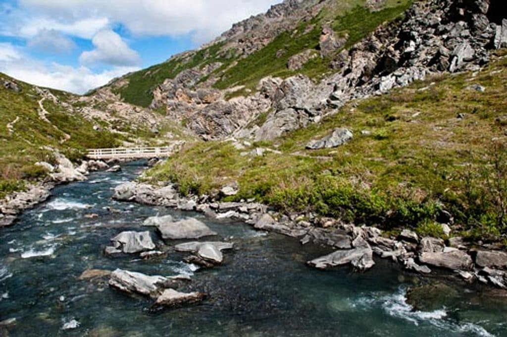
From the roadside vantage you look out over tundra cut by gravelly, braided streambeds and up to the Alaska Range. The perspective is airy and dramatic, perched above steep slopes with long views across the Plains of Murie. Even in mid‑summer, snow can linger on nearby high ridges, accenting the reds, oranges, yellows, and purples in the rock.
Geology Notes
The overlook highlights a textbook mash‑up of forces: ancient volcanism that created the colorful rocks, then tectonics and glaciation that uplifted, carved, and exposed the layers. The area is also known for geologic instability—landslides like Pretty Rocks have reshaped both the landscape and how people move through it.
Access Right Now
Since 2021, a major landslide at Pretty Rocks has limited travel beyond mile 43, just short of Polychrome. Construction of a new bridge and related road improvements is ongoing, so most visitors can’t currently reach the overlook by road. Check the National Park Service for the latest status before planning your day.

On‑Site Details
This is a simple roadside stop focused on the view. There’s no developed trailhead; any wandering is informal and can be steep or brushy. Don’t expect services or shelter here—bring what you need and keep an eye on footing near drop‑offs.
Photography & Conditions
The scene is all about contrast: colorful cliffs, green summer tundra, and pale river braids. Bring a zoom lens or binoculars to pull distant details closer. The overlook is exposed and can be very windy, and weather flips fast; clear spells can open and close quickly, so be ready to seize the moment.
A Bit of Context
From here you’re looking toward the Plains of Murie, named for biologist Adolph Murie. Meltwater from the Polychrome Glacier feeds this broad landscape—another reminder that ice and water are active architects of the view.
Where it is
63.5364, -149.9611Tips for Polychrome Overlook
- 01Check NPS road status for the Polychrome/Pretty Rocks area before you go.
- 02Pack a windproof layer—the overlook is exposed and can howl.
- 03Bring a zoom lens or binoculars to pull in distant details.
- 04There’s no maintained trail here; footing can be steep with drop‑offs.
- 05Use the mile 46 reference to anticipate the stop during a bus tour.
Amenities
Near Polychrome Overlook
All places →All trails →
1.7 mi awayPolychrome PassKaleidoscopic rock colors from a dramatic roadside perchPullout · Scenic Viewpoint
2.7 mi awayToklat River Contact StationMid-park bus stop with restrooms, bookstore, and Toklat River viewsRestroom · Exhibit
7.5 mi awayHighway PassHighest point on Park Road with tundra views and frequent wildlifeScenic Viewpoint
9.3 mi awaySable PassBear-rich alpine pass with big tundra views, no hiking allowedScenic Viewpoint
13 mi awayEielson Alpine TrailShort, very steep climb to Thorofare Ridge with big Alaska Range viewsChallenging · 1.7 mi · 1.5 hr
13 mi awayGorge Creek TrailSteep drop from Eielson to river bars with big Alaska Range viewsModerate · 2 mi · 1.5 hr
13 mi awayTundra Loop TrailTiny alpine loop with big tundra views at EielsonEasy · 0.3 mi · 30 min
24.9 mi awaySavage River Loop TrailEasy river canyon loop with bridge, big tundra views, frequent wildlifeEasy · 2 mi · 1.2 hr