Overview
About Grebe Valley Lookout
Why stop
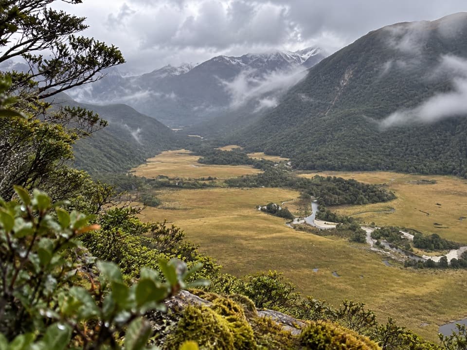
- A rare look down the river and across landslide terrain.
Heads up
- The remote, unsealed road has no fuel or mobile coverage.
Map
Where it is

The highest, rockiest slopes around here are a summer buffet for grizzly bears.
Fiordland Tour Guide
Your drive to Grebe Valley Lookout, narrated.
Parkwolf is a GPS audio tour guide for Fiordland National Park. As you drive, it chimes in with what’s ahead: hidden gems, upcoming stops, history, geology, and wildlife, right through your car’s speakers.
See the Fiordland audio tourRecorded for this place
Grebe Valley Lookout“Grebe Valley Lookout is coming up, about two hundred and eighty metres above the valley. Stop for the winding Grebe River, small lakes and grassland spread below the mountains, without a hike to reach the view.”
Plays as you drive up to Grebe Valley Lookout in the Parkwolf Fiordland Tour Guide.
More stories near here in the app
- The Owl Behind the Call
- The Sugar on the Bark
- The Crayfish's Packed Lunch
- The Kākā's Forest Toolkit
- 112 audio storiesacross Fiordland’s roads, triggered by GPS as you drive
- Wildlife heatmapsfor Kea, Fiordland Penguin, Blue Duck, and 13 more
- Works offlinemaps, 77 trails, 102 places, and audio download before you lose signal
- CarPlay readysimple controls built for the drive
“Fantastic app with many points of information… It’s great to just turn on while you’re driving and it gives you an audio tour of the national Park. We love it!!!!”


Guide
More about Grebe Valley Lookout
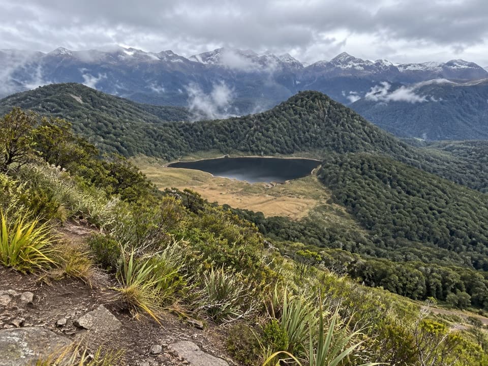
A high view on Borland RoadGrebe Valley Lookout is a roadside viewpoint about 280 metres above the valley.
Grebe Valley Lookout is a roadside viewpoint about 280 metres above the valley. The Grebe River winds among small lakes and grassland, with forest-covered mounds and steep mountains rising on either side. I'd keep going the extra 6.2 km past Borland Saddle if the road is open and you're equipped for a remote, rough drive; this is a backcountry stop, not a quick detour.
Look for the landslide moundsThe rounded, forested hills stand apart from the sharper glacially carved sides around them.
The rounded, forested hills stand apart from the sharper glacially carved sides around them. They're remnants of the Green Lake landslide, which came down from the Hunter Mountains and filled the valley with an enormous mass of rock. A panel just south of the viewpoint explains what you're looking at. For a photo, keep the winding river and small lakes below those mounds; that contrast is what makes the view distinctive.
A huge slide, thousands of years oldA 2023 study estimates the Green Lake landslide at 27 cubic kilometres and dates it to about…
A 2023 study estimates the Green Lake landslide at 27 cubic kilometres and dates it to about 15,500 years ago, after glaciers had begun retreating locally. Researchers have proposed earthquake shaking, local rock structure and the retreat of supporting ice as possible contributors; the trigger remains unsettled.
Treat the road as part of the tripFrom the gate just after Borland Lodge, it's about 15 km to Borland Saddle, then 6.
From the gate just after Borland Lodge, it's about 15 km to Borland Saddle, then 6.2 km more to the lookout. Borland Road is unsealed, narrow and steep in places, with no fuel, mobile coverage or emergency services along the way. It's unsuitable for campervans, caravans and trailers, and vehicle access depends on conditions. The road commonly closes from early June to late October, but partial closures can reach the lookout at other times too; check current conditions before setting out. Dogs aren't allowed. Use the toilet at Borland Saddle before you continue.
Built for a power lineBorland Road was built in 1963 to construct and service a transmission line between West Arm…
Borland Road was built in 1963 to construct and service a transmission line between West Arm Power Station on Lake Manapouri and the Tiwai Point aluminium smelter near Invercargill. The power station still maintains the road, and public access is allowed for recreation. That working-road origin helps explain why it feels so remote and rough compared with a typical scenic drive.
Wildlife
Wildlife in Fiordland
 1,233 sightingsKeaMost seen around 10 AMSighting map
 214 sightingsFiordland PenguinMost seen around 7 PMSighting map
 233 sightingsBlue DuckMost seen around 5 PMSighting map
 32 sightingsBottlenose DolphinMost seen around 5 PMSighting map
 252 sightingsNew Zealand Fur SealMost seen around 6 PMSighting map
 69 sightingsKākāMost seen around 6 PMSighting map
Sighting maps show where each species has been reported across Fiordland. Wildlife moves, so no sighting is guaranteed.