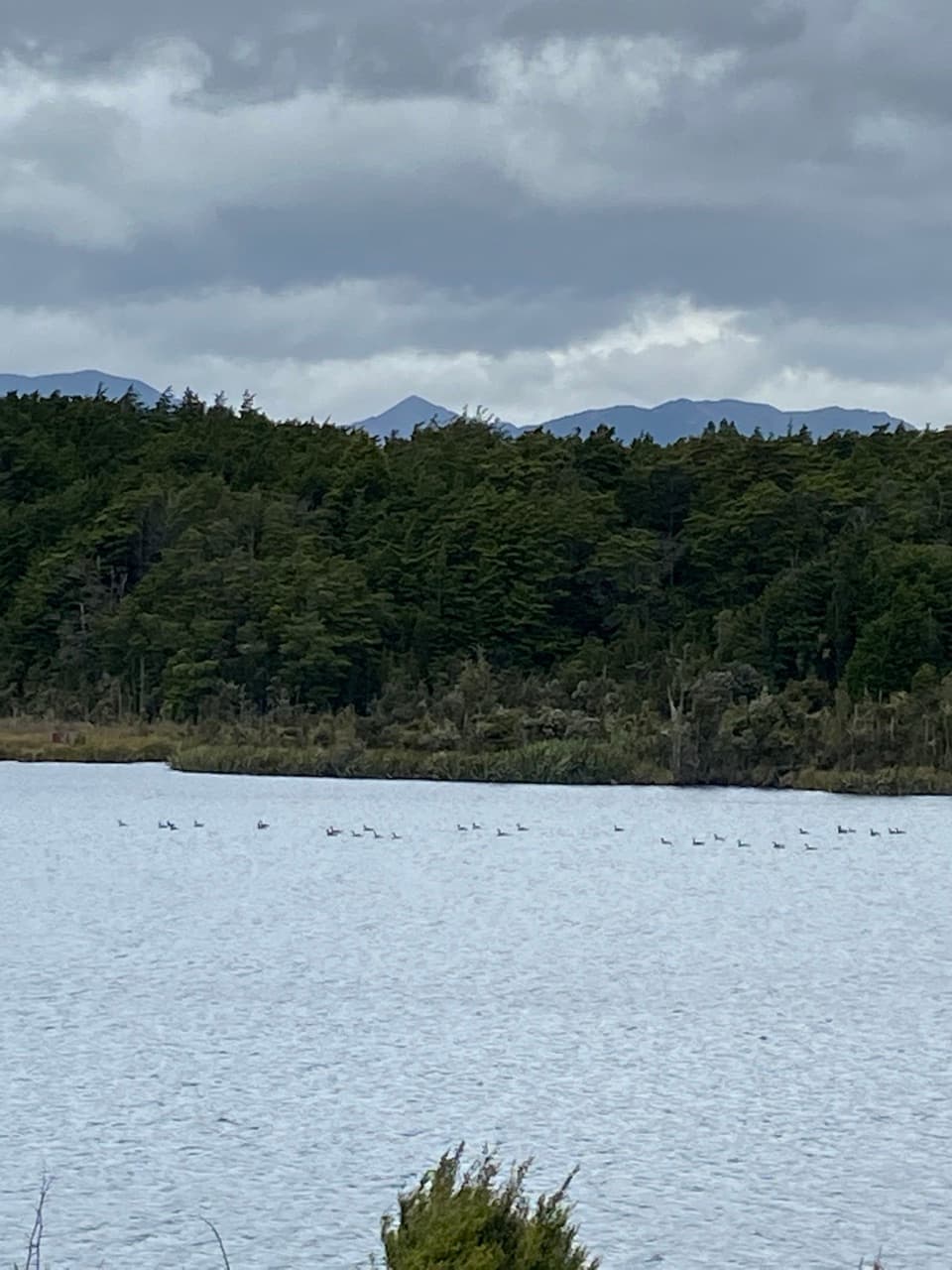
George Sound Route in Fiordland National Park

Fiordland National Park, SL

George Sound Route

13.7 miles of remote boat-assisted trail from Middle Fiord to George Sound.

Length
22.1km
Time
3.5days
Elev. change
863m
Difficulty
Challenging
  • No dogs
  • High point 874 m
Parkwolf audio tour112 stories across Fiordland’s roads

Overview

About George Sound Route

Why go

  • Links three remote lakes on a rare coast-to-lake wilderness crossing.
  • The high pass and glacial valleys give the route a striking sense of scale.

Heads up

  • Boat transfers and one-way pickup make the logistics complex.
  • A 10.5-hour stage, wet ground and unbridged creeks can delay progress.

Map & elevation

The route

Loading the Fiordland map
Full map
Elevation11–874 m
TrailheadMiddle Fiord landing, Lake Te Anau-45.09377, 167.57524
Keep this map with you offline in the Parkwolf app

Plan your hike

Before you go

Parking

There is no roadhead at either end. Arrange boat transport across Lake Te Anau from Te Anau Downs to the Middle Fiord landing, where the trail begins. Lake Hankinson requires a second boat crossing. Arrange onward pickup from George Sound by boat, floatplane or helicopter before setting out; Te Anau Downs is the departure point, not the trailhead.

Safety

DOC classifies this as an Expert route for experienced, equipped groups with backcountry navigation and river-crossing skills. The track is wet and poorly defined in places; Katherine Creek is unbridged and can be impassable after rain, and one lake section requires a wade. Lakes and rivers can rise rapidly, and winter snow or adverse weather often makes the route impassable. Carry a topo map, PLB or mountain radio, tent and extra food. No dogs.

A park ranger sits on a dash-mounted phone, talking, as Parkwolf’s Tour Guide plays “Army Cutworm Moths: A Grizzly Bear Buffet” on Grand Loop Road below Dunraven Pass in Yellowstone
Parkwolf Tour GuideThe highest, rockiest slopes around here are a summer buffet for grizzly bears.

Fiordland Tour Guide

Your drive to George Sound Route, narrated.

Parkwolf is a GPS audio tour guide for Fiordland National Park. As you drive, it chimes in with what’s ahead: hidden gems, upcoming stops, history, geology, and wildlife, right through your car’s speakers.

See the Fiordland audio tour
  • 112 audio storiesacross Fiordland’s roads, triggered by GPS as you drive
  • Wildlife heatmapsfor Kea, Fiordland Penguin, Blue Duck, and 13 more
  • Works offlinemaps, 77 trails, 102 places, and audio download before you lose signal
  • CarPlay readysimple controls built for the drive
★★★★★
“Fantastic app with many points of information… It’s great to just turn on while you’re driving and it gives you an audio tour of the national Park. We love it!!!!”
JMJamesApp Store review
Download Parkwolf on the App StoreGet Parkwolf on Google Play

4.7 from 8,600+ ratings

Trail guide

Hiking George Sound Route

A boat-assisted crossingThe George Sound Route is a 13.74-mile (22.

The George Sound Route is a 13.74-mile (22.1 km) one-way crossing from Middle Fiord on Lake Te Anau to George Sound, or Te Houhou. The mapped line includes the required 4.63 km boat crossing of Lake Hankinson; DOC’s 17.8 km (11.1 mile) figure is the walking distance alone. Allow three to four days. The route links three remote lakes, crosses Henry Pass and ends on the coast. DOC classifies it as an Expert route for experienced, well-equipped groups.

Arrange transport and nightsArrange a boat across Lake Te Anau from Te Anau Downs to Middle Fiord, the actual trailhead.

Arrange a boat across Lake Te Anau from Te Anau Downs to Middle Fiord, the actual trailhead. From the beach, a signed 15-minute track reaches Lake Hankinson. The 4.5 km lake cannot be walked around, so it must be crossed by boat or kayak in about 20 minutes; wind and few safe landing beaches can complicate the crossing. Arrange pickup at George Sound before leaving, by boat, floatplane or helicopter; there is no road access.

DOC estimates 2 hours 30 minutes from Hankinson Hut to Thomson Hut and 10.5 hours from Thomson Hut to George Sound Hut. Carry a tent for the long stage; suitable sites lie east of Henry Pass. The standard huts are first come, with no bookings, and require a hut ticket or pass. There are no cooking facilities, so bring a stove. Hut water is untreated and must be boiled. Pack extra food for weather or flood delays.

Hankinson to ThomsonFrom Hankinson Hut, the first three-wire crossing is about five minutes away; the second is…

From Hankinson Hut, the first three-wire crossing is about five minutes away; the second is roughly an hour farther on. Watch for the crossing sign. The route follows Lake Thomson’s north side to its head, then crosses Wapiti River flats to the hut. DOC’s estimate is 2 hours 30 minutes. Although marked, the route is not well defined in places; expect tree roots, tree falls, rough ground and persistent mud.

Henry Pass and Lake KatherineThe second stage climbs the valley past old markers for the unmaintained Mount Elwood mica-mine…

The second stage climbs the valley past old markers for the unmaintained Mount Elwood mica-mine route; stay on the George Sound Route. Henry Pass is at 830 m, about four and a half hours from Thomson Hut. Deadwood Lagoon is very boggy and can flood after heavy rain. The route drops steeply to Katherine Creek, which is unbridged and may be impassable after rain. It wades into Lake Katherine once, follows sections with safety chains and crosses many more creeks before George Sound Hut, one to two hours beyond the lake.

Glacial country and changing forestThe route crosses two major valleys and a mountain range.

The route crosses two major valleys and a mountain range. Glaciers carved the U-shaped valleys, hanging side valleys and high basins now filled by lakes. Around 830 m, silver beech gives way to subalpine shrubland and short tussock. The climb to Henry Pass marks that change in vegetation, with steep forested slopes, lakes and a high basin shaping the view. Cloud can close in across this wet landscape.

Te Houhou and the old trackTe Houhou is the commonly used Māori name for George Sound.

Te Houhou is the commonly used Māori name for George Sound. Māori used the area seasonally for food and other resources and as a stopping place along the Fiordland coast. In 1889, conservationist Richard Henry crossed from Middle Fiord and cleared a track toward the sound. Maintenance later became erratic, and the track was abandoned in 1906; that history fits a route still marked in places but not consistently defined. The English name’s origin is uncertain.

Weather, gear and accessThis remote route calls for backcountry navigation and river-crossing experience.

This remote route calls for backcountry navigation and river-crossing experience. DOC says topo maps and a personal locator beacon or mountain radio are essential. Rivers and lakes can rise quickly, and floods can make sections impassable. Snow and adverse weather often make the route impassable in winter; check current conditions before committing. Huts do not make this a supported trip: carry your own tent, stove and food, boil untreated water, and take extra supplies. Dogs are not allowed.

Wildlife

Wildlife in Fiordland

All Fiordland wildlife maps

Sighting maps show where each species has been reported across Fiordland. Wildlife moves, so no sighting is guaranteed.

Parkwolf’s Fiordland ranking

Top-rated trails in Fiordland

All 77 trails
  1. 1Milford TrackChallenging · 53.5 km
  2. 2Routeburn TrackChallenging · 33 km
  3. 3Kepler TrackChallenging · 60 km
  4. 4Routeburn Track: Key Summit TrackModerate · 6.8 km
  5. 5Lake Marian TrackChallenging · 6.2 km
  6. 6Hump Ridge TrackChallenging · 61.5 km

Take Parkwolf to Fiordland.

The audio tour guide for the drive, plus offline maps, trails, and wildlife heatmaps for when the signal drops.

4.7 from 8,600+ ratings

Download Parkwolf on the App StoreGet Parkwolf on Google Play