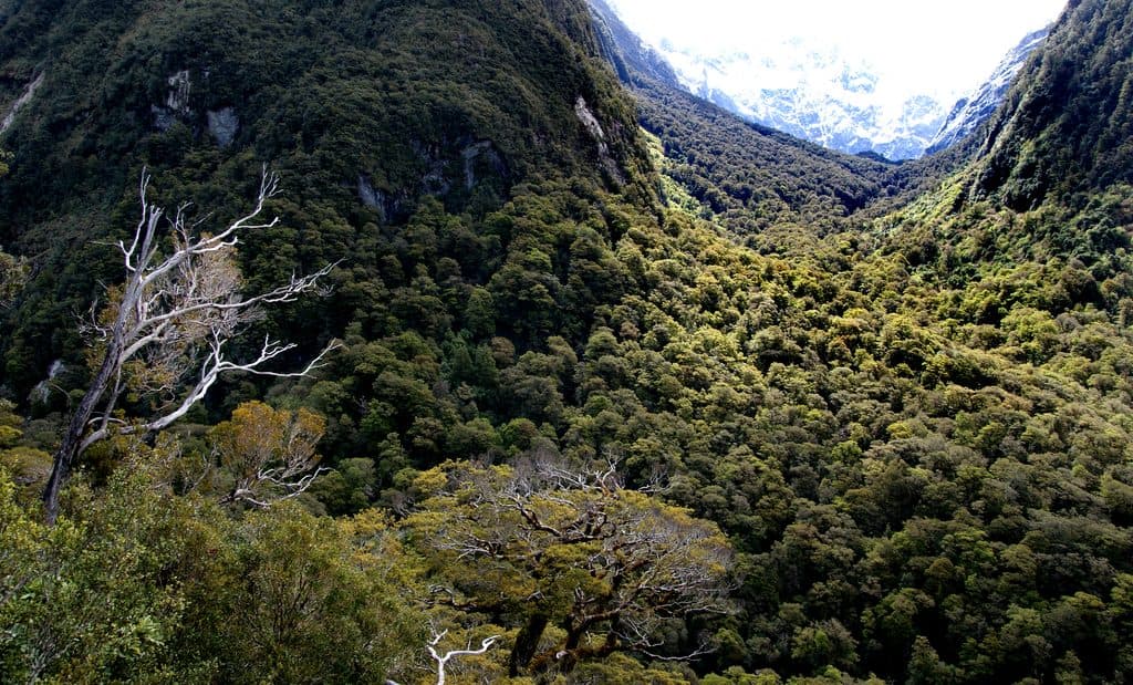
Kepler Track in Fiordland National Park

#3 of 68 trails in Fiordland

Fiordland National Park, SL

Kepler Track

A 60 km Great Walk loop through beech forest, lakeshores, and exposed alpine ridges.

Photo: Public Domain
Length
60km
Time
1.3days
Elev. change
1,157m
Difficulty
Challenging
  • Loop
  • No dogs
  • High point 1,358 m
Parkwolf audio tour126 stories across Fiordland’s roads

Overview

About Kepler Track

Why go

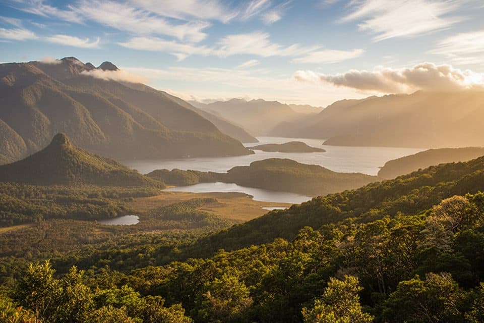
  • Long, continuous alpine ridgeline with panoramic views
  • Purpose-built loop close to Te Anau with hut stages and a flexible Rainbow Reach exit

Heads up

  • Huts and campsites book out quickly during the Great Walks season
  • Alpine sections are exposed to sudden weather changes and winter hazards
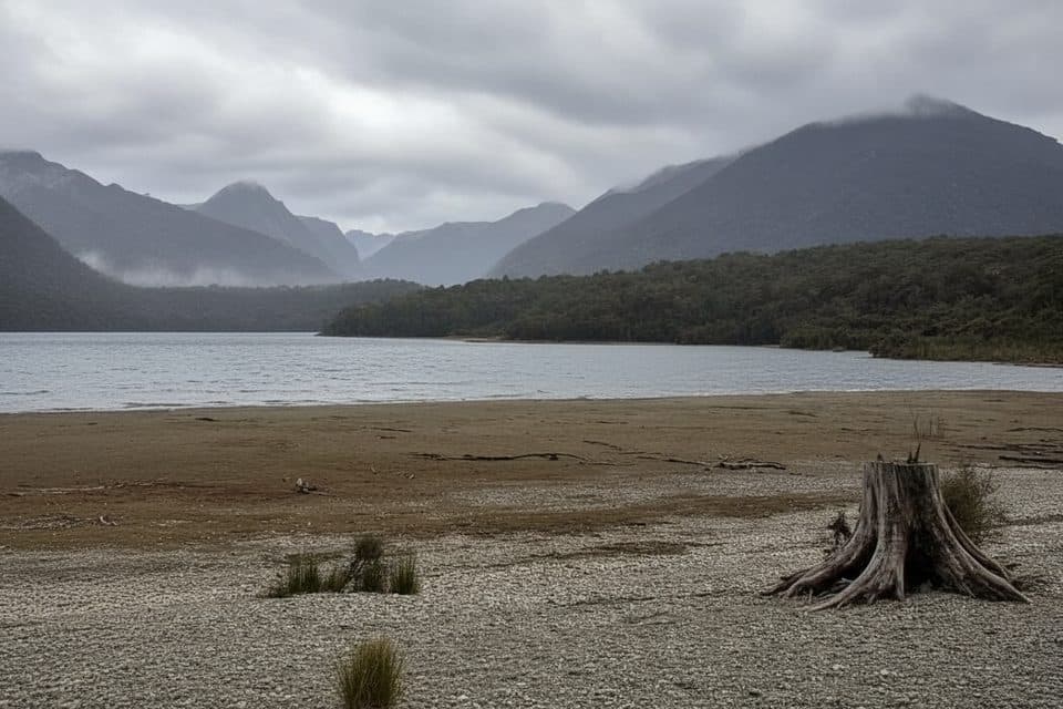
Kepler Track is a 60 km (37.3 mile) Great Walk loop in Fiordland National Park. It links the shores of Lake Te Anau and Lake Manapouri with mossy beech forest, wetlands, limestone features, and exposed tussock ridges. Most walkers take 3–4 days and 3 nights.
Parkwolf’s verdictWhy hike it

Map & elevation

The route

Loading the Fiordland map
Full map
Elevation201–1,358 m
TrailheadKepler Track Carpark (Control Gates)-45.44234, 167.68874
Keep this map with you offline in the Parkwolf app

Plan your hike

Before you go

Parking

Park at the Kepler Track carpark near the Control Gates, or arrange a shuttle from Te Anau. Rainbow Reach has an optional shuttle exit, but the full-loop route returns to the Kepler Track carpark. Do not leave valuables in vehicles at trailheads.

Safety

The alpine ridges are exposed to rapidly changing wind, rain, snow, and ice. The full loop has long, uneven days, steep sections, river-crossing and navigation hazards, and reduced facilities outside the Great Walks season. Book huts and campsites in season; dogs are not permitted on the track.

A park ranger sits on a dash-mounted phone, talking, as Parkwolf’s Tour Guide plays “Army Cutworm Moths: A Grizzly Bear Buffet” on Grand Loop Road below Dunraven Pass in Yellowstone
Parkwolf Tour GuideThe highest, rockiest slopes around here are a summer buffet for grizzly bears.

Fiordland Tour Guide

Your drive to Kepler Track, narrated.

Parkwolf is a GPS audio tour guide for Fiordland National Park. As you drive, it chimes in with what’s ahead: hidden gems, upcoming stops, history, geology, and wildlife, right through your car’s speakers.

See the Fiordland audio tour

More stories near here in the app

  • Te Anau: The Gateway to Fiordland
  • Te Anau: Fiordland's Adventure Basecamp
  • Te Anau's Living Galaxy
  • Queens Reach: The River Anduin
  • 126 audio storiesacross Fiordland’s roads, triggered by GPS as you drive
  • Wildlife heatmapsfor Kea, Fiordland Penguin, Blue Duck, and 13 more
  • Works offlinemaps, 68 trails, 124 places, and audio download before you lose signal
  • CarPlay readysimple controls built for the drive
★★★★★
“Fantastic app with many points of information… It’s great to just turn on while you’re driving and it gives you an audio tour of the national Park. We love it!!!!”
JMJamesApp Store review
Download Parkwolf on the App StoreGet Parkwolf on Google Play

4.7 from 8,600+ ratings

Trail guide

Hiking Kepler Track

The routeThe full loop starts at the Kepler Track carpark near the Control Gates, follows the Te Anau…

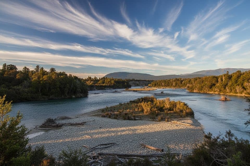
The full loop starts at the Kepler Track carpark near the Control Gates, follows the Te Anau lakeshore to Brod Bay, then climbs to Luxmore Hut and crosses the alpine ridge toward Iris Burn Hut. It descends through the Iris Burn valley to Moturau Hut, crosses the wetland to Rainbow Reach, and follows the Waiau River back to the Kepler Track carpark. Rainbow Reach is an optional shorter exit for transport; it is not the endpoint of this full-loop record.

DOC's stage distances total about 60.1 km: 5.6 km from the carpark to Brod Bay, 8.2 km to Luxmore Hut, 14.6 km to Iris Burn Hut, 16.2 km to Moturau Hut, 6 km to Rainbow Reach, and 9.5 km back to the carpark. The stored line represents the complete physical loop; it does not duplicate the return corridor or include optional side trips such as Mount Luxmore summit or Luxmore Cave.

Scenery and difficultyExpect beech forest and lake margins at lower elevations, a sustained climb above Brod Bay,…

Expect beech forest and lake margins at lower elevations, a sustained climb above Brod Bay, panoramic alpine views, exposed ridgelines, steep descents, river valleys, and fragile wetlands. This is a multi-day tramp with long days, uneven terrain, and limited services. The alpine sections are especially sensitive to wind, rain, snow, and fast weather changes.

Huts, access, and planningThe route uses Luxmore, Iris Burn, and Moturau huts, plus designated campsites.

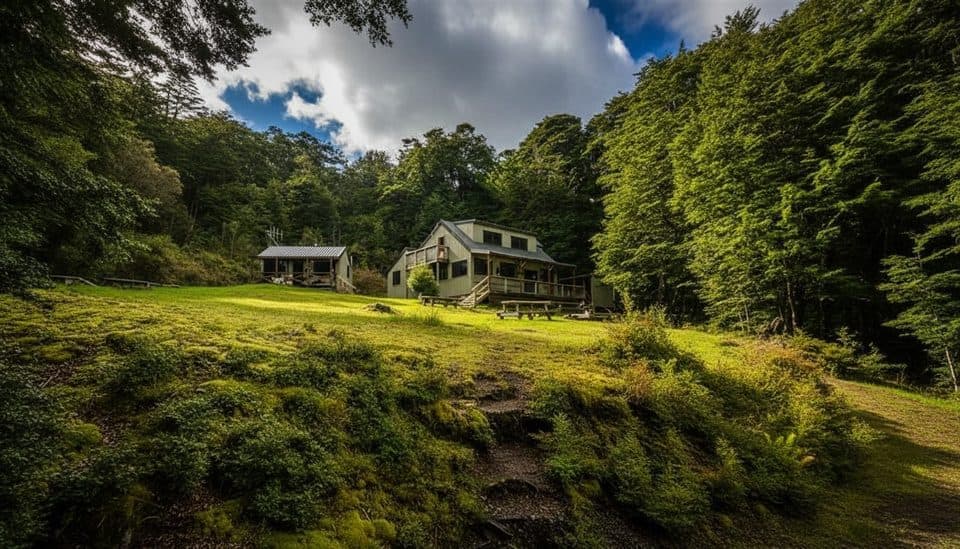
The route uses Luxmore, Iris Burn, and Moturau huts, plus designated campsites. During the Great Walks season, huts and campsites must be booked in advance. Transport from Te Anau can be arranged for the carpark, and a shuttle from Rainbow Reach can shorten the final section, but those transport choices do not change the full-loop distance above. Carry food, water-treatment supplies, warm layers, rain protection, navigation equipment, and a headlamp; facilities and services are reduced outside the Great Walks season.

Conditions and rulesFrom May to late October, expect shorter daylight, cold and wet conditions, snow or ice, and…

From May to late October, expect shorter daylight, cold and wet conditions, snow or ice, and possible river-crossing and navigation hazards; attempt the route then only with the appropriate alpine skills and equipment. Dogs are not permitted on the Kepler Track. Check DOC's current track and booking information before departure, and secure valuables out of vehicles at trailheads.

Wildlife

Wildlife in Fiordland

All Fiordland wildlife maps

Sighting maps show where each species has been reported across Fiordland. Wildlife moves, so no sighting is guaranteed.

Keep exploring

Near Kepler Track

See it all on the map

Trails that start nearby

Places near the trailhead

Parkwolf’s Fiordland ranking

Top-rated trails in Fiordland

All 68 trails
  1. 1Milford TrackChallenging · 53.4 km
  2. 2Routeburn TrackChallenging · 33 km
  3. 4Luxmore Summit TrackChallenging · 33.5 km
  4. 5Kepler Track to Mount LuxmoreChallenging · 37 km
  5. 6Sutherland Falls TrackModerate · 4.7 km
  6. 7Lake Marian TrackChallenging · 6.3 km

Take Parkwolf to Fiordland.

The audio tour guide for the drive, plus offline maps, trails, and wildlife heatmaps for when the signal drops.

4.7 from 8,600+ ratings

Download Parkwolf on the App StoreGet Parkwolf on Google Play