Parking
Park at the Bartlett Cove hub by the Glacier Bay Lodge and Visitor Information Station; the trail starts right from this area.

#2 of 3 trails in Glacier Bay
Glacier Bay National Park, AK
A gentle bayside stroll into Huna Tlingit culture and Bartlett Cove
Overview
The Tlingit Trail is an easy, short, and culture-forward walk in Bartlett Cove, starting in front of the Glacier Bay Lodge. Expect minimal elevation and a well‑maintained path—this is a leisurely outing designed for learning and lingering, not logging miles. The out-and-back route is about 1.0 mile total (0.5 mile each way), with interpretive stops that can easily stretch a quick walk into an hour of exploring.
If you want an immediate feel for Glacier Bay’s living culture and coastal rainforest without committing to a big hike, this is the move. Interpretive exhibits along the way spotlight Huna Tlingit history and connection to this homeland, and you’ll pass cultural fixtures like the beautifully crafted Huna Tribal House, a traditional hand-carved canoe, and even a complete whale skeleton on display. The trail traces the shore of Bartlett Cove, so you get water views, moss-draped forest, and the sounds of the bay as you wander.
 Parkwolf’s verdictWhy Go
Map & elevation
Plan your hike

The highest, rockiest slopes around here are a summer buffet for grizzly bears.
Glacier Bay Tour Guide
Parkwolf is a GPS audio tour guide for Glacier Bay National Park. As you drive, it chimes in with what’s ahead: hidden gems, upcoming stops, history, geology, and wildlife, right through your car’s speakers.
Recorded for this trailhead
Visitor Information Station: Backcountry Mission Control“You're coming up on the Visitor Information Station, or VIS, down by the main dock.”
Plays as you drive up to this trailhead in the Parkwolf Glacier Bay Tour Guide.
More stories near here in the app
“Fantastic app with many points of information… It’s great to just turn on while you’re driving and it gives you an audio tour of the national Park. We love it!!!!”


Trail guide
The walking is easy and mostly flat. Surfaces are primarily packed dirt/gravel with occasional boardwalk-style or meadow sections. A first segment—between the trailhead and a small pond—is fully accessible, making this an excellent family option or leg-stretcher when you arrive by boat. Plan to pause often for signage; the interpretive info is the point here. Wildlife is possible: think squirrels and birds in the trees and, with luck, marine life out in the cove.
Wildlife
 98 sightingsHumpback WhaleMost seen around 6 AMSighting map
 48 sightingsOrcaMost seen around 5 PMSighting map
 110 sightingsBrown BearMost seen around 7 PMSighting map
 312 sightingsSea OtterMost seen around 4 PMSighting map
 106 sightingsMountain GoatMost seen around 6 PMSighting map
 93 sightingsBald EagleMost seen around 5 PMSighting map
Sighting maps show where each species has been reported across Glacier Bay. Wildlife moves, so no sighting is guaranteed.
Keep exploring
 EasyForest Loop Trail1.1 mi · 45 min · 0.1 mi awayEasy Bartlett Cove loop through spruce–hemlock forest to the beach
 ModerateBartlett Lake Trail9.2 mi · 7.5 hr · 0.6 mi awayLong, soggy rainforest trek to a quiet lake—bring rubber boots.
 Ranger station · At the trailheadBartlett Cove Visitor Information Station (VIS)Permit and orientation hub by the Bartlett Cove dock
 Sight · 0.1 mi awayHumpback Whale ExhibitOpen-air skeleton of “Snow,” a famed humpback
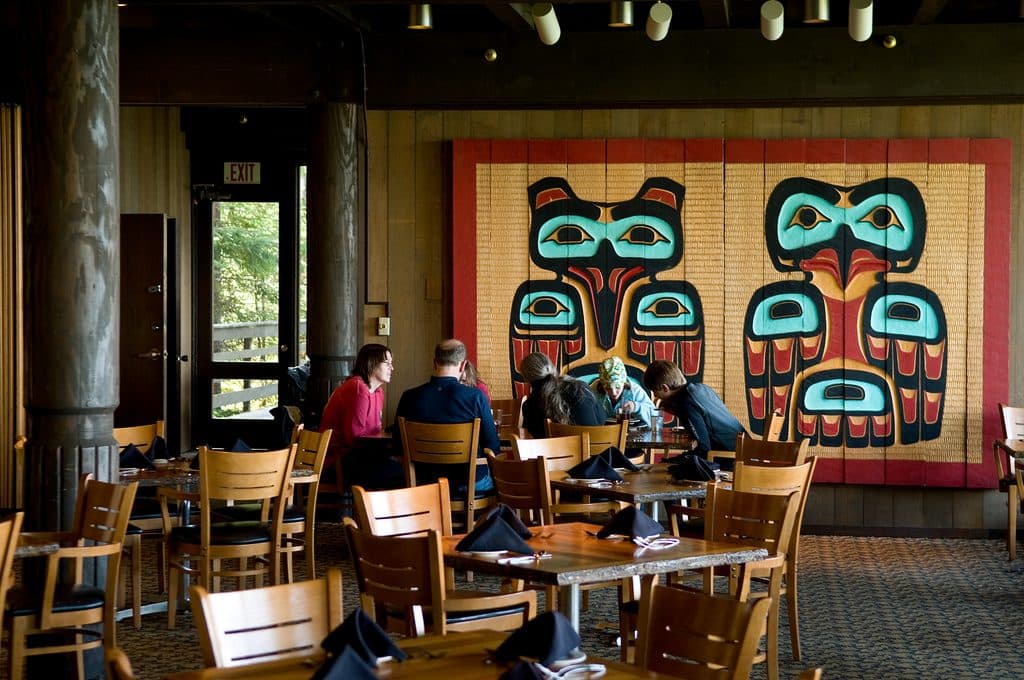 Restaurant · 0.1 mi awayFairweather Dining RoomLocal seafood with big Bartlett Cove views
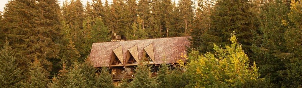 Visitor center · 0.1 mi awayPark Visitor CenterSmall, smart hub with exhibits, views, and a whale-listening hydrophone
 Sight · 0.2 mi awayXunaa Shuká HítA living Tlingit clan house on Bartlett Cove’s shoreline
 Campground · 0.4 mi awayBartlett Cove CampgroundFree walk-in rainforest campground with a communal beach fire pit
 Sight · 1.2 mi awayBartlett CoveHub for trails, day tours, culture, and free camping
 Sight · 1.2 mi awayLester IslandQuiet, kayak-friendly island just off Bartlett Cove
Parkwolf’s Glacier Bay ranking
The audio tour guide for the drive, plus offline maps, trails, and wildlife heatmaps for when the signal drops.