
Place · 0.8 mi away
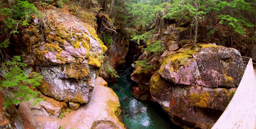
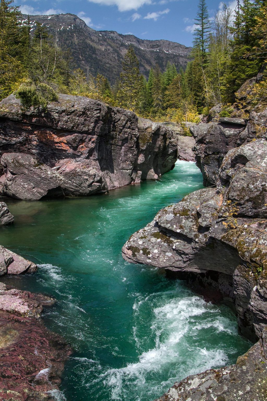
Avalanche Gorge is the showpiece cut into the lower Avalanche Creek corridor—an icy-blue torrent slicing through striking red bedrock. It sits along the Trail of the Cedars on the west side of the park, a short stroll from the road and a natural warm‑up for the popular hike to Avalanche Lake.
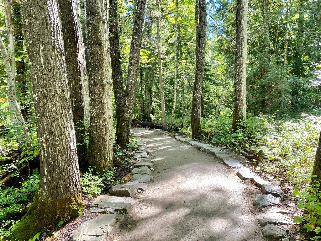
Expect a narrow, sculpted chasm where Avalanche Creek scours layered rock, plus a cathedral of ancient western red cedars and hemlocks—many more than 500 years old—fueled by the valley’s humidity. The gorge reveals itself early from the boardwalk before the path climbs toward the lake, so even a short walk delivers a big payoff.
Start on the Trail of the Cedars boardwalk, then join the Avalanche Lake Trail. You’ll follow the creek past multiple gorge viewpoints before continuing toward the lake if you choose. The overall hike runs roughly 4.5–6.0 miles round trip with about 700–760 feet of gain, depending on where you begin the loop and how far along the lake shore you wander. The initial boardwalk is easy; beyond that, expect roots, rocks, and steady grades.
This scene is pure Glacier: a side valley off the glacially carved McDonald Valley, with a creek that’s been polishing bedrock into smooth, crimson corridors for ages. In 1895, Dr. Lyman Sperry named Avalanche Basin after witnessing repeated avalanches; he later discovered the Sperry Glacier that feeds many of the area’s waterfalls.
Deer and small critters are common, and both black and grizzly bears use this corridor. Carry bear spray, hike in groups, make noise in brushy sections, and give wildlife plenty of space. Temporary closures can happen when bears are active.
You’ll find restrooms at/near the trailhead and a vault toilet up by the lake. Picnic tables and benches cluster around the Avalanche Creek day‑use area, and potable water is available seasonally at nearby Avalanche Campground. This is one of the park’s busiest hubs: arrive early, consider the seasonal shuttle, and be aware that vehicle reservations are required in peak season for popular corridors. Dogs aren’t allowed on these trails.
For the gorge’s best color and contrast, go around daybreak before the sun crests the ridge or return later in the afternoon with the sun at your back. Bring a cloth for spray, and a polarizer if you carry one. It can be breezy or misty up at the lake even in August—layers help.
Yes—Avalanche Gorge is one of the most accessible, dramatic creek cuts in the park. Even if you don’t hike the full lake trail, the early gorge views make it a must‑see stop.
June through October, conditions and road status permitting. For smaller crowds, be at the lot before morning rush or aim for late afternoon. Early and late light flatters the gorge; midday is harsh and the parking crunch is real.
Place · 0.8 mi away
Place · 0.9 mi away
Place · 1.4 mi away
Place · 1.9 mi away
Moderate · 0.5 mi away
Moderate · 0.9 mi away
Easy · 0.9 mi away
Easy · 3.8 mi away

Parkwolf Tour Guide
