Upper McDonald Creek Trail in Glacier National Park

Glacier National Park, MT

Upper McDonald Creek Trail

A gentle creek walk to two cascades and a quiet forest finish.

Photo: Public Domain
Length
5.4mi
Time
2.5hr
Elev. change
220ft
Difficulty
Easy
  • No dogs
  • High point 3,448 ft
  • #48 of 157 in Glacier

Hear the audio tour

Upper McDonald Creek Trailhead

Overview

About Upper McDonald Creek Trail

Why go

  • McDonald Falls and Sacred Dancing Cascades come early.
  • A gentle creek walk ends at a rock outcrop beneath Mount Cannon.
  • The first half-mile to McDonald Falls is paved and accessible.

Heads up

  • The full 5.4-mile outing repeats the same trail on the return.
  • The small road-side pull-off has room for only a few cars.

Map & elevation

The route

Loading the Glacier map
Full map
Elevation3,228–3,448 ft
TrailheadNorth Lake McDonald Road trailhead pull-off48.63728, -113.86843
Keep this map with you offline in the Parkwolf app

Plan your hike

Before you go

Parking

Use the small Upper McDonald Creek Trailhead pull-off on North Lake McDonald Road, just after the creek bridge. It holds only a few cars; reported alternatives are a pull-off near the bridge or the larger lot at the North Lake McDonald Road and Going-to-the-Sun Road junction.

Safety

Pets are not permitted on park trails. Only the first paved half-mile to McDonald Falls is identified as accessible; that designation does not cover the full route.

1 active Glacier alert

  • ClosureTwo Medicine Campground closed for 2026 constructionTwo Medicine Campground is closed throughout 2026 because of construction in the Two Medicine developed area.Official details
Glacier alerts
A park ranger sits on a dash-mounted phone, talking, as Parkwolf’s Tour Guide plays “Army Cutworm Moths: A Grizzly Bear Buffet” on Grand Loop Road below Dunraven Pass in Yellowstone
Parkwolf Tour GuideThe highest, rockiest slopes around here are a summer buffet for grizzly bears.

Glacier Tour Guide

Your drive to Upper McDonald Creek Trail, narrated.

Parkwolf is a GPS audio tour guide for Glacier National Park. As you drive, it chimes in with what’s ahead: hidden gems, upcoming stops, history, geology, and wildlife, right through your car’s speakers.

See the Glacier audio tour

Recorded for this trailhead

Upper McDonald Creek Trailhead
0:00 / 0:24
“Upper McDonald Creek Trailhead is ahead, for a gentle walk with cascades, wetland and long stretches of forest. Allow about two and a half hours for the full five point four mile out-and-back.”

Plays as you drive up to this trailhead in the Parkwolf Glacier Tour Guide.

More stories near here in the app

  • McDonald Falls
  • Johns Lake Loop Trailhead
  • Sacred Dancing Cascade
  • Trout Lake Trailhead
  • 204 audio storiesacross Glacier’s roads, triggered by GPS as you drive
  • Wildlife heatmapsfor Grizzly Bear, Wolverine, Mountain Goat, and 13 more
  • Works offlinemaps, 157 trails, 91 places, and audio download before you lose signal
  • CarPlay readysimple controls built for the drive
★★★★★
“Our first time to glacier and we used the audio portion for Going to the Sun Road. Wonderful information with perfect advice of what to see and do along the road.”
PaisleyParkFanApp Store review
Download Parkwolf on the App StoreGet Parkwolf on Google Play

4.7 from 8,600+ ratings

Trail guide

Hiking Upper McDonald Creek Trail

The walkUpper McDonald Creek Trail is a 5.4-mile out-and-back, about 2.

Upper McDonald Creek Trail is a 5.4-mile out-and-back, about 2.72 miles each way, from North Lake McDonald Road to a rocky creekside outcrop near Avalanche Creek. The grade is gentle, but it is a proper half-day walk once you stop at the water; allow about 2½ hours. Route descriptions put the full outing between 5.3 and 5.6 miles, so think of it as roughly 5½ miles. You return on the same trail.

If you mainly want McDonald Falls, the first paved half-mile is the easy shorter option. Continue beyond the falls for Sacred Dancing Cascades and the quieter forest stretch that makes this more than a quick viewpoint walk.

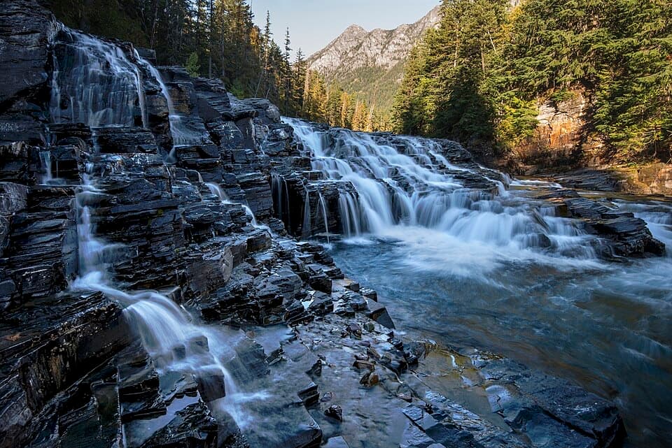
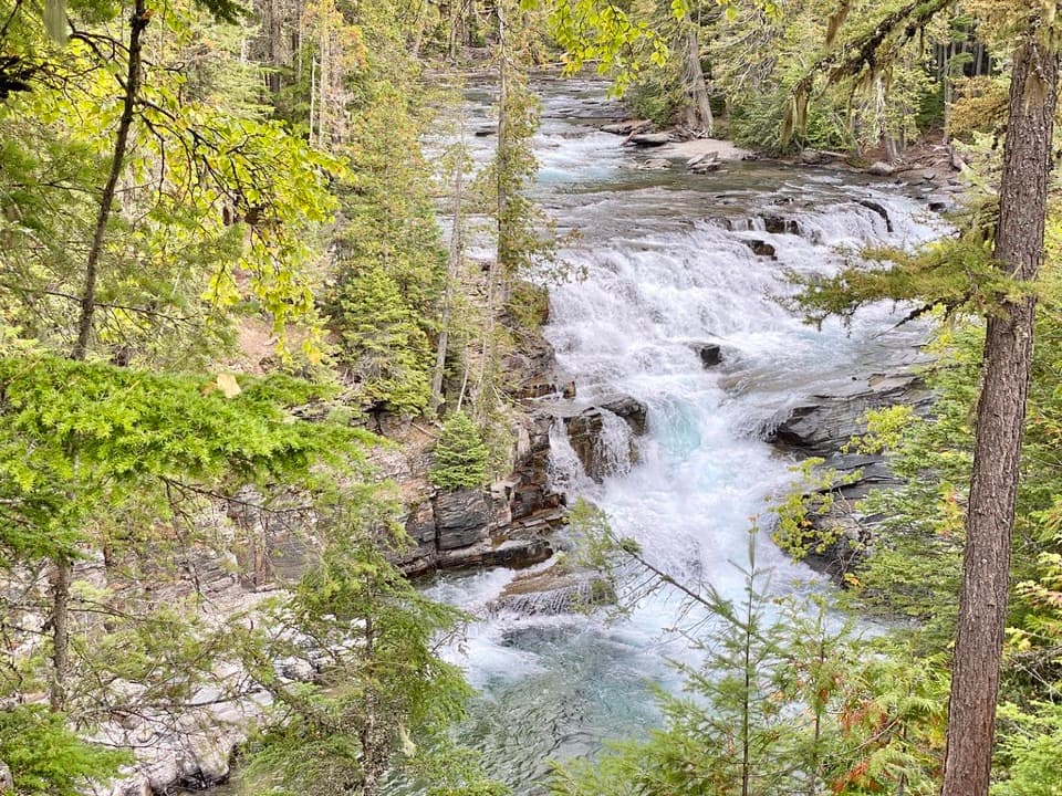
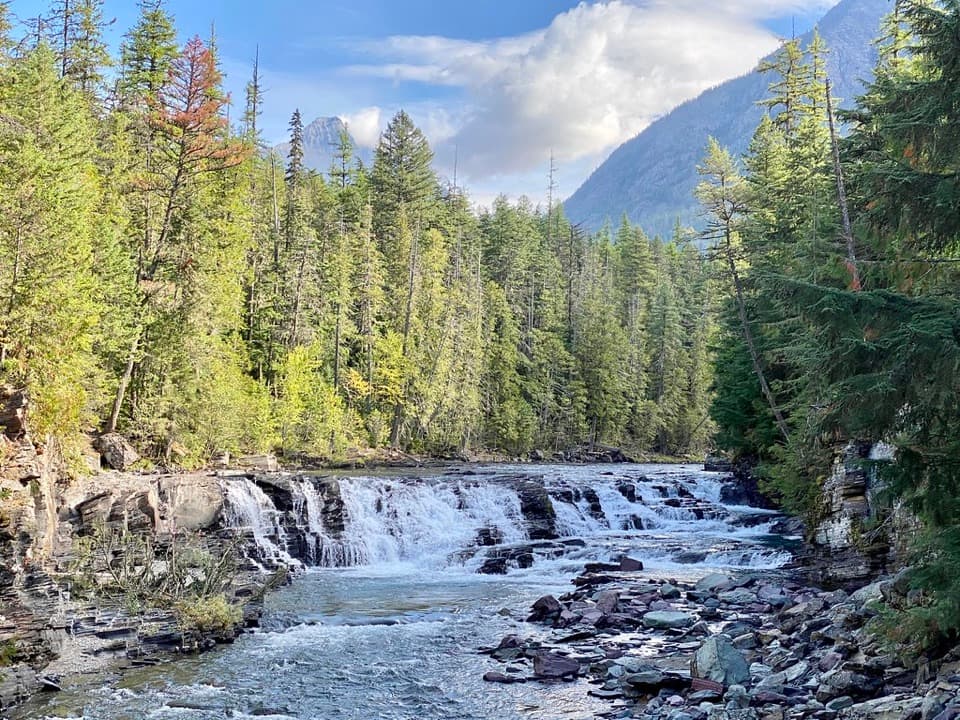
Falls and cascadesThe paved approach reaches McDonald Falls early.

The paved approach reaches McDonald Falls early. Around three-quarters of a mile in, Sacred Dancing Cascades tumbles over dark, layered rock. At the horse-path junction, stay straight on the creek trail. A footbridge beyond the cascades can connect to Johns Lake Loop, but that is an optional route change, not part of this out-and-back.

The long middle stretchPast the cascades, the trail crosses an oxbow wetland beside the creek, then leaves the water…

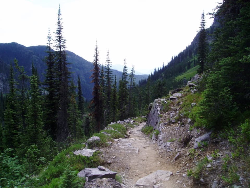
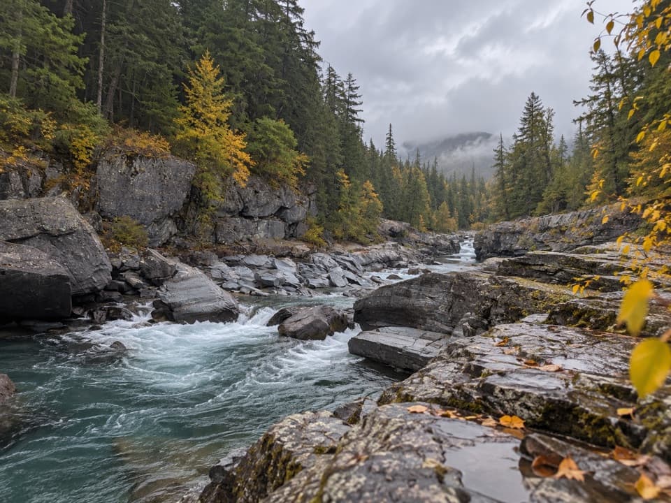
Past the cascades, the trail crosses an oxbow wetland beside the creek, then leaves the water for roughly a mile of forest before returning to the creek. Expect stretches where the woods, moss, and old trees are the point; you do not stay beside rushing water the whole way. The quieter upper section is the reason to keep going if you have the time.

Where to turn aroundThe trail passes Avalanche Creek Overlook, a wooden platform across the creek, then continues a…

The trail passes Avalanche Creek Overlook, a wooden platform across the creek, then continues a short way to a low rock outcrop beside the water. That is the described endpoint. Mount Cannon rises above the upstream view, with the creek in front of you; this is the strongest place to take in the length of the walk before heading back.

The forest and wetlandThe valley’s damp forest holds western hemlock and western red cedar, with some trees estimated…

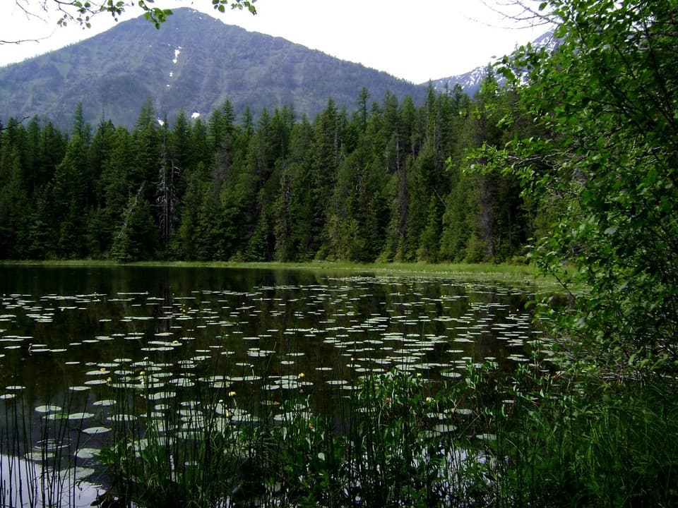
The valley’s damp forest holds western hemlock and western red cedar, with some trees estimated at more than 500 years old. The oxbow wetland is described as waterfowl habitat and possible moose habitat, especially around quieter morning or evening periods; wildlife is never a sure thing.

Access and practical detailsThe trailhead is a small pull-off on North Lake McDonald Road just after the creek bridge, with…

The trailhead is a small pull-off on North Lake McDonald Road just after the creek bridge, with space for only a few cars. The reported alternatives are a pull-off by the bridge or the larger lot at the North Lake McDonald Road and Going-to-the-Sun Road junction. The falls viewpoint has no restrooms or drinking water. Only the first paved half-mile to McDonald Falls is identified as accessible; do not assume that applies to the full trail. Pets are not permitted on park trails.

Wildlife

Wildlife in Glacier

All Glacier wildlife maps

Sighting maps show where each species has been reported across Glacier. Wildlife moves, so no sighting is guaranteed.

Keep exploring

Near Upper McDonald Creek Trail

See it all on the map

Trails that start nearby

Places near the trailhead

Parkwolf’s Glacier ranking

Top-rated trails in Glacier

All 157 trails
  1. 1Highline TrailChallenging · 11.8 mi
  2. 2Grinnell Glacier TrailChallenging · 10 mi
  3. 3Iceberg Lake TrailModerate · 9.6 mi
  4. 4Hidden Lake Overlook TrailModerate · 2.6 mi
  5. 5Avalanche Lake TrailModerate · 5 mi
  6. 6Trail of the CedarsEasy · 0.9 mi

Take Parkwolf to Glacier.

The audio tour guide for the drive, plus offline maps, trails, and wildlife heatmaps for when the signal drops.

4.7 from 8,600+ ratings

Download Parkwolf on the App StoreGet Parkwolf on Google Play