
Place · 3 mi away
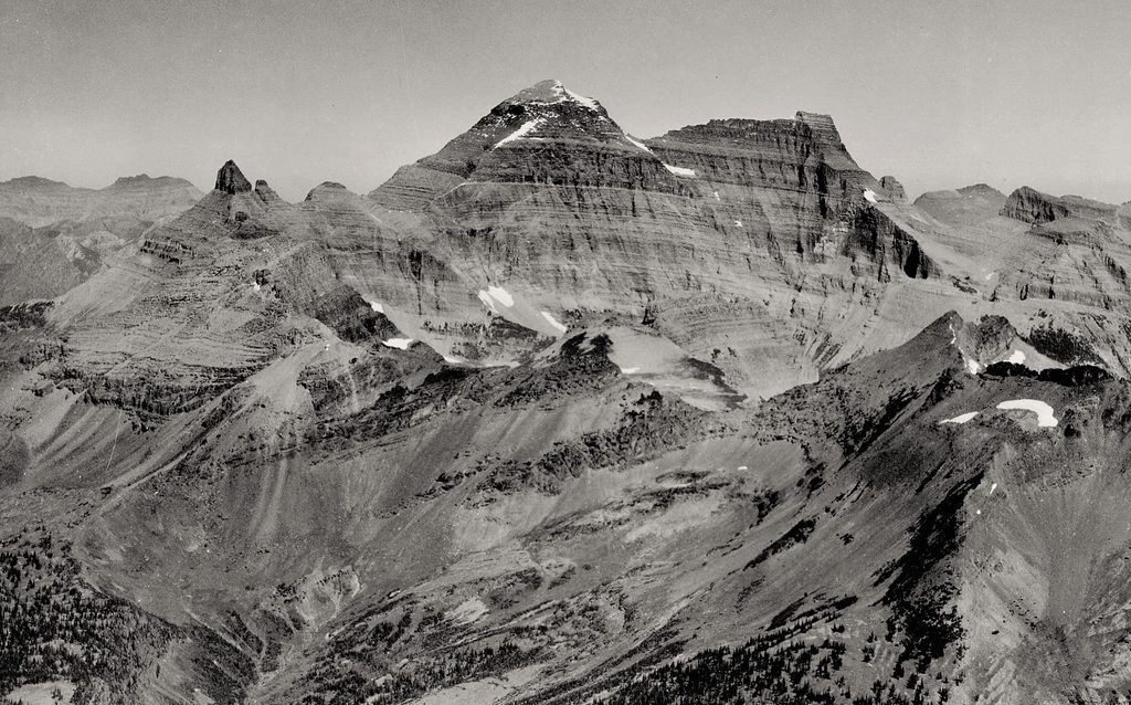
Mount Cleveland (10,466 ft) is Glacier’s big one—towering, prominent, and unapologetically wild. It sits close to the Canadian border and rises so abruptly above deep valleys that the summit feels like a lookout over half the Rockies. This is not a casual day hike; it’s a serious, remote climb that rewards preparation with solitude and ridiculous views.
Most parties start from the Belly River trailhead near Chief Mountain and backpack in. A common strategy is to camp around Lake Mokowanis or Mokowanis Junction (by permit), then continue toward Stoney Indian Pass. From there, you leave established trail and work the south ridge—navigating ledges and exposed sections on the ridge’s east side. Expect significant off‑trail travel and tricky route‑finding once you depart the pass.
Typical itineraries log big mileage just to get in position. One trip outline: roughly 14.4 miles to reach Lake Mokowanis from the trailhead, then about 6.1 miles of gorgeous trail toward Stoney Indian Pass before the scrambly business begins. Another report pegs the standard ascent as a strenuous, multi‑day effort totaling around 30 km round trip with over 2,000 m of cumulative gain.
This is prime grizzly country—bear sign has even been noted near the summit. Carry bear spray, make noise, and be meticulous with food storage. Beyond wildlife, the mountain is notorious for sudden weather shifts; snow and cold can slam you in mid‑summer. Helmets and solid footwear are smart for the loose, exposed ledges, and you’ll want real navigation tools once you leave the trail.
Backcountry camps on the approach (Stoney Indian Lake is the classic target) are permit‑controlled and competitive. Be ready with alternates like Mokowanis Junction if your first choice is full. Build in enough days to backpack in, stage your summit window, and hike out without rushing decision‑making on exposed terrain.
Late August into early September tends to offer the most reliable summit windows, with a better shot at minimal snow. Earlier in summer can still carry lingering snow and trickier conditions. There are no on‑site amenities or hours to worry about—plan around weather, permits, and your team’s fitness.
Cleveland is the signature summit of the Lewis Range—ancient sedimentary layers pushed skyward into the park’s highest point. The mountain has a storied climbing history, including the tragic 1969 “Mount Cleveland Five” avalanche on the north face, a sobering reminder of how serious this peak can be.
If you’re an experienced, fit climber with a taste for remote objectives, Mount Cleveland delivers a classic Glacier epic—huge views, real solitude, and a satisfying, committing line. For casual hikers, it’s better admired from afar than attempted.
Place · 3 mi away
Place · 3.4 mi away
Place · 3.5 mi away
Place · 3.6 mi away
Challenging · 3 mi away
Challenging · 3 mi away
Challenging · 11.9 mi away
Challenging · 11.9 mi away

Parkwolf Tour Guide
