
Place · 0.4 mi away
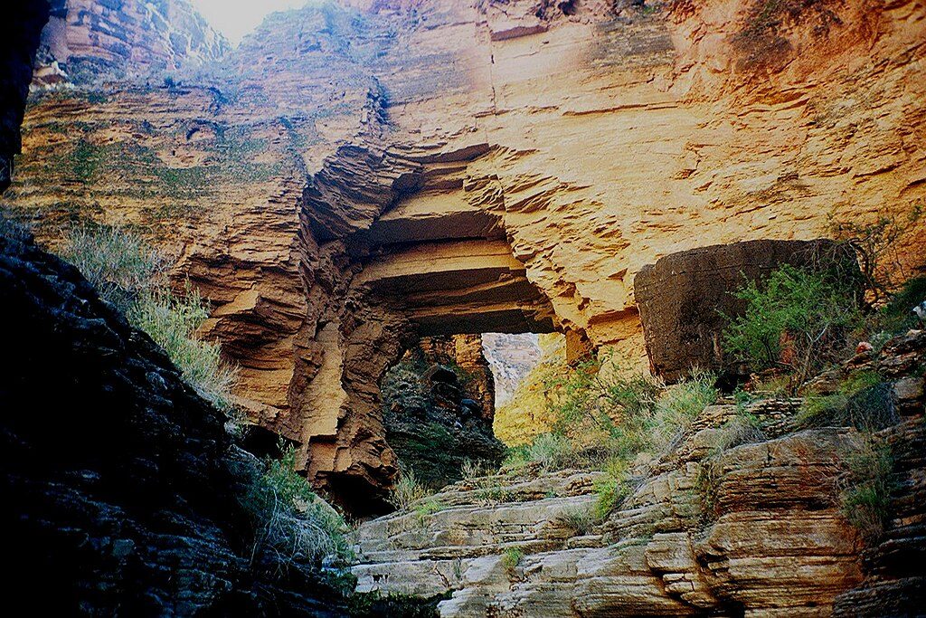
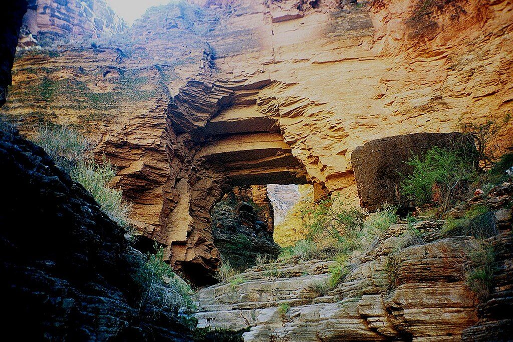
Royal Arch is a massive natural arch tucked deep in a side canyon of the remote western South Rim. Getting here isn’t casual—it’s typically a 3–5 day backpack via the Royal Arch Loop, with long, rugged miles and true wilderness solitude. If you’re after a backcountry trophy, this is it.
Most itineraries start from the South Bass Trailhead and weave across Tonto segments into Royal Arch Canyon, then drop to the Colorado River near Elves Chasm before climbing back out. An alternate entry/exit via Point Huitzil is also used. This is an unmaintained route with only intermittent cairns—treat it as a navigation problem, not a sidewalk.
This is one of the park’s tougher backpacking routes. Expect extensive scrambling and a mandatory rappel on the way toward the river. Don’t count on old fixed lines; bring your own ~50 ft rope and webbing and know how to use them. A satellite messenger or PLB is smart—there’s no cell service and rescue is far away.
Plan conservatively. Stretches of the Tonto can be dry, and some sources (like in Garnet or west‑draining side canyons) may be salty even when present. Elves Chasm is perennial, but all water must be treated. Running out isn’t an option here, so carry ample capacity and confirm recent conditions before you go.
The arch sits in the Supai Formation above the Redwall Limestone. Over millions of years, water and wind exploited fractures in the sandstone, carving out the span you see today—an elegant window into the canyon’s erosional toolbox.
You may hear canyon tree frogs at night and spot lizards and typical canyon birds by day. In spring, look for hedgehog cactus blooms along Tonto segments—small surprises in a rugged place where larger wildlife is sparse.
Aim for spring or fall when temperatures are reasonable. Summer heat and winter ice can turn cruxes dangerous. Crowds are minimal along the route; you might see river parties at Elves Chasm midday. For photography, early and late light flatter the arch and canyon walls, and spring flow beneath the arch (when present) adds extra magic.
Place · 0.4 mi away
Place · 2.6 mi away
Place · 5.8 mi away
Place · 9.8 mi away
Challenging · 4.5 mi away
Challenging · 11.4 mi away
Challenging · 11.5 mi away
Challenging · 16.2 mi away

Parkwolf Tour Guide
