Baker Archaeological Site in Great Basin National Park

Sight · Great Basin National Park

Baker Archaeological Site

A short, booklet-guided walk through a Fremont village site.

Photo: Flickr
Type
Sight
Audio stories
2 nearby
  • Parking
  • Restrooms
  • Exhibit
  • Picnic tables

Hear the audio tour

Great Basin Visitor Center: Prometheus in Cross-Section

Overview

About Baker Archaeological Site

Why stop

  • The numbered route makes the village plan easy to follow.

Heads up

  • There are no original buildings above ground.

Map

Where it is

Loading the Great Basin map
Full map
SightBaker Archaeological Site39.03741, -114.12243
Keep this map with you offline in the Parkwolf app

Plan your stop

Before you go

4 active Great Basin alerts

  • CautionStage II fire restrictions prohibit outdoor fires and smokingStage II fire restrictions are active throughout Great Basin National Park because of extreme fire danger. - Do not use campfires, charcoal grills, or smoke outdoors anywhere in the park.Official details
  • CautionPotable water is unavailable at park campgroundsPotable water is currently unavailable in every Great Basin National Park campground; bring sufficient water or fill containers before settling in.Official details

See all 4 alerts
A park ranger sits on a dash-mounted phone, talking, as Parkwolf’s Tour Guide plays “Army Cutworm Moths: A Grizzly Bear Buffet” on Grand Loop Road below Dunraven Pass in Yellowstone
Parkwolf Tour GuideThe highest, rockiest slopes around here are a summer buffet for grizzly bears.

Great Basin Tour Guide

Your drive to Baker Archaeological Site, narrated.

Parkwolf is a GPS audio tour guide for Great Basin National Park. As you drive, it chimes in with what’s ahead: hidden gems, upcoming stops, history, geology, and wildlife, right through your car’s speakers.

Recorded for this area

Great Basin Visitor Center: Prometheus in Cross-Section
0:00 / 0:33
“Great Basin Visitor Center is coming up, just north of Baker. I'd give the exhibits twenty minutes and head for the real trunk section from Prometheus, a bristlecone pine cut down for research in nineteen sixty-four.”

Plays on the road 1.6 mi from Baker Archaeological Site in the Parkwolf Great Basin Tour Guide.

More stories near here in the app

  • Baker Fuel and RV: Fuel, Showers and Laundry
  • A Cave's Hollow Straws
  • Ranching Exhibit: Look Up Under the Roof
  • Baker Village Beneath the Ground
  • 36 audio storiesacross Great Basin’s roads, triggered by GPS as you drive
  • Wildlife heatmapsfor Elk, Mule Deer, Wild Turkey, and 13 more
  • Works offlinemaps, 29 trails, 29 places, and audio download before you lose signal
  • CarPlay readysimple controls built for the drive
★★★★★
“Fantastic app with many points of information… It’s great to just turn on while you’re driving and it gives you an audio tour of the national Park. We love it!!!!”
JMJamesApp Store review
Download Parkwolf on the App StoreGet Parkwolf on Google Play

4.7 from 8,600+ ratings

Guide

More about Baker Archaeological Site

What this site isBaker Archaeological Site marks a Fremont village occupied around 1220–1295 CE, on the open…

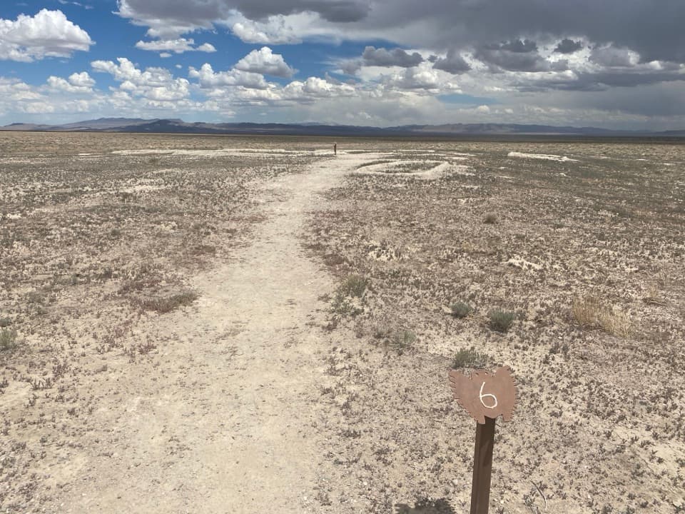
Baker Archaeological Site marks a Fremont village occupied around 1220–1295 CE, on the open desert just north of Great Basin's visitor center. It’s an easy, numbered walk through the village layout, not a set of standing ruins: the excavated features were reburied for protection, and the low walls you see are modern. Go for the archaeology and its story, not the expectation of preserved buildings.

Get the booklet firstAllow about 30 minutes for the easy, level 0.4-mile route.

Allow about 30 minutes for the easy, level 0.4-mile route. Pick up the self-guided booklet at the trailhead kiosk before you start; its numbered explanations add the context this open site needs. Check the box while you’re there, since the booklet hasn’t always been available.

The village planSmall pit houses and granaries once clustered around a larger central house; the community…

Small pit houses and granaries once clustered around a larger central house; the community farmed in this high-desert valley. Archaeologists from Brigham Young University and the Bureau of Land Management excavated the site from 1991 to 1994. After studying it, they covered the original remains to protect them; the low walls visible today were built in 2002, so don’t mistake them for original masonry. Reported finds included obsidian, turquoise and shell fragments, now held at Brigham Young University’s Museum of People and Cultures.

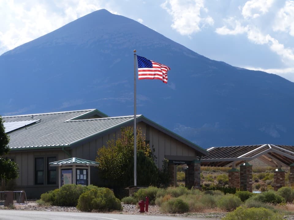
A quick stop near BakerThe BLM-managed site is reached by Baker Cut-Off, just north of the Great Basin Visitor Center.

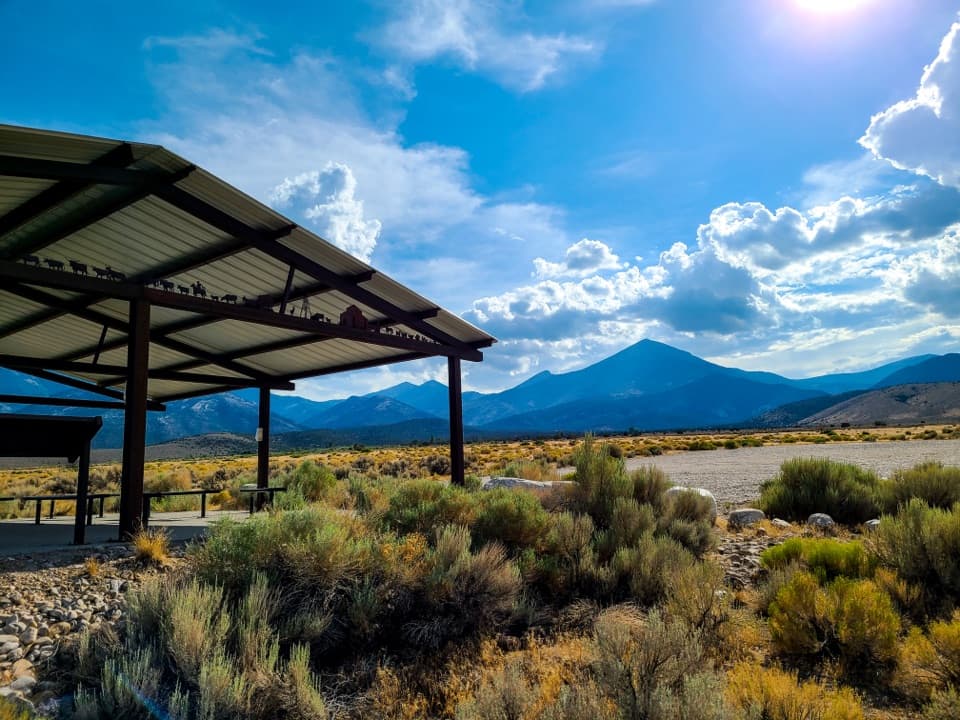
The BLM-managed site is reached by Baker Cut-Off, just north of the Great Basin Visitor Center. At the trailhead there’s parking, a restroom, picnic tables and a sun shelter, but no water. The route crosses open ground with little shade, so it works best as a short history stop or picnic break.

Wildlife

Wildlife in Great Basin

All Great Basin wildlife maps

Sighting maps show where each species has been reported across Great Basin. Wildlife moves, so no sighting is guaranteed.

Parkwolf’s Great Basin ranking

Top sights in Great Basin

All 29 places
  1. 1Lehman CavesSight
  2. 2Wheeler Peak Bristlecone GroveSight
  3. 3Wheeler PeakSight
  4. 4Mather OverlookSight
  5. 5Wheeler Peak OverlookSight
  6. 6Astronomy AmphitheaterSight

Take Parkwolf to Great Basin.

The audio tour guide for the drive, plus offline maps, trails, and wildlife heatmaps for when the signal drops.

4.7 from 8,600+ ratings

Download Parkwolf on the App StoreGet Parkwolf on Google Play