
Place
Challenging
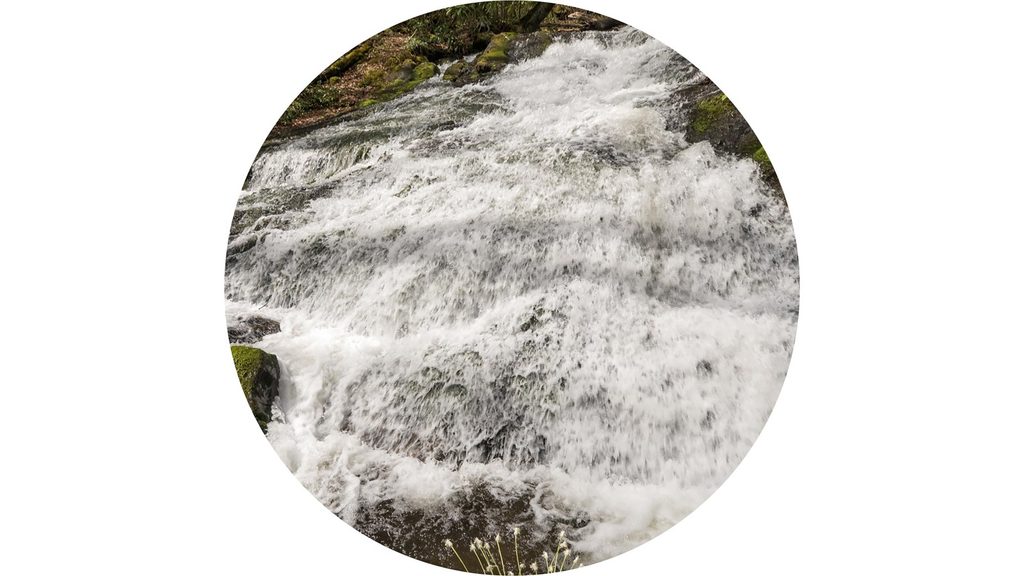
If you love miles of moving water, spring wildflowers, and a real sense of Smokies solitude, Chasteen Creek delivers. The full Chasteen Creek Trail is a 10.8-mile out-and-back with about 2,670 feet of gain and typically takes just under 6 hours. Most hikers, though, opt for the easier out-and-back to Chasteen Creek Cascade—roughly 3.6 to 5 miles round trip depending on where you start within Smokemont—trading elevation for creekside wandering and a worthy waterfall view.
From the first steps, water is the constant companion. The approach along Bradley Fork follows an old logging road, wide and generally well-maintained, with rhododendron, mossy banks, and that steady rush of the stream. In spring, the corridor erupts with white trillium, fringed phacelia, foamflower, violets, and other bloomers, and the greenery stays lush well into fall. The cascade itself is a classic Smokies bedrock slide—about 30 feet of frothy whitewater spilling over mossy rock into shallow pools—especially photogenic after rains. Downstream cataracts add extra payoff when flow is high.
Start from Smokemont Campground and follow Bradley Fork (also part of the Benton MacKaye Trail) for about 1.1–1.2 miles to the junction with Chasteen Creek. Turn right, pass Backcountry Campsite 50 less than 50 yards later, then continue upstream. After crossing a footbridge, watch for a split: take the left spur at the horse hitching post to reach the cascade. It’s easy to overshoot if you keep climbing on the main trail. Beyond the falls, the trail steepens and continues several miles into the backcountry toward Hughes Ridge and Enloe Creek—fewer people, more effort, same soothing creek soundtrack.
The shorter cascade hike is an easy, gradual climb that often feels nearly flat. Expect muddy stretches—especially after rain—thanks to shared horse use along Bradley Fork and the early Chasteen segment. The full 10.8-mile out-and-back is a different beast: longer, steeper, and generally considered challenging. Sturdy, waterproof footwear pays off.
March through November is prime. Spring brings peak wildflowers and strong flow; fall adds color. For photography, overcast or rainy days are ideal—the cascade pops, and glare drops. After heavy rain, both the main cascade and the smaller downstream slides are at their best. Warm months can bring gnats; pack repellent.
Park at Smokemont Campground and start on Bradley Fork at the north end (D loop area near campsite 45). A park parking tag is required.
Shared with horses; expect muddy, slick tread after rain. The cascade spur at the hitching post is easy to miss—stay left. Gnats can be heavy in warm months. Permits required for backcountry camping.
Place
Place
Place
Place
Challenging
Moderate
Challenging
Easy

Parkwolf Tour Guide
