Footprints Shelter in Hawaiʻi Volcanoes National Park

Sight · Hawaiʻi Volcanoes National Park

Footprints Shelter

A short walk to ancient footprints with a story still in dispute.

Type
Sight
Nearest trail
0.7 mi
Audio stories
2 nearby
  • Exhibit
  • #16 of 35 sights

Hear the audio tour

Footprints Shelter: Tracks in the Ash

Overview

About Footprints Shelter

Why stop

  • Human footprints preserved in volcanic ash, with a story worth unpacking.

Heads up

  • It takes a 1.6-mile round trip through a dry, exposed landscape.

Map

Where it is

Loading the Hawaiʻi Volcanoes map
Full map
SightFootprints Shelter19.35852, -155.36497
Keep this map with you offline in the Parkwolf app

Plan your stop

Before you go

5 active Hawaiʻi Volcanoes alerts

  • ClosureWork closures on Hilina Pali and Mauna Loa roadsMentions Hilina Pali, referenced in this guideRoad work is restricting motorized and all-use access on portions of Hilina Pali Road and Mauna Loa Road.Official details
  • ClosureStorm-damage closures at Kahuku, Kīpukapuaulu, and Sulphur BanksStorm damage and hazardous trees continue to restrict access at Kahuku and Kīpukapuaulu; the damaged Sulphur Banks Bridge is closed.Official details

See all 5 alerts
A park ranger sits on a dash-mounted phone, talking, as Parkwolf’s Tour Guide plays “Army Cutworm Moths: A Grizzly Bear Buffet” on Grand Loop Road below Dunraven Pass in Yellowstone
Parkwolf Tour GuideThe highest, rockiest slopes around here are a summer buffet for grizzly bears.

Hawaiʻi Volcanoes Tour Guide

Your drive to Footprints Shelter, narrated.

Parkwolf is a GPS audio tour guide for Hawaiʻi Volcanoes National Park. As you drive, it chimes in with what’s ahead: hidden gems, upcoming stops, history, geology, and wildlife, right through your car’s speakers.

See the Hawaiʻi Volcanoes audio tour

Recorded for this place

Footprints Shelter: Tracks in the Ash
0:00 / 0:28
“The Kaʻū Desert Trailhead is coming up, with a walk to Footprints Shelter for anyone curious about the people who crossed this volcanic landscape.”

Plays as you drive up to Footprints Shelter in the Parkwolf Hawaiʻi Volcanoes Tour Guide.

More stories near here in the app

  • Rain That Keeps the Ground Bare
  • One Park on Two Islands
  • A Spider Beneath a Leaf
  • A Clock Inside a Crystal
  • 58 audio storiesacross Hawaiʻi Volcanoes’s roads, triggered by GPS as you drive
  • Wildlife heatmapsfor Hawaiian Goose (Nēnē), Green Sea Turtle, Hawaiian Hawk ('Io), and 13 more
  • Works offlinemaps, 33 trails, 53 places, and audio download before you lose signal
  • CarPlay readysimple controls built for the drive
★★★★★
“Fantastic app with many points of information… It’s great to just turn on while you’re driving and it gives you an audio tour of the national Park. We love it!!!!”
JMJamesApp Store review
Download Parkwolf on the App StoreGet Parkwolf on Google Play

4.7 from 8,600+ ratings

Guide

More about Footprints Shelter

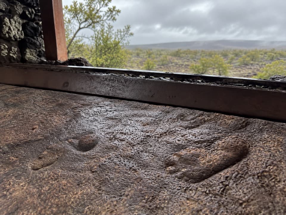
A short walk into the Kaʻū DesertFootprints Shelter protects an exhibit of human footprints preserved in volcanic ash.

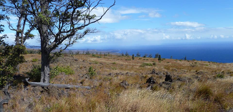
Footprints Shelter protects an exhibit of human footprints preserved in volcanic ash. It’s an easy 0.8-mile walk one way from the Kaʻū Desert Trailhead beside Highway 11, or about 1.6 miles round trip. It’s a good stop if you’re curious about Hawaiʻi’s human history as well as its volcanoes; the shelter is the destination, with the stark desert all around it.

The story is still unsettledThe familiar story links the prints to Keoua’s party during the 1790 eruption, but that…

The familiar story links the prints to Keoua’s party during the 1790 eruption, but that connection is speculative. The ash formed in multiple explosive episodes between about AD 1500 and 1790. The prints may record everyday activity in the area; another interpretation places them in 1790, made by family groups—mostly women and children—before the eruption’s most violent phase. The age and story are still debated, so treat the exhibit as an invitation to look closer rather than a settled answer.

More than one journeyTwo footprint-bearing ash layers lie about 90 cm apart, and tracks run in both directions.

Two footprint-bearing ash layers lie about 90 cm apart, and tracks run in both directions. The wider desert also holds evidence of temporary habitation, trails, petroglyphs, and volcanic-glass quarries. Hawaiians shaped volcanic glass into sharp cutting tools. The footprints are one striking trace of people moving through and using the Kaʻū landscape, not the only one.

Keep to the pathBring water and food before leaving the road: the wider Kaʻū Desert route has little shade and…

Bring water and food before leaving the road: the wider Kaʻū Desert route has little shade and no water. Stay on the established trail, since the ash is fragile and easy to damage. The shelter is on a short walk, while the route continues toward Mauna Iki and much farther toward Hilina Pali Road.

Wildlife

Wildlife in Hawaiʻi Volcanoes

All Hawaiʻi Volcanoes wildlife maps

Sighting maps show where each species has been reported across Hawaiʻi Volcanoes. Wildlife moves, so no sighting is guaranteed.

Parkwolf’s Hawaiʻi Volcanoes ranking

Top sights in Hawaiʻi Volcanoes

All 53 places
  1. 1UēkahunaSight
  2. 2Nāhuku Lava TubeSight
  3. 3Kīlauea OverlookSight
  4. 4Puʻuloa PetroglyphsSight
  5. 5Hōlei Sea ArchSight
  6. 6Kīlauea Iki OverlookSight

Take Parkwolf to Hawaiʻi Volcanoes.

The audio tour guide for the drive, plus offline maps, trails, and wildlife heatmaps for when the signal drops.

4.7 from 8,600+ ratings

Download Parkwolf on the App StoreGet Parkwolf on Google Play