Grandma Gatewood Trail in Hocking Hills State Park

#7 of 18 trails in Hocking Hills

Hocking Hills State Park, OH

Grandma Gatewood Trail

A tough 5.3-mile crossing for waterfalls, caves and sandstone gorge.

Photo: Wikimedia Commons
Length
5.3mi
Time
3.5hr
Elev. change
355ft
Difficulty
Challenging
  • Dogs allowed
  • High point 1,085 ft

Hear the audio tour

Old Man's Cave

Overview

About Grandma Gatewood Trail

Why go

  • One walk connects Old Man’s Cave, Cedar Falls and Ash Cave.
  • A changing mix of waterfalls, sandstone gorges and hemlock forest.

Heads up

  • Steep stairs and repeated creek crossings slow the first section.
  • Point-to-point logistics; walking back roughly doubles the hike.

Map & elevation

The route

Loading the Hocking Hills map
Full map
Elevation730–1,085 ft
TrailheadUpper Falls, Old Man’s Cave39.43616, -82.53904
Keep this map with you offline in the Parkwolf app

Plan your hike

Before you go

Parking

Start at Upper Falls in the Old Man’s Cave access area and finish at the Ash Cave lot. They are separate trailheads, so arrange a pickup or leave a vehicle at each end before setting out. I could not confirm a regular park shuttle for the through-hike.

Safety

This difficult route has repeated creek crossings, steep stairs and uneven sandstone; footing can be slick, and winter ice is common. Dogs must stay leashed with a leash no longer than six feet. Plan the hike within park trail hours: 30 minutes before sunrise to 30 minutes after sunset.

A park ranger sits on a dash-mounted phone, talking, as Parkwolf’s Tour Guide plays “Army Cutworm Moths: A Grizzly Bear Buffet” on Grand Loop Road below Dunraven Pass in Yellowstone
Parkwolf Tour GuideThe highest, rockiest slopes around here are a summer buffet for grizzly bears.

Hocking Hills Tour Guide

Your drive to Grandma Gatewood Trail, narrated.

Parkwolf is a GPS audio tour guide for Hocking Hills State Park. As you drive, it chimes in with what’s ahead: hidden gems, upcoming stops, history, geology, and wildlife, right through your car’s speakers.

Recorded for this trailhead

Old Man's Cave
0:00 / 0:28
“You're approaching Old Man's Cave, where the creek winds past waterfalls, stone tunnels and a huge sandstone shelter.”

Plays as you drive up to this trailhead in the Parkwolf Hocking Hills Tour Guide.

More stories near here in the app

  • Hocking Hills State Park Campground
  • Hocking Hills Hike-In Campground
  • Rose Lake Walking Access
  • John Glenn Astronomy Park
  • 22 audio storiesacross Hocking Hills’s roads, triggered by GPS as you drive
  • Wildlife heatmapsfor White-tailed Deer, Snapping Turtle, Chipmunk, and 9 more
  • Works offlinemaps, 18 trails, 29 places, and audio download before you lose signal
  • CarPlay readysimple controls built for the drive
★★★★★
“Fantastic app with many points of information… It’s great to just turn on while you’re driving and it gives you an audio tour of the national Park. We love it!!!!”
JMJamesApp Store review
Download Parkwolf on the App StoreGet Parkwolf on Google Play

4.7 from 8,600+ ratings

Trail guide

Hiking Grandma Gatewood Trail

The full 5.3-mile routeGrandma Gatewood Trail is a 5.

Grandma Gatewood Trail is a 5.3-mile, one-way hike from Upper Falls at Old Man’s Cave to Ash Cave. It links three of Hocking Hills’ best-known sandstone gorges. The park rates it difficult; allow about 3 to 4 hours of walking, plus time at the falls and cave. That’s a planning estimate, since there isn’t a dependable published time for the whole traverse. Steep gorge stairs and repeated creek crossings make the first miles slower than the distance suggests. You finish at a different lot, so set up a pickup or leave a car at each end. Walking back makes this about a 10.6-mile day.

Upper Falls and Old Man’s CaveThe route drops from Upper Falls into the gorge, where sandstone walls crowd the creek and…

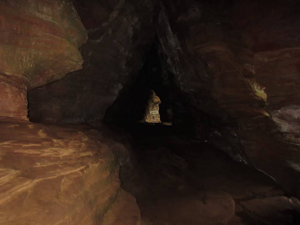
The route drops from Upper Falls into the gorge, where sandstone walls crowd the creek and hemlocks keep the path shaded. Expect uneven rock, short steep descents and several creek crossings. A rock tunnel, the recess that gives Old Man’s Cave its name, and Lower Falls come in quick succession. There’s a marked connector back toward the visitor center partway through the gorge; it’s a useful shorter outing, but it doesn’t complete the Grandma Gatewood crossing.

Along the creek to Cedar FallsSouth of Lower Falls, the blue-marked corridor follows the creek beneath hemlocks and sandstone…

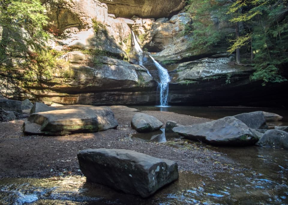
South of Lower Falls, the blue-marked corridor follows the creek beneath hemlocks and sandstone cliffs toward Hemlock Bridge, then climbs toward Cedar Falls. The route shares this stretch with the Buckeye Trail. At junctions, stay on the blue Grandma Gatewood line rather than taking the separate Whispering Cave route. Cedar Falls drops below tall cliffs into a pool; it’s one of the route’s main rewards, and you can take a short break at the falls before the longer southern leg.

A different walk to Ash CaveFrom Cedar Falls, the trail goes behind the picnic area onto a forest road.

From Cedar Falls, the trail goes behind the picnic area onto a forest road. The first stretch is on that road, then the route crosses Chapel Ridge Road, passes Ash Cave Fire Tower and follows more forest road before dropping through mixed woods and hemlocks beside the stream that feeds Ash Cave. This leg spends more time in the forest and on old service roads than in the narrow gorges, so the walk changes character after Cedar Falls.

How the caves formedOld Man’s Cave and Ash Cave are sandstone recesses, shaped as water and weathering widen cracks…

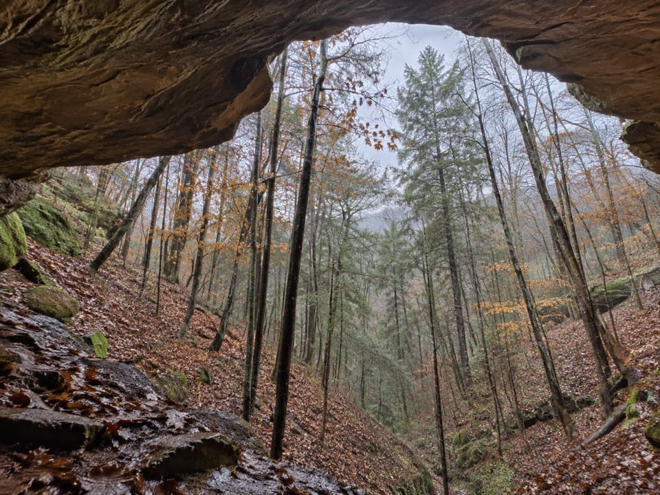
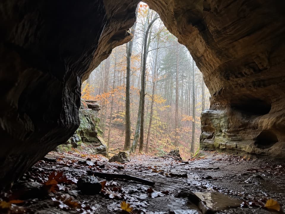
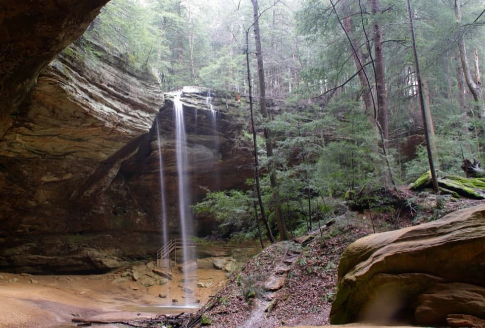
Old Man’s Cave and Ash Cave are sandstone recesses, shaped as water and weathering widen cracks in the rock. The softer middle layer erodes faster than the harder rock above and below it, leaving the broad overhangs you see along the route. Ash Cave is the finish: a wide arcing chamber with a seasonal waterfall. For a photo, stand across the shallow stream and include someone beneath the overhang; it gives the cave a sense of scale.

Emma “Grandma” GatewoodThe trail honors Emma Gatewood, the Ohio hiker who completed the Appalachian Trail in 1955 and…

The trail honors Emma Gatewood, the Ohio hiker who completed the Appalachian Trail in 1955 and later helped dedicate the first section of the Buckeye Trail. She returned to Hocking Hills for annual winter hikes from 1967 through 1973. The name fits a route that doubles as part of the Buckeye Trail and links several separate park areas rather than ending at one overlook.

Plan the one-way walkThe main access lots have picnic areas and latrines, and there are shelters at Old Man’s Cave,…

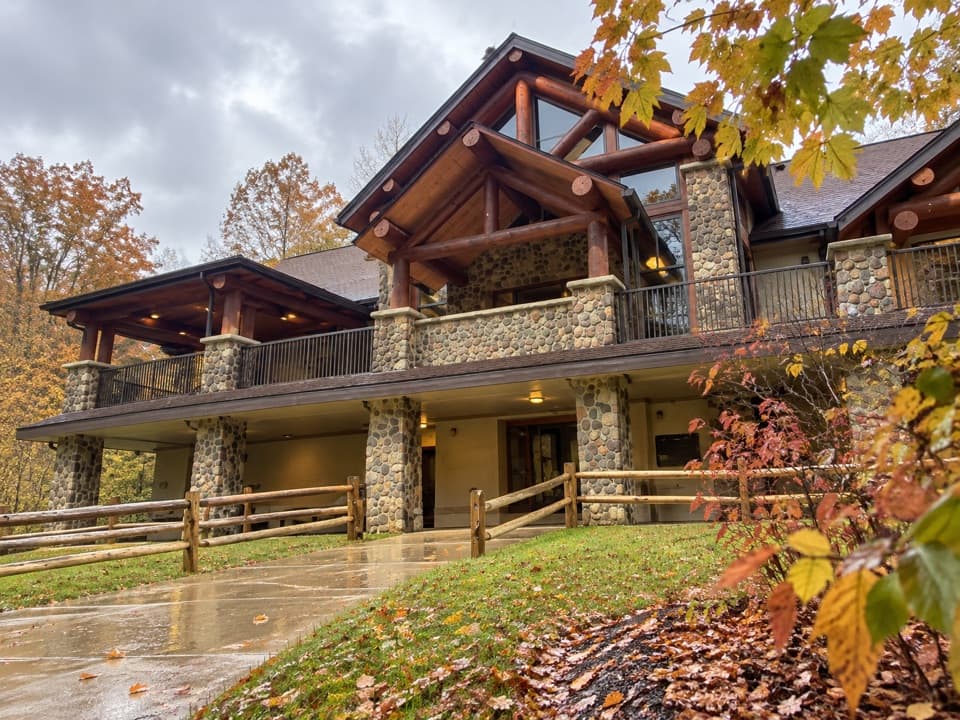
The main access lots have picnic areas and latrines, and there are shelters at Old Man’s Cave, Cedar Falls and Ash Cave. Plan food and water before starting; no refill or food stop on the through-route was confirmed. Leashed pets are allowed, with a six-foot maximum leash. Park trails are open from 30 minutes before sunrise to 30 minutes after sunset, and winter ice is common in the gorges. If you only want Ash Cave, its separate quarter-mile paved accessible path from the south lot is a much easier visit than this through-hike.

Wildlife

Wildlife in Hocking Hills

All Hocking Hills wildlife maps

Sighting maps show where each species has been reported across Hocking Hills. Wildlife moves, so no sighting is guaranteed.

Keep exploring

Near Grandma Gatewood Trail

See it all on the map

Trails that start nearby

Places near the trailhead

Parkwolf’s Hocking Hills ranking

Top-rated trails in Hocking Hills

All 18 trails
  1. 1Old Man’s Cave TrailModerate · 1 mi
  2. 2Ash Cave Gorge TrailEasy · 0.6 mi
  3. 3Conkles Hollow Rim TrailChallenging · 2 mi
  4. 4Whispering Cave TrailChallenging · 3.3 mi
  5. 5Rock House Gorge TrailModerate · 0.6 mi
  6. 6Cedar Falls TrailModerate · 0.6 mi

Take Parkwolf to Hocking Hills.

The audio tour guide for the drive, plus offline maps, trails, and wildlife heatmaps for when the signal drops.

4.7 from 8,600+ ratings

Download Parkwolf on the App StoreGet Parkwolf on Google Play