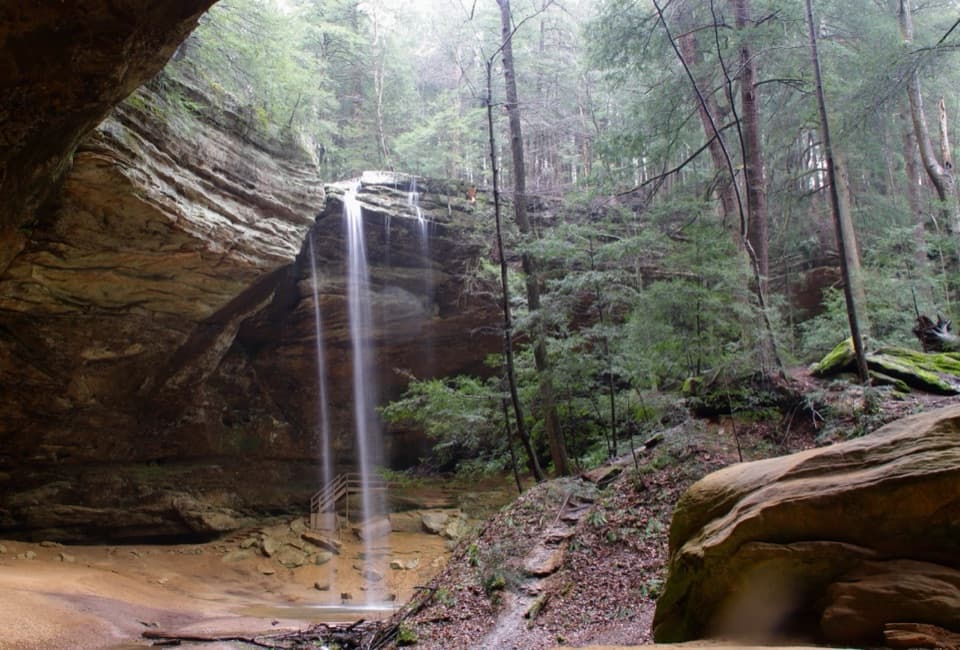
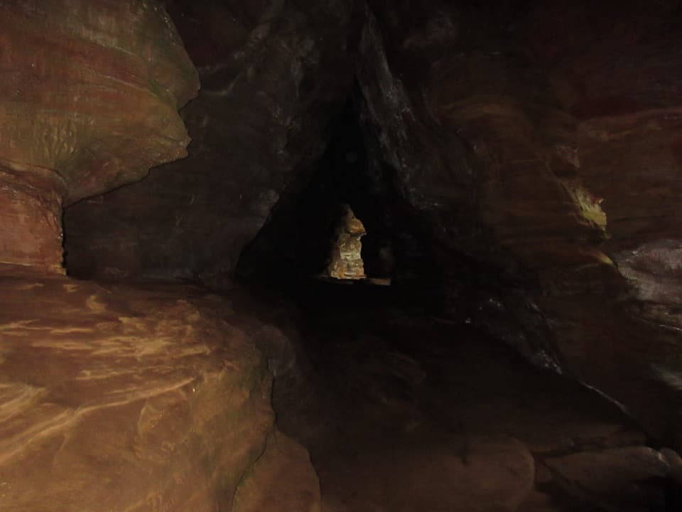
Parking
Park at Old Man’s Cave and begin from the Upper Falls kiosk. Follow the blue markers to the purple trail; the route finishes near the Visitor Center.
#4 of 18 trails in Hocking Hills
Hocking Hills State Park, OH
A rugged one-way circuit to Whispering Cave via Hemlock Bridge.
Overview
Whispering Cave Trail is a rugged 3.3-mile one-way circuit through the Old Man’s Cave gorge area, over Hemlock Bridge and on to a broad sandstone recess with a seasonal waterfall. Start at the Upper Falls kiosk and finish on the Visitor Center side. You follow a blue-marked approach and the purple Whispering Cave route rather than doubling back; the cave spur is part of the visit. I’d choose it if you want a demanding half-day walk with several different stops. Allow about three hours, especially if you linger at the bridge and cave. A 4.5-mile figure appears elsewhere without endpoints; 3.3 miles describes this Upper Falls-to-Visitor Center line. Spurs to Broken Rock Falls, Lower Falls and Old Man’s Cave add distance. For a shorter alternative, the separate lodge-to-cave out-and-back is about one mile round trip.
 Parkwolf’s verdictIs this the hike for you?
Map & elevation
Plan your hike

The highest, rockiest slopes around here are a summer buffet for grizzly bears.
Hocking Hills Tour Guide
Parkwolf is a GPS audio tour guide for Hocking Hills State Park. As you drive, it chimes in with what’s ahead: hidden gems, upcoming stops, history, geology, and wildlife, right through your car’s speakers.
Recorded for this trailhead
Old Man's Cave“You're approaching Old Man's Cave, where the creek winds past waterfalls, stone tunnels and a huge sandstone shelter.”
Plays as you drive up to this trailhead in the Parkwolf Hocking Hills Tour Guide.
More stories near here in the app
“Fantastic app with many points of information… It’s great to just turn on while you’re driving and it gives you an audio tour of the national Park. We love it!!!!”


Trail guide
From the Upper Falls kiosk, follow the blue markers about 1.5 miles to the signed purple trail. The blue leg takes you through the Old Man’s Cave gorge area to Hemlock Bridge. Cross the swinging bridge, then continue on the purple route toward Whispering Cave and back toward the Visitor Center. This is a one-way system, so follow the signs through the circuit instead of treating the cave as a turnaround. The route finishes near the Visitor Center, on the other side of the same Old Man’s Cave parking area from the Upper Falls start.
The mileage understates the effort. Expect repeated climbs and descents on rugged dirt, exposed roots, rock scrambles and many stone and wooden steps. The cave approach drops down a long run of wooden steps, then climbs steeply as you leave. Cliff edges and uneven footing make this a poor choice if steep ground or stairs are a problem. Stay on the marked trail; the park does not allow wading or swimming in creeks or waterfalls.
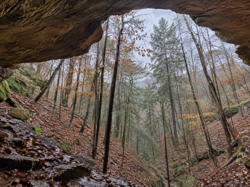
The destination is a broad recess in the sandstone, not a deep underground cavern. A seasonal waterfall can spill across the opening, but its flow varies with rainfall. Look up at the rock lip and out through the hollow to the trees beyond. It’s the route’s signature view; frame the overhang around the wooded gorge, and treat the waterfall as a bonus rather than a guarantee.
Whispering Cave formed in a softer middle layer of Black Hand sandstone. Weathering widened cracks in the rock into recesses, while water washing away loosely cemented grains leaves the small honeycomb pockets visible in the cliffs. Large blocks below the walls are slump blocks that fell as cracks widened and the cliff lost support.
Ice sheets never covered this part of the park, but glacial runoff carried eastern hemlock, Canada yew, and yellow and black birch into the gorge landscape. The Delaware word Hockhockin, meaning “bottleneck,” describes the narrow, gourd-shaped gorge of the Hocking River. Delaware, Shawnee and Wyandot people lived and hunted in the region; an Indigenous path through the park connected villages and hunting grounds toward Chillicothe. That historic path is separate from today’s marked hiking route.
Old Man’s Cave Visitor Center is near the finish, with restrooms, a gift shop and exhibits. The parking area has picnic tables, grills and latrines. The state park lodge has a full-service restaurant, but it is a separate stop rather than food on the trail. Dogs are allowed on a leash no longer than six feet; with this many stairs and cliff edges, the route can be a tough fit for many pets.
Wildlife
 16 sightingsWhite-tailed DeerMost seen around 7 AMSighting map
 87 sightingsSnapping TurtleMost seen around 5 PMSighting map
 14 sightingsChipmunkMost seen around 8 AMSighting map
 19 sightingsGray RatsnakeMost seen around 6 PMSighting map
 47 sightingsWatersnakeMost seen around 10 AMSighting map
 11 sightingsRing-necked SnakeMost seen around 7 PMSighting map
Sighting maps show where each species has been reported across Hocking Hills. Wildlife moves, so no sighting is guaranteed.
Keep exploring
 ModerateOld Man’s Cave Trail1 mi · 1 hr · At the trailheadA one-mile gorge loop past a waterfall, cave and stone tunnels.
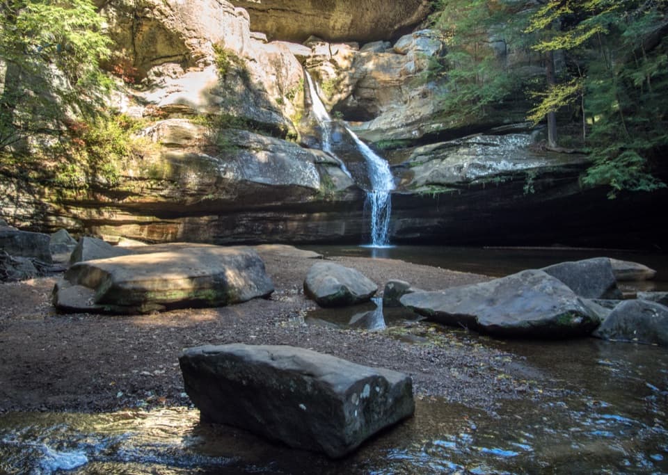 ModerateGorge Overlook Trail2.8 mi · 1.8 hr · 0.1 mi awayA point-to-point gorge walk from Old Man’s Cave to Cedar Falls.
 ChallengingGrandma Gatewood Trail5.3 mi · 3.5 hr · 0.1 mi awayA tough 5.3-mile crossing for waterfalls, caves and sandstone gorge.
 ModerateBroken Rock Trail0.3 mi · 20 min · 0.4 mi awayA short, steep stair climb to a sandstone cleft waterfall
 ModerateRose Lake Trail2.5 mi · 1.5 hr · 0.7 mi awayA rooty 2.5-mile walk to loop Hocking Hills’ 17-acre lake.
 ModerateWhispering Cave Trail from the Lodge0.6 mi · 45 min · 1 mi awayFrom the Lodge, steep steps lead to a broad sandstone recess.
 ModerateCedar Falls Trail0.6 mi · 40 min · 1.5 mi awayA short waterfall loop with uneven, stepped gorge trails.
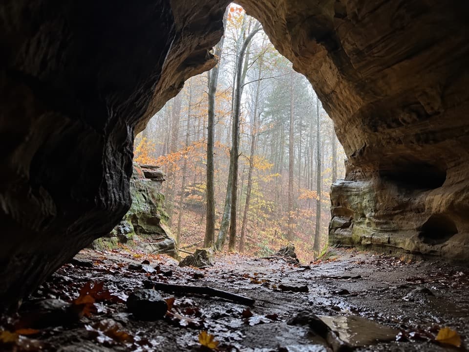 ModerateChapel Cave Trail1.8 mi · 1.3 hr · 1.8 mi awayA creekside bridle trail leads to a cave with a 21-horse legend.Sight · 0.1 mi awayUpper FallsA waterfall and stone bridge introduce the sandstone gorge.
 Campground · 0.1 mi awayHocking Hills State Park CampgroundStay beside Old Man’s Cave, with full-hookup sites and cabins.
 Sight · 0.1 mi awayDevil's BathtubA swirling sandstone basin is the gorge walk's standout stop.
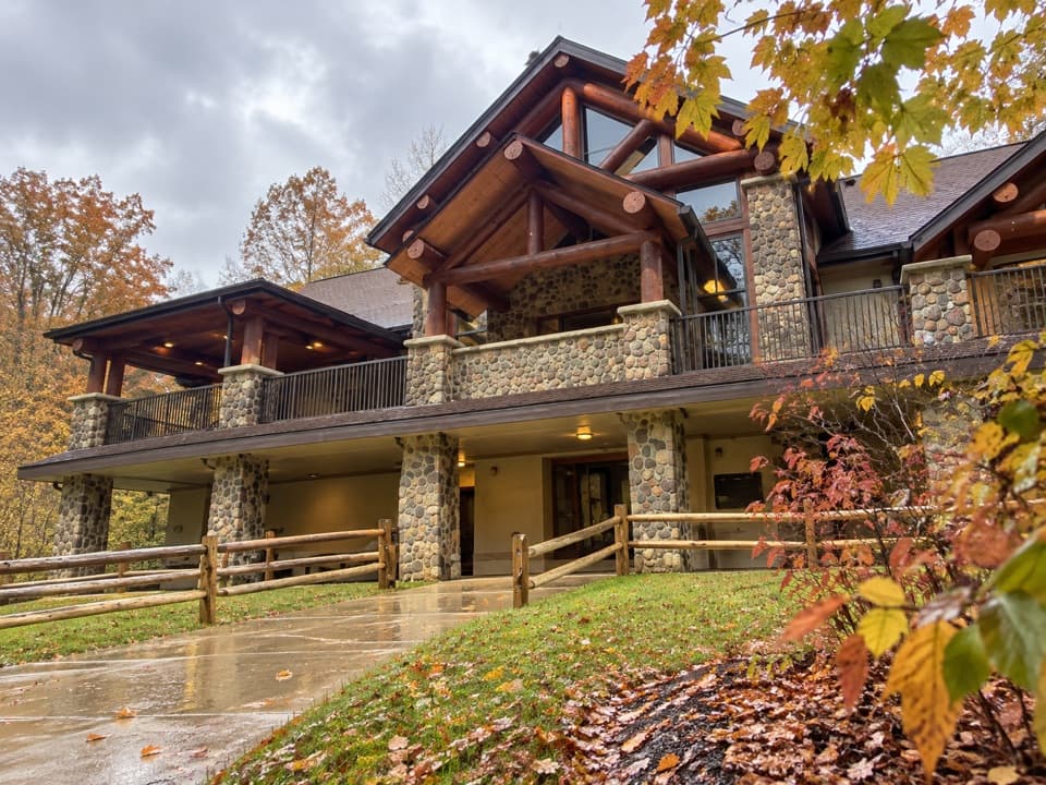 Visitor center · 0.2 mi awayHocking Hills State Park Visitor CenterA useful first stop for regional exhibits and resident raptors.
 Sight · 0.2 mi awayHocking Hills Archery RangeA good side stop if you brought your archery gear.
 Sight · 0.3 mi awayOld Man's CaveA rock shelter above a gorge of waterfalls and winding creek.
 Sight · 0.4 mi awayLower FallsA curved ledge and shaded pool reward the descent into the gorge.
 Sight · 0.5 mi awayBroken Rock FallsA stair-heavy spur leads to a tucked-away sandstone cascade.
Parkwolf’s Hocking Hills ranking
The audio tour guide for the drive, plus offline maps, trails, and wildlife heatmaps for when the signal drops.