
Place · 0 mi away
Challenging
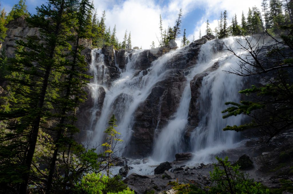
Tangle Ridge is a moderately challenging, rewarding ridge hike starting right at Tangle Falls along the Icefields Parkway. Expect a quiet, sustained climb that trades the roadside bustle for big alpine views. This is an out-and-back route that typically takes 4–6 hours to complete.
The route is approximately 6.7 miles total (round-trip) with about 3,773 feet (1,150 m) of elevation gain. The summit stands around 9,846 feet (3,001 m), and most hikers will want a solid half day to account for breaks and photo stops.
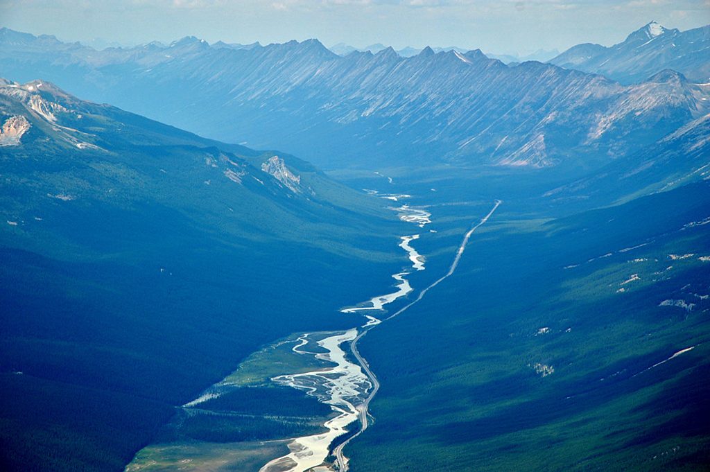
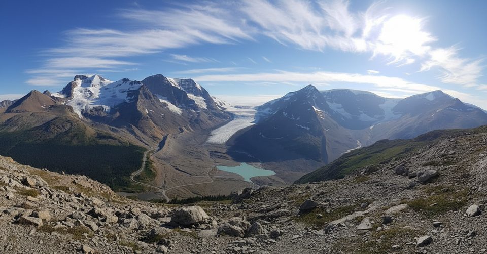
From the Tangle Falls parking area, carefully cross the highway and pick up the path. It parallels the road briefly, then swings into dense forest along Tangle Creek before the real work begins. Above treeline, the trail grows faint and the terrain turns rocky and steep with sections of scree; cairns help mark the way. The payoff is a long, airy ridge with sweeping looks at the Columbia Icefield, Sunwapta Pass, and neighboring peaks (including Mount K2). It’s notably quieter than high-profile nearby hikes like Wilcox Pass or Parker Ridge.
You’ll start at a multi-tiered roadside cascade, then trade subalpine forest for a classic Canadian Rockies skyline. Keep an eye out for glacial landforms—U-shaped valleys, moraines, cirques, and rugged outcrops. Wildlife sightings can include marmots around the rocks and, higher up, mountain goats or bighorn sheep.
Late June through September typically offers the best conditions. Early summer can hang onto snow patches, while autumn brings crisp air and golden larch color with clearer views. Winter travel is not recommended for casual hikers due to significant avalanche hazard and unmaintained conditions.
If you’re up for a steep climb and some route-finding on rocky alpine terrain, Tangle Ridge delivers outsized, Icefields-grade views with far fewer crowds than the area’s marquee trails. For those wanting a mellower outing with less elevation, consider the more popular nearby options—but for solitude plus summit-scale vistas, this ridge is an excellent call.
Park at the signed Tangle Falls pullout; the trail begins across Highway 93. It’s about 7 km north of the Columbia Icefield Centre and 94 km south of Jasper.
Fast-moving highway crossing; steep, rocky terrain with loose scree; fading trail above treeline requiring cairn-based navigation; rapidly changing mountain weather; significant avalanche risk in winter.
Place · 0 mi away
Place · 1 mi away
Place · 4.1 mi away
Place · 4.2 mi away
Easy · 4.4 mi away
Moderate · 4.6 mi away
Moderate · 5.5 mi away
Moderate · 5.5 mi away

Parkwolf Tour Guide
