Pros & cons
PROS
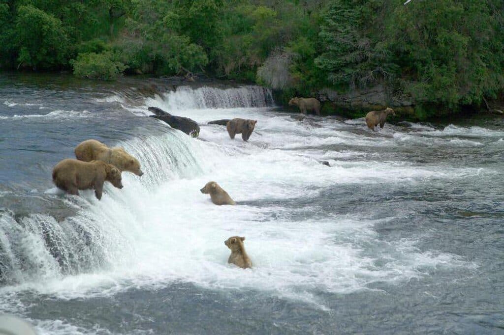
- Prime brown bear viewing during salmon runs
- Wide tidal flats make boat or kayak viewing easy at safe distances
CONS
- No facilities or infrastructure of any kind
- Challenging access with big tides, fog, and rapidly changing weather
Overview
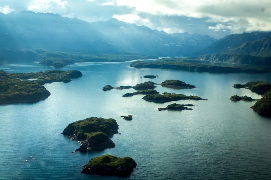
Geographic Harbor sits at the head of Amalik Bay on Katmai’s Pacific coast—a remote, undeveloped anchorage of mudflats, creeks, and steep green walls where the wild feels close and constant. There are no docks, campgrounds, toilets, or platforms here; it’s pure backcountry, reached by boat or floatplane when the weather allows.
Why it’s special
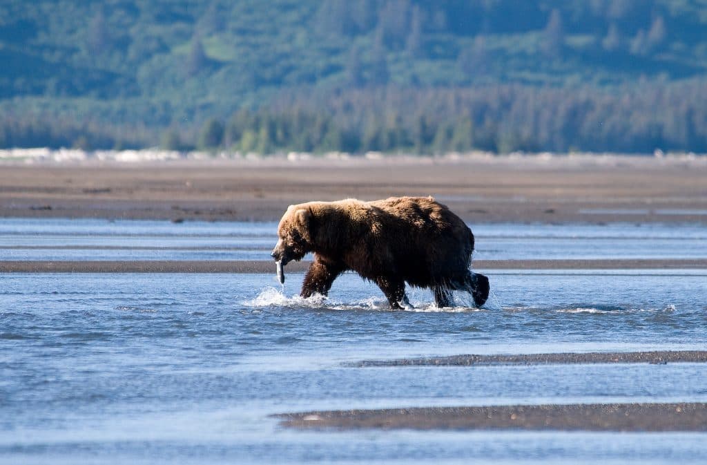
This is one of Katmai’s most reliable coastal bear‑viewing spots when salmon pulse into the creeks, typically mid‑summer into early fall. The broad tidal flats let you watch bears from a respectful distance—often from a boat or kayak—while they fish, wander, and interact across the estuary.
Getting there
There are no roads to Katmai’s coast. Most visitors come via charter boat from coastal hubs or by floatplane drop‑off. Expect rapidly changing seas, fog, and strong tidal currents in nearby Shelikof Strait; schedules are weather‑dependent, and flexibility is part of any successful plan.
On the water and along the flats
Tides rule everything here. Plan outings around big tide swings and swift currents. Kayakers should avoid creek mouths during peak bear use, give generous standoff distances, and be prepared for surf landings—or to remain afloat—if bears are present along potential landing spots. You’ll be anchoring or beach‑landing; there are no public docks.
Camping and practicalities
This is entirely backcountry with no established sites. Expect soft tidal mud, limited freshwater near the saltwater flats, and frequent bear traffic. Camp well above the high‑tide line, follow strict food‑storage and bear‑distance rules, and check current backcountry and coastal advisories before you go.
Geology and history
Katmai’s coast has been sculpted by ice and fire. Ash from the 1912 Novarupta–Katmai eruption influenced soils and streams across the region. Amalik Bay once saw a short‑lived coal venture in the early 1920s; a small carve‑out was made from the young monument, later re‑incorporated with the 1931 expansion—a move driven in part to protect outstanding brown bear habitat that today includes Geographic Harbor.
Best time to visit
July through September lines up with salmon runs and the most consistent bear activity. Shoulder seasons bring fewer bears and more volatile weather. Build in weather and tide margins for any itinerary; there are no services to fall back on out here.

Where it is
58.1105, -154.5889Tips for Geographic Harbor
- 01Target July–September to align with salmon pulses and peak bear activity.
- 02Plan every move around tides and currents; build slack‑tide windows into outings.
- 03Avoid creek mouths when bears are actively feeding and keep generous standoff distances.
- 04Camp well above the high‑tide line and practice strict food storage.
- 05Have weather flexibility; fog and seas in Shelikof Strait can delay travel.
Near Geographic Harbor
All places →All trails →
3.9 mi awayAmalik BayRaw, boat-in bay with zero services and serious solitude
4.7 mi awayTakli Island Archeological DistrictRemote island archaeology with 7,000 years of human history
5.8 mi awayKinak BayRemote coastal bay for wild, uncrowded bear viewing by boat
17.6 mi awayCrater LakeRemote caldera lake born from Katmai’s 1912 eruption
53.1 mi awayBrooks River Elevated BoardwalkElevated stroll to world-class bear viewing on the Brooks RiverEasy · 2.2 mi · 1 hr
Brooks Falls TrailShort, flat walk to world-class brown bear viewing platformsEasy · 1.2 mi · 30 min
Dumpling Mountain TrailBig Brooks Camp views, real tundra, and real bear countryChallenging · 8 mi · 5.3 hr
Cultural Site TrailA flat, 0.5-mile walk to a reconstructed Alutiiq home by Brooks River.Easy · 0.5 mi · 15 min