Bear Glacier Lagoon in Kenai Fjords National Park

#7 of 30 sights in Kenai Fjords

Sight · Kenai Fjords National Park

Bear Glacier Lagoon

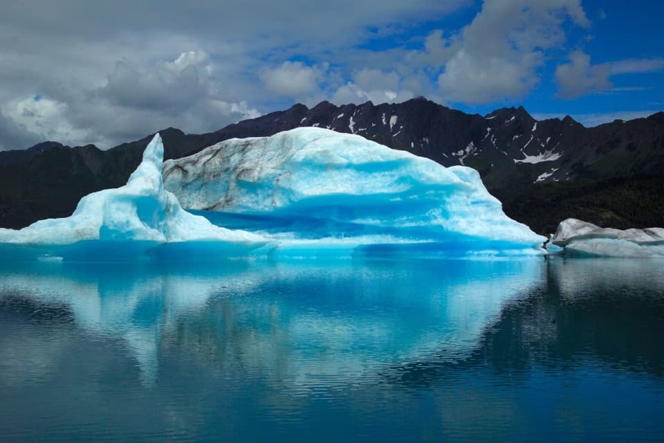
A remote lagoon packed with building-sized icebergs.

Photo: National Park Service

Overview

About Bear Glacier Lagoon

Why stop

  • A rare chance to paddle among enormous icebergs.

Heads up

  • The exposed, fog-prone approach is beyond casual paddling.

Map

Where it is

Loading the Kenai Fjords map
Full map
SightBear Glacier Lagoon59.95357, -149.55345
Keep this map with you offline in the Parkwolf app

Plan your stop

Before you go

Getting there takes local knowledge

The coastal approach faces the Gulf of Alaska and has few places to land. Fog often blankets the lagoon, making navigation and distance from the ice harder to judge. A water taxi is the recommended way in; paddling the route is not for beginners. Don’t treat a boat tour that passes the glacier as the same experience as reaching the lagoon and spending time among its icebergs.

5 active Kenai Fjords alerts

  • ClosureHerman Leirer Road to Exit Glacier closed to carsHerman Leirer Road, the only road access into Kenai Fjords National Park, is currently closed to automobile traffic.Official details
  • ClosureExit Glacier canyon closure: sudden outburst-flood riskThe canyon from Exit Glacier’s toe to where Exit Creek opens into the Outwash Plain is closed; stay on designated park trails.Official details
See all 5 alerts
A park ranger sits on a dash-mounted phone, talking, as Parkwolf’s Tour Guide plays “Army Cutworm Moths: A Grizzly Bear Buffet” on Grand Loop Road below Dunraven Pass in Yellowstone
Parkwolf Tour GuideThe highest, rockiest slopes around here are a summer buffet for grizzly bears.

Kenai Fjords Tour Guide

Your drive to Bear Glacier Lagoon, narrated.

Parkwolf is a GPS audio tour guide for Kenai Fjords National Park. As you drive, it chimes in with what’s ahead: hidden gems, upcoming stops, history, geology, and wildlife, right through your car’s speakers.

  • 20 audio storiesacross Kenai Fjords’s roads, triggered by GPS as you drive
  • Wildlife heatmapsfor Orca, Humpback Whale, Black Bear, and 13 more
  • Works offlinemaps, 5 trails, 37 places, and audio download before you lose signal
  • CarPlay readysimple controls built for the drive
★★★★★
“Fantastic app with many points of information… It’s great to just turn on while you’re driving and it gives you an audio tour of the national Park. We love it!!!!”
JMJamesApp Store review
Download Parkwolf on the App StoreGet Parkwolf on Google Play

4.7 from 8,600+ ratings

Guide

More about Bear Glacier Lagoon

A remote lake beneath Bear GlacierBear Glacier Lagoon is a proglacial lake, formed between Bear Glacier and its moraine about 12…

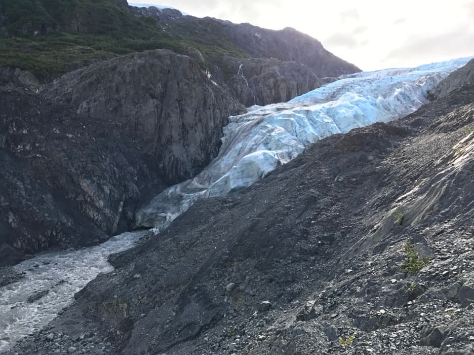
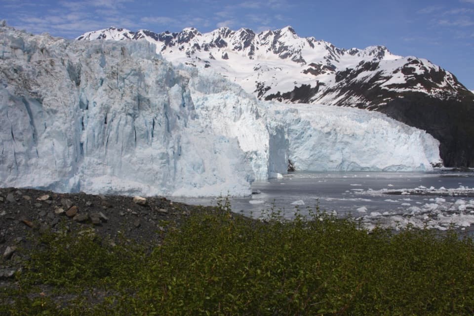
Bear Glacier Lagoon is a proglacial lake, formed between Bear Glacier and its moraine about 12 miles southwest of Seward. It’s known for trips among giant floating icebergs, with the glacier and steep mountain walls around the basin. This is a destination for a deliberate backcountry trip, not a quick roadside stop. A foreground iceberg or kayak against the glacier and mountain walls gives a photo a sense of the place’s scale.

Give the ice roomMany bergs are building-sized and mostly underwater.

Many bergs are building-sized and mostly underwater. They can roll or break without warning, and glacier calving can send large waves across the water. Keep at least half a mile from the glacier face and stay at least twice an iceberg’s height or width away from it. Camp at least two miles from the glacier.

A lake formed as the glacier retreatedBear Glacier covered this basin before 1950.

Bear Glacier covered this basin before 1950. A small lake appeared by 1961 and had doubled in size by 1984 as the glacier pulled back. Another glacier-dammed lake, several miles up-glacier, periodically drains under Bear Glacier into the lagoon. During a monitored 2018 outburst, lagoon water rose about 6.5 feet in 96 hours before breaching the moraine. These floods can change water levels and the outlet quickly, so old reports of a particular landing or channel aren’t a reliable route plan.

Camp self-sufficientlyThis is a backcountry trip, not a serviced campground.

This is a backcountry trip, not a serviced campground. There are no bear boxes and few places to hang food, so use a bear-resistant container; coastal campers on the park side must pack out human waste. The lagoon crosses federal park and Alaska state land, so know which side you’re on and which rules apply to your landing and camp.

Wildlife

Wildlife in Kenai Fjords

All Kenai Fjords wildlife maps

Sighting maps show where each species has been reported across Kenai Fjords. Wildlife moves, so no sighting is guaranteed.

Parkwolf’s Kenai Fjords ranking

Top sights in Kenai Fjords

All 37 places
  1. 1Exit Glacier OverlookSight
  2. 2Aialik GlacierSight
  3. 3Harding Icefield OverlookSight
  4. 4Glacier ViewSight
  5. 5Holgate GlacierSight
  6. 6Northwestern GlacierSight

Take Parkwolf to Kenai Fjords.

The audio tour guide for the drive, plus offline maps, trails, and wildlife heatmaps for when the signal drops.

4.7 from 8,600+ ratings

Download Parkwolf on the App StoreGet Parkwolf on Google Play