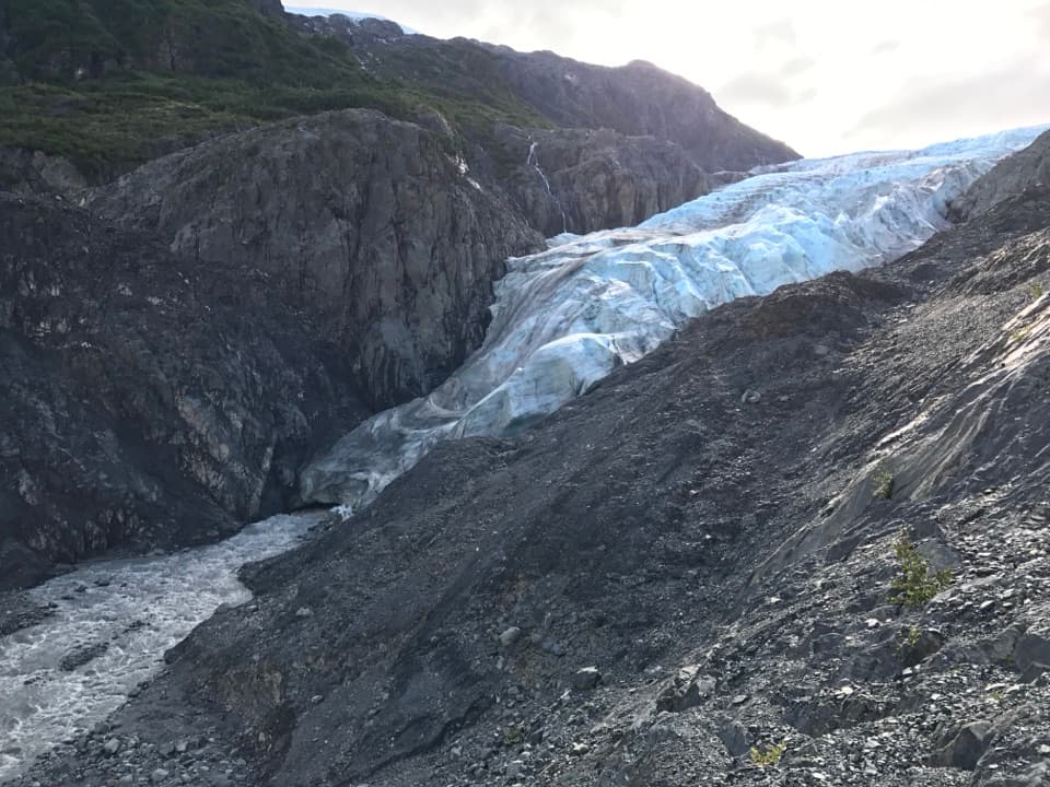
Exit Glacier Overlook in Kenai Fjords National Park

#1 of 30 sights in Kenai Fjords

Sight · Kenai Fjords National Park

Exit Glacier Overlook

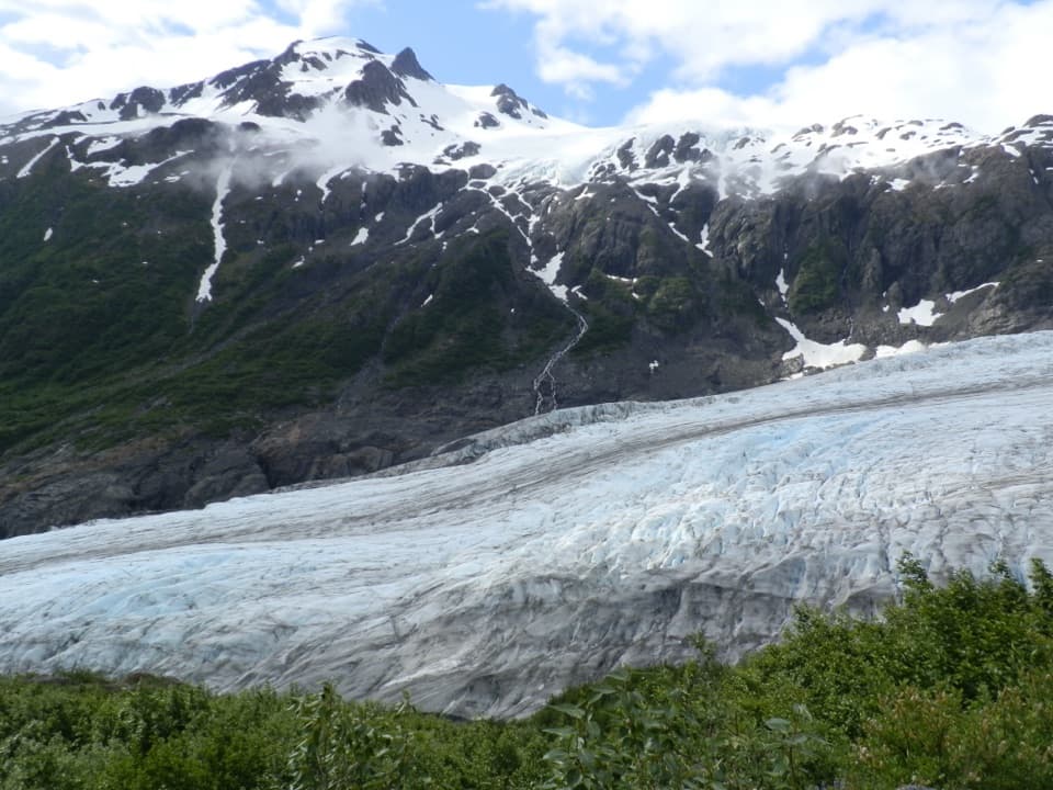
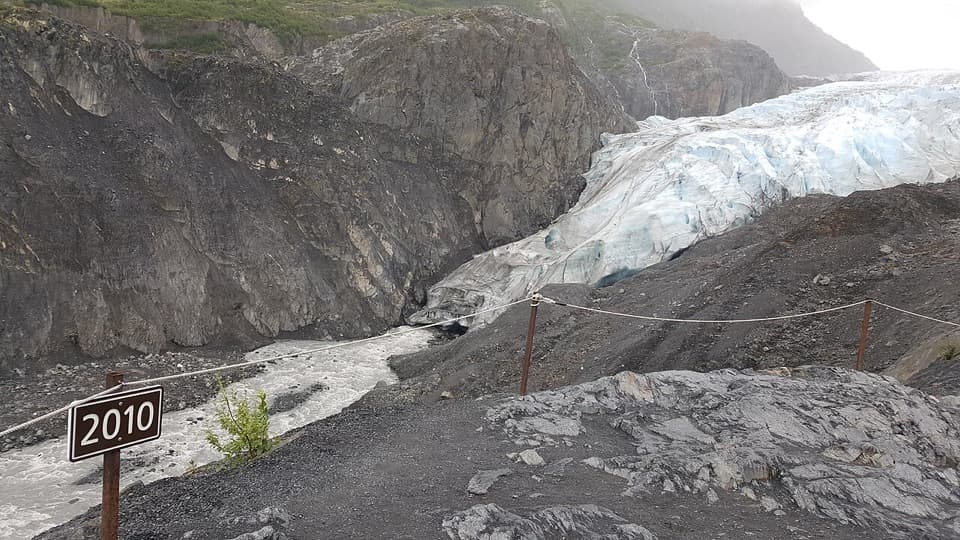
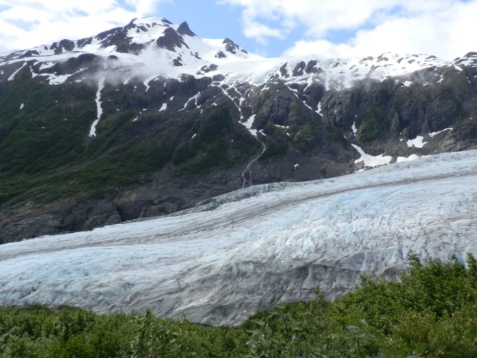
A close glacier view, marked by where its toe stood in 2005.

Photo: Wikimedia Commons
Type
Sight
Nearest trail
0.4 mi
Audio stories
3 nearby
  • Scenic viewpoint
  • Exhibit

Hear the audio tour

Exit Glacier and the Nature Center

Overview

About Exit Glacier Overlook

Why stop

  • Bare moraine and meltwater make the scale of retreat visible.

Heads up

  • The closer view takes a moderately strenuous spur beyond the accessible loop.

Map

Where it is

Loading the Kenai Fjords map
Full map
SightExit Glacier Overlook60.18014, -149.64536
Keep this map with you offline in the Parkwolf app

Plan your stop

Before you go

The overlook spur and accessible loop are different stops

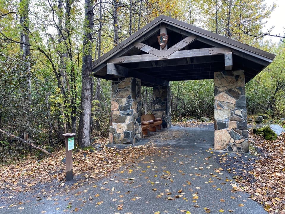
From the Exit Glacier Nature Center, the accessible one-mile Glacier View Loop passes through cottonwood forest to Glacier View, a separate lower panorama. At the trail-side kiosk, the route to Exit Glacier Overlook continues another 0.6 mile. That final spur is rated moderately strenuous, and you retrace it on the way back. The accessible description covers the loop, not the overlook spur; the spur’s accessibility is not assessed. If you need the documented accessible route, stop at lower Glacier View, which has an accessible spotting scope.

5 active Kenai Fjords alerts

  • ClosureHerman Leirer Road to Exit Glacier closed to carsMentions this placeHerman Leirer Road, the only road access into Kenai Fjords National Park, is currently closed to automobile traffic.Official details
  • ClosureExit Glacier canyon closure: sudden outburst-flood riskMentions Exit Glacier, referenced in this guideThe canyon from Exit Glacier’s toe to where Exit Creek opens into the Outwash Plain is closed; stay on designated park trails.Official details
See all 5 alerts
A park ranger sits on a dash-mounted phone, talking, as Parkwolf’s Tour Guide plays “Army Cutworm Moths: A Grizzly Bear Buffet” on Grand Loop Road below Dunraven Pass in Yellowstone
Parkwolf Tour GuideThe highest, rockiest slopes around here are a summer buffet for grizzly bears.

Kenai Fjords Tour Guide

Your drive to Exit Glacier Overlook, narrated.

Parkwolf is a GPS audio tour guide for Kenai Fjords National Park. As you drive, it chimes in with what’s ahead: hidden gems, upcoming stops, history, geology, and wildlife, right through your car’s speakers.

Recorded for this place

Exit Glacier and the Nature Center
0:00 / 0:36
“You're approaching the Exit Glacier Nature Center, the starting point for walks to the glacier views.”

Plays as you drive up to Exit Glacier Overlook in the Parkwolf Kenai Fjords Tour Guide.

More stories near here in the app

  • Exit Glacier Campground
  • Harding Icefield Trail
  • Exit Glacier Roadside Viewpoint
  • An Orca Family’s Voice
  • 20 audio storiesacross Kenai Fjords’s roads, triggered by GPS as you drive
  • Wildlife heatmapsfor Orca, Humpback Whale, Black Bear, and 13 more
  • Works offlinemaps, 5 trails, 37 places, and audio download before you lose signal
  • CarPlay readysimple controls built for the drive
★★★★★
“Fantastic app with many points of information… It’s great to just turn on while you’re driving and it gives you an audio tour of the national Park. We love it!!!!”
JMJamesApp Store review
Download Parkwolf on the App StoreGet Parkwolf on Google Play

4.7 from 8,600+ ratings

Guide

More about Exit Glacier Overlook

Take the closer glacier viewExit Glacier Overlook is a trail-end viewpoint in the glacier-carved valley, above the…

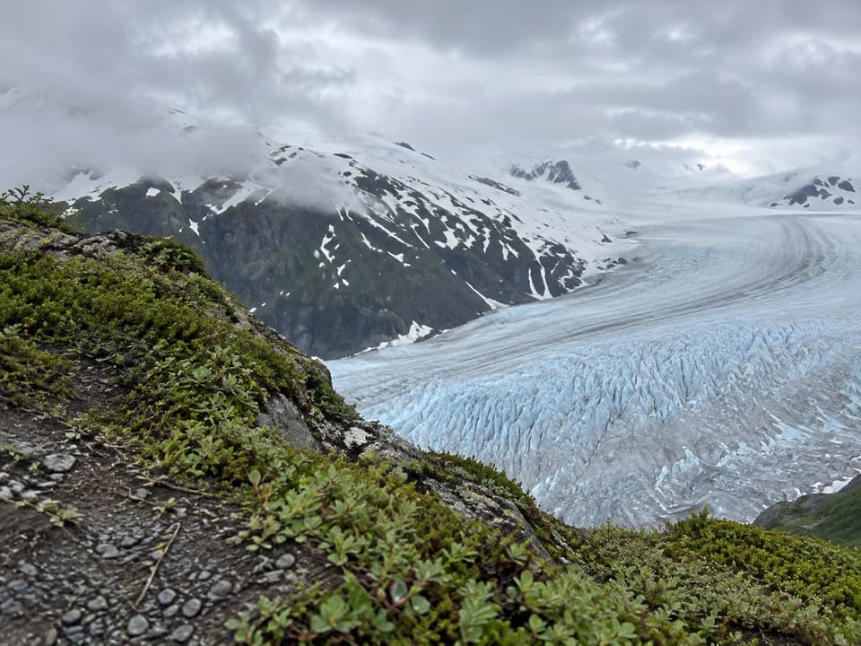
Exit Glacier Overlook is a trail-end viewpoint in the glacier-carved valley, above the meltwater stream. It gives one of the closest views of the ice, and the bare rock and 2005 marker make this a more revealing stop than a quick look from lower Glacier View. I’d take the spur if you want to understand the retreat, not just see a glacier. The point is the view and the changing landscape, not walking up to the ice.

Set up at the nature centerFrom Seward Highway, turn onto Herman Leirer Road (also called Exit Glacier Road) at mile 3 and…

From Seward Highway, turn onto Herman Leirer Road (also called Exit Glacier Road) at mile 3 and drive 8.4 miles to the nature-center parking lot. Summer parking is limited from late morning into midafternoon, so arrive earlier or later if you can. Cars usually can’t reach the area from late October through mid-May because of snow.

Use the base-area restroom and summer water refill before setting out: flush toilets operate from Memorial Day through Labor Day, pit toilets are available the rest of the year, and potable water is at the restroom building in summer. Picnic tables are beside the parking lot. Leashed dogs and bicycles are allowed on the road and in the lot, but neither is allowed on the trails.

A marker from 2005The glacier’s toe stood where the overlook is now in 2005.

The glacier’s toe stood where the overlook is now in 2005. The rock around the marker is still mostly bare; plants have had little time to establish since the ice pulled back. The marker turns a distant idea into a place you can point to: the edge of Exit Glacier used to reach this spot.

A glacier the park keeps measuringExit Glacier flows down from Harding Icefield into a valley carved by ice.

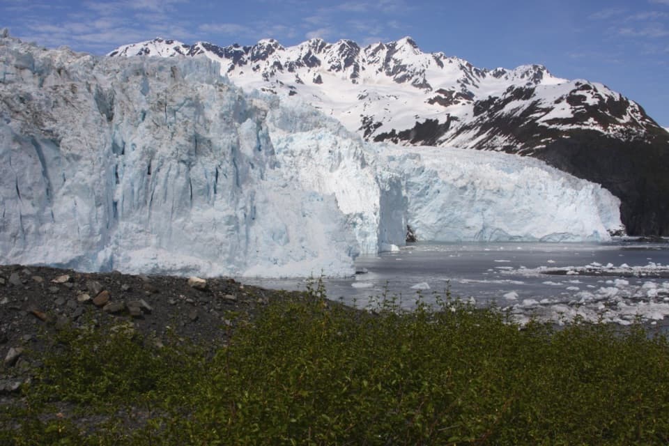
Exit Glacier flows down from Harding Icefield into a valley carved by ice. The park tracks the glacier’s terminus each fall with GPS or aerial photography, measuring changes in its length and width against historic mapped positions. Look from the marker to the blue-white ice and then down to the meltwater; the overlook shows the valley as an active landscape, not a finished one.

Plant life follows the retreatThe newly exposed ground changes in stages.

The newly exposed ground changes in stages. Lichens and pioneer plants colonize rock and silt near the ice; alder and willow follow, then black cottonwood forest, and eventually shade-tolerant mountain hemlock. That sequence is why the near-glacier moraine looks so different from the forest on the approach.

The wider Exit Glacier area supports moose in the willow and cottonwood valley bottom, and mountain goats and bears on the surrounding slopes. Alaska’s wildlife agency also notes tiny nocturnal iceworms in the surface snow and ice. Those are area-wide possibilities, not sightings to count on at the overlook.

Frame the ice with the retreatKeep some of the gray moraine in the foreground so the glacier doesn’t float against the dark…

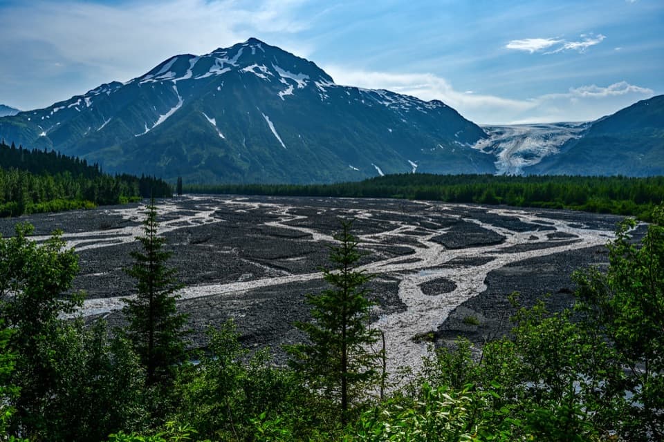
Keep some of the gray moraine in the foreground so the glacier doesn’t float against the dark valley walls. The 2005 marker makes a useful point of comparison: include it with the present ice to show how far the toe has moved. The broader outwash plain is another distinct view from the overlook area.

Wildlife

Wildlife in Kenai Fjords

All Kenai Fjords wildlife maps

Sighting maps show where each species has been reported across Kenai Fjords. Wildlife moves, so no sighting is guaranteed.

Keep exploring

Near Exit Glacier Overlook

See it all on the map

Trails nearby

More stops nearby

Parkwolf’s Kenai Fjords ranking

Top sights in Kenai Fjords

All 37 places
  1. 2Aialik GlacierSight
  2. 3Harding Icefield OverlookSight
  3. 4Glacier ViewSight
  4. 5Holgate GlacierSight
  5. 6Northwestern GlacierSight
  6. 7Bear Glacier LagoonSight

Take Parkwolf to Kenai Fjords.

The audio tour guide for the drive, plus offline maps, trails, and wildlife heatmaps for when the signal drops.

4.7 from 8,600+ ratings

Download Parkwolf on the App StoreGet Parkwolf on Google Play