
Place · 2.4 mi away
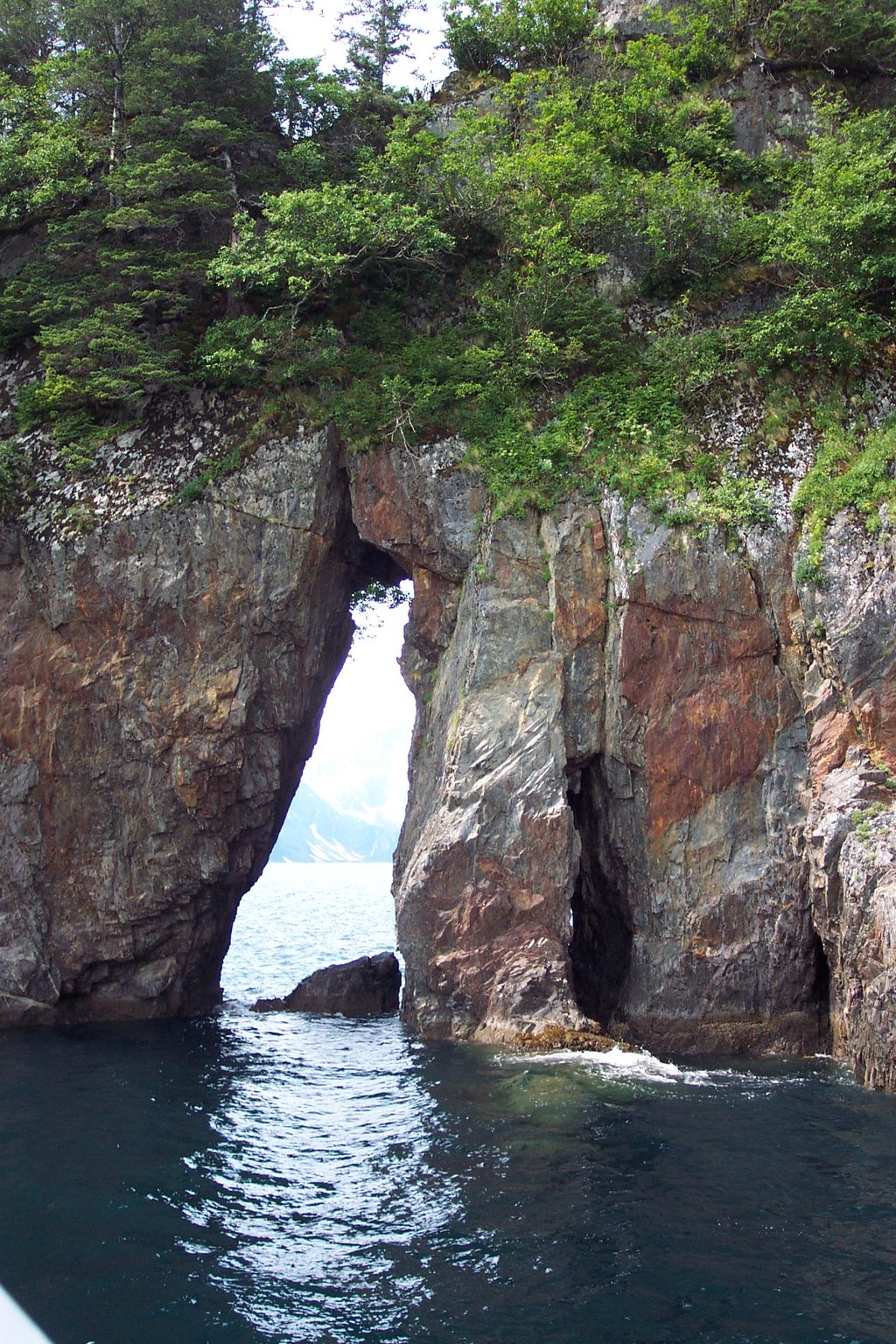
Three Hole Point is a rocky headland on the Aialik Peninsula, best known for three natural arches punched through its coastal cliffs. It sits inside Aialik Bay—one of the park’s wild marine basins—so you experience it from the water, not from a road or trail.
From a boat or kayak, the headland’s “three holes” line up as windows through dark rock, with glacier-capped peaks often framing the skyline. The shoreline here is rugged and sheer, typical of fjords carved by ancient ice, and the formation stands out as a distinctive waypoint in the bay.
Waves and weather gnawed at fractured coastal rock to carve the arches over time. The setting reflects the broader glacial story of Kenai Fjords: ice sculpted the deep basin of Aialik Bay, and ongoing marine erosion refined details like these arches along its steep margins.
Plan to view Three Hole Point from the water. Tour boats traversing Aialik Bay frequently pass the headland, and experienced paddlers sometimes add it to kayak routes. There’s no road access, no landing infrastructure, and no facilities. For marine travel, the park emphasizes using nautical charts and tide tables—conditions change quickly in this coastal environment.
Aialik Bay is rich in marine life. While nothing is guaranteed, boats here commonly watch for sea otters, harbor seals, Steller sea lions, puffins and other seabirds, and, in summer, humpback or killer whales. Bring binoculars or a zoom lens so you can keep a respectful distance and still get a satisfying look.
The arches read best from the water at slight angles rather than straight on. Long lenses compress the “windows” against distant peaks; wide angles capture the full headland against the bay. Cloudy days can be a gift—soft light holds detail in dark rock, and mist adds mood.
This is pure wilderness coastline: no docks, no restrooms, no picnic tables, no marked trails. Come self-sufficient, and treat the area as a remote backcountry stop even if you’re on a tour boat.
The point has been a mariner’s landmark for over a century and is now a highlight on modern sightseeing routes through Aialik Bay. Its three arches make it one of the more recognizable rock features in the area.
Place · 2.4 mi away
Place · 3.1 mi away
Place · 5.8 mi away
Place · 6.7 mi away
Challenging · 29.4 mi away
Easy · 29.4 mi away
Easy · 29.4 mi away
Easy · 29.4 mi away

Parkwolf Tour Guide
