Glacier Overlook Trail in Kenai Fjords National Park

#2 of 5 trails in Kenai Fjords

Kenai Fjords National Park, AK

Glacier Overlook Trail

A rocky climb above the accessible lower loop to Exit Glacier.

Photo: Wikimedia Commons
Length
2.2mi
Time
1.5hr
Elev. change
213ft
Difficulty
Moderate
  • Loop
  • No dogs
  • High point 604 ft

Hear the audio tour

Exit Glacier and the Nature Center

Overview

About Glacier Overlook Trail

Why go

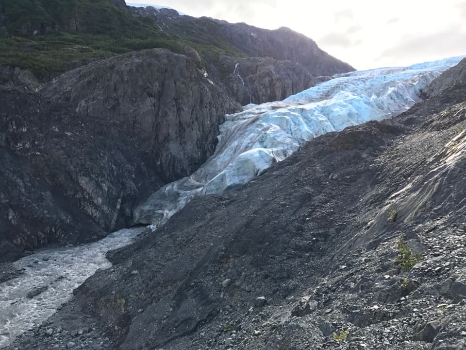
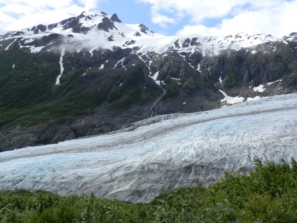
  • The upper viewpoint frames Exit Glacier inside its carved valley.
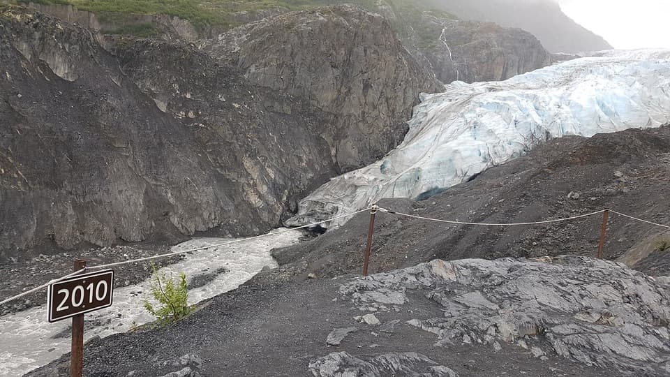
  • Dated markers make the glacier’s changing edge visible along the walk.

Heads up

  • The upper loop is rougher and more strenuous than the paved lower path.

Map & elevation

The route

Loading the Kenai Fjords map
Full map
Elevation390–604 ft
TrailheadExit Glacier Nature Center60.18833, -149.63156
Keep this map with you offline in the Parkwolf app

Plan your hike

Before you go

Parking

Follow Herman Leirer Road about 8.4 miles from the Seward Highway turnoff to the Exit Glacier Nature Center lot. Parking is limited, especially from 10:30 a.m. to 3:30 p.m. The road is usually snow-inaccessible to cars from late October to mid-May; check current access.

Safety

The upper loop climbs exposed rock with uneven footing. Stay on designated trails and behind barriers; sudden glacier outburst floods can send water, ice and rock through the creek corridor below. There is no cell coverage in the Exit Glacier area.

5 active Kenai Fjords alerts

  • ClosureHerman Leirer Road to Exit Glacier closed to carsMentions Herman Leirer Road, referenced in this guideHerman Leirer Road, the only road access into Kenai Fjords National Park, is currently closed to automobile traffic.Official details
  • ClosureExit Glacier canyon closure: sudden outburst-flood riskMentions Exit Glacier, referenced in this guideThe canyon from Exit Glacier’s toe to where Exit Creek opens into the Outwash Plain is closed; stay on designated park trails.Official details
See all 5 alerts
A park ranger sits on a dash-mounted phone, talking, as Parkwolf’s Tour Guide plays “Army Cutworm Moths: A Grizzly Bear Buffet” on Grand Loop Road below Dunraven Pass in Yellowstone
Parkwolf Tour GuideThe highest, rockiest slopes around here are a summer buffet for grizzly bears.

Kenai Fjords Tour Guide

Your drive to Glacier Overlook Trail, narrated.

Parkwolf is a GPS audio tour guide for Kenai Fjords National Park. As you drive, it chimes in with what’s ahead: hidden gems, upcoming stops, history, geology, and wildlife, right through your car’s speakers.

Recorded for this trailhead

Exit Glacier and the Nature Center
0:00 / 0:36
“You're approaching the Exit Glacier Nature Center, the starting point for walks to the glacier views.”

Plays as you drive up to this trailhead in the Parkwolf Kenai Fjords Tour Guide.

More stories near here in the app

  • Exit Glacier Campground
  • Harding Icefield Trail
  • Exit Glacier Roadside Viewpoint
  • An Orca Family’s Voice
  • 20 audio storiesacross Kenai Fjords’s roads, triggered by GPS as you drive
  • Wildlife heatmapsfor Orca, Humpback Whale, Black Bear, and 13 more
  • Works offlinemaps, 5 trails, 37 places, and audio download before you lose signal
  • CarPlay readysimple controls built for the drive
★★★★★
“Fantastic app with many points of information… It’s great to just turn on while you’re driving and it gives you an audio tour of the national Park. We love it!!!!”
JMJamesApp Store review
Download Parkwolf on the App StoreGet Parkwolf on Google Play

4.7 from 8,600+ ratings

Trail guide

Hiking Glacier Overlook Trail

The full circuitThe Glacier Overlook circuit starts and finishes at Exit Glacier Nature Center. It is about 2.

The Glacier Overlook circuit starts and finishes at Exit Glacier Nature Center. It is about 2.2 miles, linking the accessible Glacier View Loop through cottonwoods with the rougher Overlook loop to the designated viewpoint. The saved distance covers the whole lower loop and the upper loop, including its return; the 0.6-mile figure in some directions describes the stretch toward the overlook. Plan about 1.5 hours if you want time at both views. If you need a shorter, easier walk, stay on the lower loop, about a mile. The upper route is a real climb, not just a little add-on to the paved path.

Through the cottonwoodsThe lower loop is the gentler half.

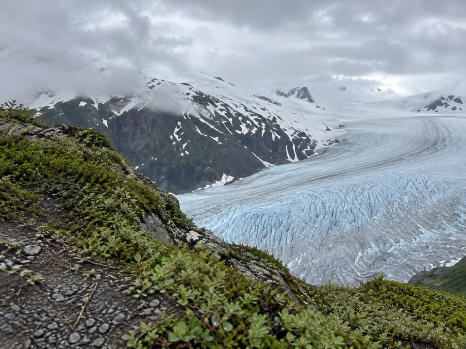
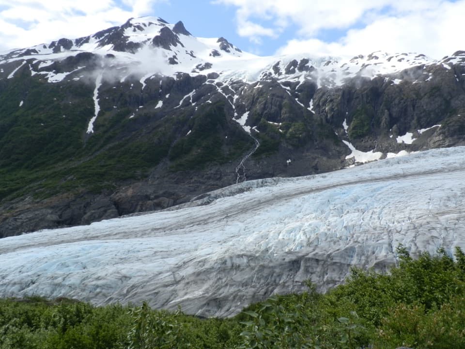
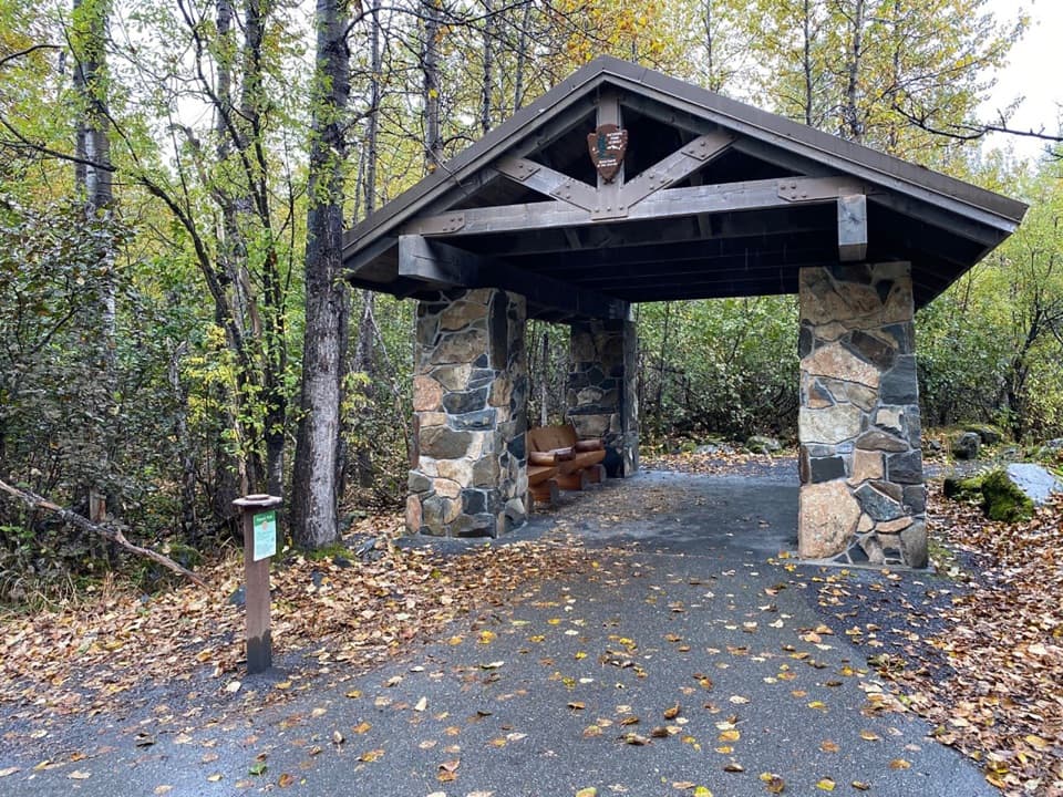
The lower loop is the gentler half. It follows maintained, accessible path through cottonwood forest before opening to a broad view of Exit Glacier descending from the Harding Icefield. A trail-side kiosk marks the turn for the upper loop. You can stop at the lower viewpoint and finish the easy loop there; that gives you the glacier panorama without the rockier climb. Restrooms and the nature center are back at the start, not along the trail.

Climb to the overlookPast the kiosk, the path climbs across exposed rock to the designated Glacier Overlook.

Past the kiosk, the path climbs across exposed rock to the designated Glacier Overlook. The National Park Service describes this section as moderately strenuous. It's maintained, but the ground is rougher and the uneven steps slow the pace; this is the part to skip if you want an all-paved outing. At the top, Exit Glacier sits inside its carved valley. The view from the marked overlook is the payoff; the glacier toe and the creek canyon below are not part of this walk. Stay on the route and behind barriers. A photo with the creek and one of the dated markers in the foreground gives the ice a useful sense of scale.

Read the markersDated markers along the approach show where the glacier's edge reached in earlier years.

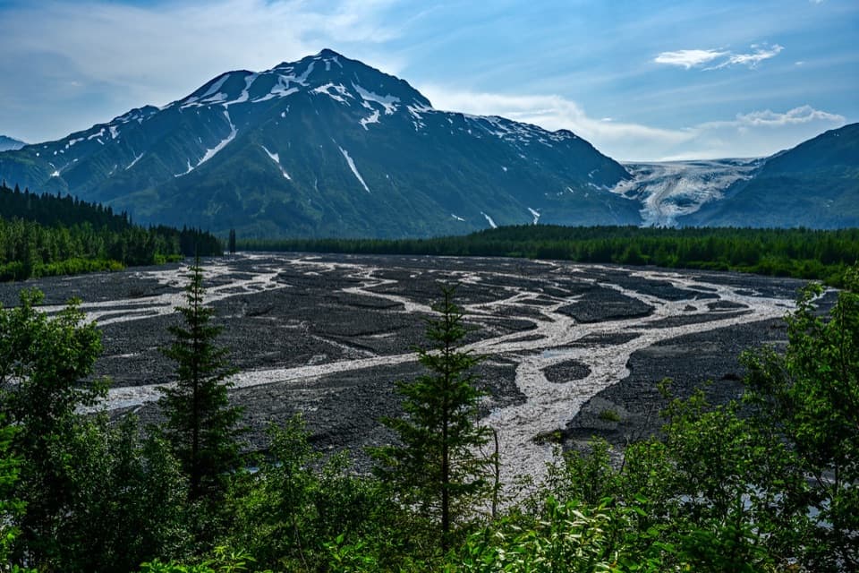
Dated markers along the approach show where the glacier's edge reached in earlier years. A 1926 marker sits on the lower path, and a 2010 marker is visible at the overlook. The outwash is also a lesson in what happens after the ice moves: plants recolonize newly exposed ground. The park tracks the glacier's terminus each year, so the markers make a landscape change visible without turning the hike into a lecture. Give the lower panorama a second look on your way back; the broad view helps explain how the ice and creek shaped the valley.

Access and rulesFollow Herman Leirer Road to the nature-center lot; parking is limited, especially from late…

Follow Herman Leirer Road to the nature-center lot; parking is limited, especially from late morning through mid-afternoon. The access road is usually snow-inaccessible to cars from late October to mid-May, so check its status before driving out. The nature center has area exhibits, a bookstore, picnic tables, seasonal toilets and summer drinking water; there are no restrooms on the trails. Pets aren't allowed on park trails, even on leash, though leashed pets may remain on the road and in the parking lot. There is no cell coverage in the Exit Glacier area. Sudden glacier outburst floods can send water, ice and rock through the creek corridor below, which is another reason to keep to the marked trail. If you want a much longer day hike, the Harding Icefield Trail is a separate eight-mile round trip.

Wildlife

Wildlife in Kenai Fjords

All Kenai Fjords wildlife maps

Sighting maps show where each species has been reported across Kenai Fjords. Wildlife moves, so no sighting is guaranteed.

Keep exploring

Near Glacier Overlook Trail

See it all on the map

Trails that start nearby

Places near the trailhead

Parkwolf’s Kenai Fjords ranking

Top-rated trails in Kenai Fjords

All 5 trails
  1. 1Harding Icefield TrailChallenging · 7.8 mi
  2. 3Glacier View Loop TrailEasy · 1 mi
  3. 4Top of the Cliffs via Harding Icefield TrailChallenging · 4.6 mi
  4. 5Marmot Meadows via Harding Icefield TrailChallenging · 3 mi

Take Parkwolf to Kenai Fjords.

The audio tour guide for the drive, plus offline maps, trails, and wildlife heatmaps for when the signal drops.

4.7 from 8,600+ ratings

Download Parkwolf on the App StoreGet Parkwolf on Google Play