Top of the Cliffs via Harding Icefield Trail in Kenai Fjords National Park

#4 of 5 trails in Kenai Fjords

Kenai Fjords National Park, AK

Top of the Cliffs via Harding Icefield Trail

A steep climb to the first wide views of Harding Icefield.

Length
4.6mi
Time
5hr
Elev. change
2,041ft
Difficulty
Challenging
  • No dogs
  • High point 2,464 ft

Hear the audio tour

Harding Icefield Trail

Overview

About Top of the Cliffs via Harding Icefield Trail

Why go

  • The first broad views of Harding Icefield and its nunataks.
  • A high alpine turnaround before the full trail’s 7.8-mile round trip.

Heads up

  • A strenuous climb of about 2,000 feet, with steep switchbacks.
  • No water or toilets along the trail.

Map & elevation

The route

Loading the Kenai Fjords map
Full map
Elevation423–2,464 ft
TrailheadHarding Icefield Trail Register60.18415, -149.63772
Keep this map with you offline in the Parkwolf app

Plan your hike

Before you go

Parking

Use the Exit Glacier Nature Center parking area at the end of Herman Leirer Road, then follow the paved access beside the nature center to the Harding Icefield Trail Register. Parking is limited and especially busy from about 10 a.m. to 3:30 p.m. in June through August. The mapped trail distance begins at the register, uphill from the lot.

Safety

The upper route is steep and can hold snow into early July, with avalanche danger and fast-changing weather. Follow orange flags where snow covers the trail and stay on the tread through fragile alpine plants. Black bears are regularly seen along this route. There is no water or toilet along the trail; carry water or a filter.

5 active Kenai Fjords alerts

  • ClosureHerman Leirer Road to Exit Glacier closed to carsMentions Herman Leirer Road, referenced in this guideHerman Leirer Road, the only road access into Kenai Fjords National Park, is currently closed to automobile traffic.Official details
  • ClosureExit Glacier canyon closure: sudden outburst-flood riskMentions Exit Glacier, referenced in this guideThe canyon from Exit Glacier’s toe to where Exit Creek opens into the Outwash Plain is closed; stay on designated park trails.Official details
See all 5 alerts
A park ranger sits on a dash-mounted phone, talking, as Parkwolf’s Tour Guide plays “Army Cutworm Moths: A Grizzly Bear Buffet” on Grand Loop Road below Dunraven Pass in Yellowstone
Parkwolf Tour GuideThe highest, rockiest slopes around here are a summer buffet for grizzly bears.

Kenai Fjords Tour Guide

Your drive to Top of the Cliffs via Harding Icefield Trail, narrated.

Parkwolf is a GPS audio tour guide for Kenai Fjords National Park. As you drive, it chimes in with what’s ahead: hidden gems, upcoming stops, history, geology, and wildlife, right through your car’s speakers.

Recorded for this trailhead

Harding Icefield Trail
0:00 / 0:25
“You're nearing the Exit Glacier area, where the hike to the Harding Icefield begins. This is a full-day climb to a view across ice and snow pierced by dark mountain peaks.”

Plays as you drive up to this trailhead in the Parkwolf Kenai Fjords Tour Guide.

More stories near here in the app

  • Exit Glacier and the Nature Center
  • Exit Glacier Campground
  • Exit Glacier Roadside Viewpoint
  • An Orca Family’s Voice
  • 20 audio storiesacross Kenai Fjords’s roads, triggered by GPS as you drive
  • Wildlife heatmapsfor Orca, Humpback Whale, Black Bear, and 13 more
  • Works offlinemaps, 5 trails, 37 places, and audio download before you lose signal
  • CarPlay readysimple controls built for the drive
★★★★★
“Fantastic app with many points of information… It’s great to just turn on while you’re driving and it gives you an audio tour of the national Park. We love it!!!!”
JMJamesApp Store review
Download Parkwolf on the App StoreGet Parkwolf on Google Play

4.7 from 8,600+ ratings

Trail guide

Hiking Top of the Cliffs via Harding Icefield Trail

A high turnaround before the full icefield hikeTop of the Cliffs is an out-and-back on Harding Icefield Trail, climbing from the trail…

Top of the Cliffs is an out-and-back on Harding Icefield Trail, climbing from the trail register above Exit Glacier to the first official icefield overlook. The park map marks the turnaround at 2.3 miles each way, or 4.6 miles round trip; another park page rounds it to about 2.4 miles each way. The line to this turnaround measures about 2.23 miles on the mapped trail, which fits the map's rounded figure. Plan on four to six hours. This is the route to choose when you want the Harding Icefield view but don't want to continue to the full trail's emergency shelter and end point.

The climb is the commitment. The register sits at about 426 feet and Top of the Cliffs at 2,454 feet, a rise of roughly 2,000 feet before you turn around. The park describes this hike as strenuous, and the miles underestimate the effort.

From forest to Marmot MeadowsThe trail starts across the valley floor through cottonwood and alder forest.

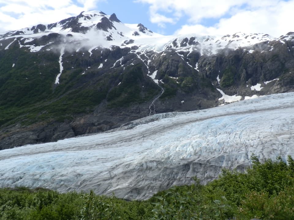
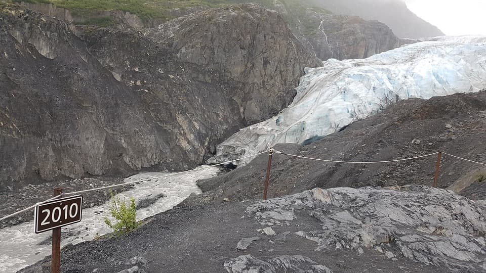
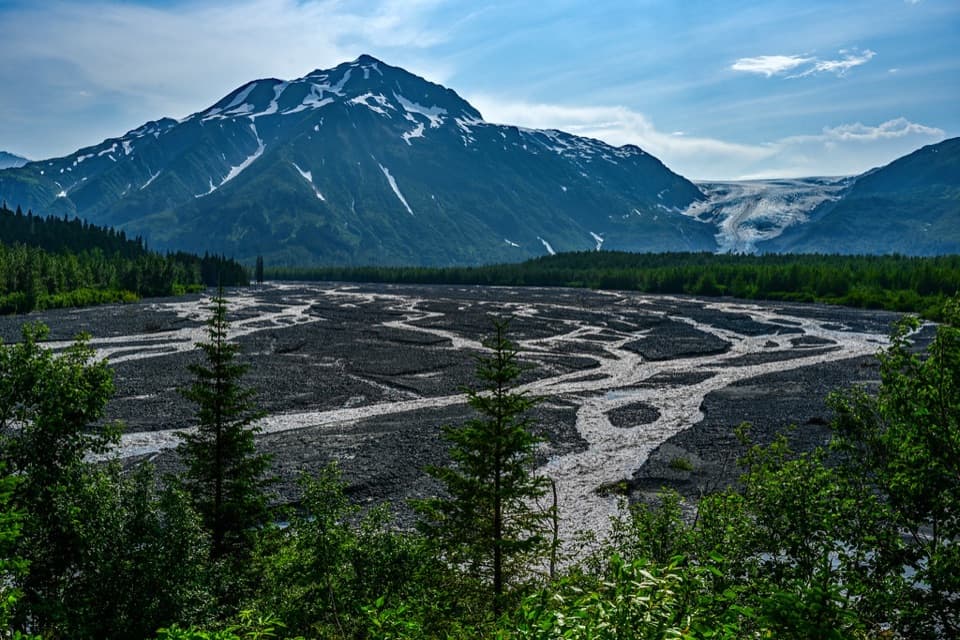
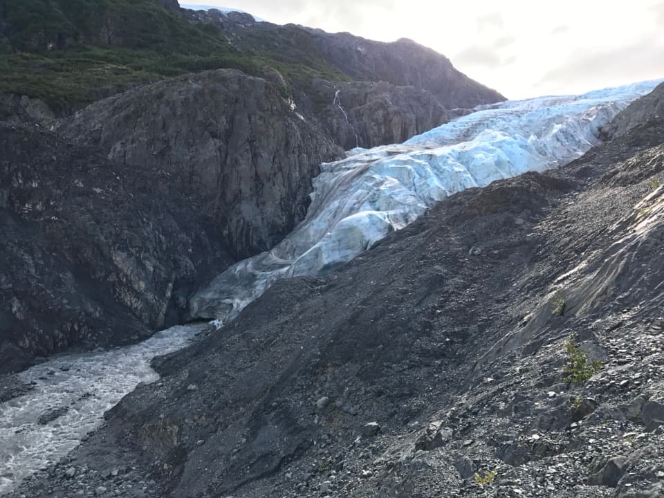
The trail starts across the valley floor through cottonwood and alder forest. Views over the valley and the end of Exit Glacier appear early. About 0.8 mile in, a wooden bridge crosses a rushing stream; farther up, the forest opens at Marmot Meadows. The park map puts the meadow about 1.5 miles from the register; a separate park page says about 1.3. From the meadow you can look down toward the glacier from above, a good payoff even if you decide not to continue.

The name comes from hoary marmots once often seen there. They're less conspicuous now as vegetation has grown over parts of the meadow. This is a useful place to pause before the route's hardest stretch.

The steepest climb is still aheadAbove Marmot Meadows, the park identifies the trail to Top of the Cliffs as its steepest…

Above Marmot Meadows, the park identifies the trail to Top of the Cliffs as its steepest section, with many switchbacks. The turns are there for a reason: stay on the trail through fragile alpine plants rather than cutting across the slope. In snow, orange flags mark the route. The upper trail often holds snow into early July, so the map line and a clear summer tread may not be visible on every visit.

Harding Icefield and its nunataksTop of the Cliffs is marked at 2,454 feet, where the first broad views open across Harding…

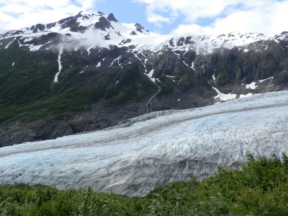
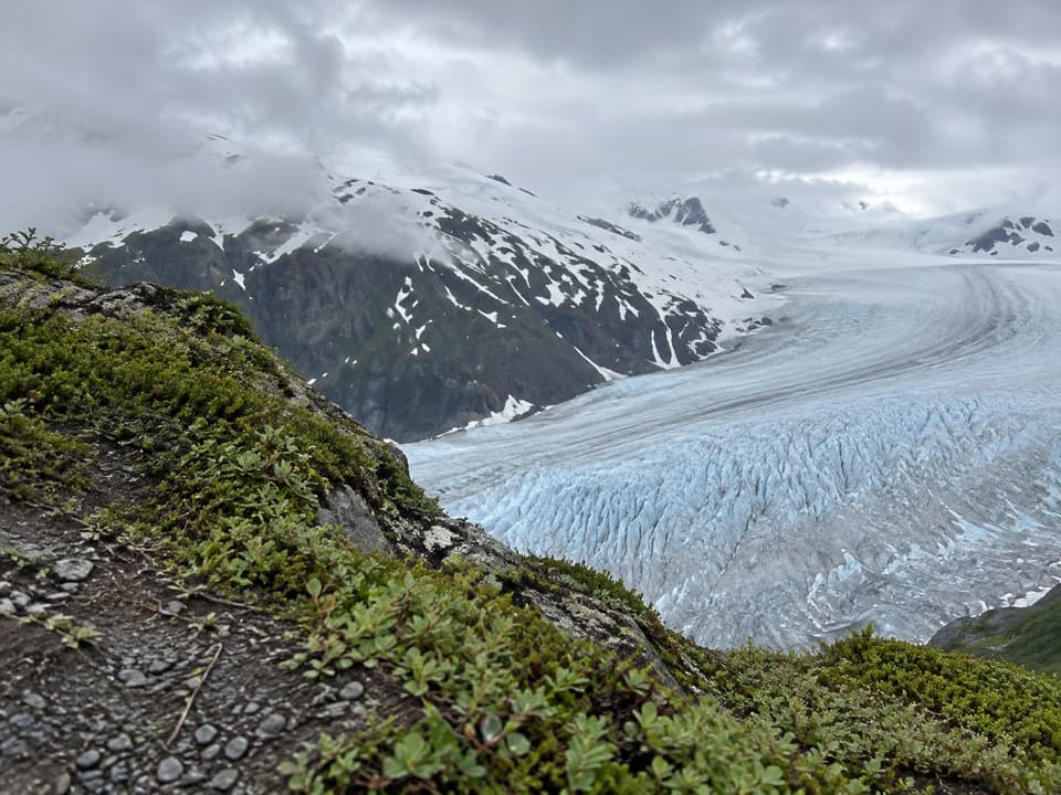
Top of the Cliffs is marked at 2,454 feet, where the first broad views open across Harding Icefield and the dark peaks that rise through its snow. Those isolated peaks are nunataks. The Harding Icefield covers about 700 square miles, and Exit Glacier spills down from it below the route. For a photo, keep some of the glacier or rocky ridge in the foreground with the icefield beyond; that gives the view its depth and scale.

This is a turnaround, not the end of Harding Icefield Trail. The full outing continues past the emergency shelter at 3.7 miles and ends about 3.9 miles from the register, for a 7.8-mile round trip. Marmot Meadows is the shorter option if the steep upper switchbacks are more than you want today.

Start at the register, not the parking lotPark at the Exit Glacier Nature Center at the end of Herman Leirer Road, then follow the paved…

Park at the Exit Glacier Nature Center at the end of Herman Leirer Road, then follow the paved access by the nature center to the Harding Icefield Trail Register. The distance above begins at the register, uphill from the parking area. Parking is limited and is busiest from about 10 a.m. to 3:30 p.m. in June through August. Restrooms and a picnic area are down by the nature center; there are no toilets or water sources along the trail. Bring at least two liters of water per person or a filter, since untreated stream water can carry Giardia.

Black bears are regularly seen along Harding Icefield Trail, especially around salmonberry thickets. Keep the park's bear guidance in mind. Weather can change quickly at this elevation, and snow and avalanche hazards can persist on the upper trail. Check the park's current conditions before setting out. Pets aren't allowed on park trails.

Wildlife

Wildlife in Kenai Fjords

All Kenai Fjords wildlife maps

Sighting maps show where each species has been reported across Kenai Fjords. Wildlife moves, so no sighting is guaranteed.

Keep exploring

Near Top of the Cliffs via Harding Icefield Trail

See it all on the map

Trails that start nearby

Places near the trailhead

Parkwolf’s Kenai Fjords ranking

Top-rated trails in Kenai Fjords

All 5 trails
  1. 1Harding Icefield TrailChallenging · 7.8 mi
  2. 2Glacier Overlook TrailModerate · 2.2 mi
  3. 3Glacier View Loop TrailEasy · 1 mi
  4. 5Marmot Meadows via Harding Icefield TrailChallenging · 3 mi

Take Parkwolf to Kenai Fjords.

The audio tour guide for the drive, plus offline maps, trails, and wildlife heatmaps for when the signal drops.

4.7 from 8,600+ ratings

Download Parkwolf on the App StoreGet Parkwolf on Google Play