Marmot Meadows in Kenai Fjords National Park

#10 of 30 sights in Kenai Fjords

Sight · Kenai Fjords National Park

Marmot Meadows

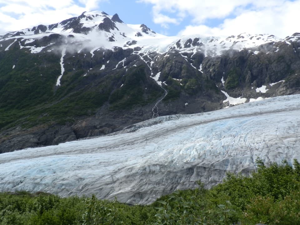
A steep climb earns an elevated view of Exit Glacier.

Photo: National Park Service
Type
Sight
Nearest trail
0.9 mi
Audio stories
2 nearby
  • Scenic viewpoint

Hear the audio tour

Harding Icefield Trail

Overview

About Marmot Meadows

Why stop

  • An open meadow breaks up the forested climb.

Heads up

  • The approach is steep, gaining roughly 1,000 feet per mile.

Map

Where it is

Loading the Kenai Fjords map
Full map
SightMarmot Meadows60.18176, -149.66291
Keep this map with you offline in the Parkwolf app

Plan your stop

Before you go

5 active Kenai Fjords alerts

  • ClosureHerman Leirer Road to Exit Glacier closed to carsMentions Exit Glacier, referenced in this guideHerman Leirer Road, the only road access into Kenai Fjords National Park, is currently closed to automobile traffic.Official details
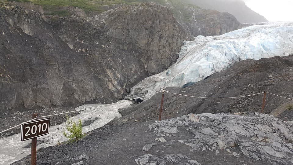
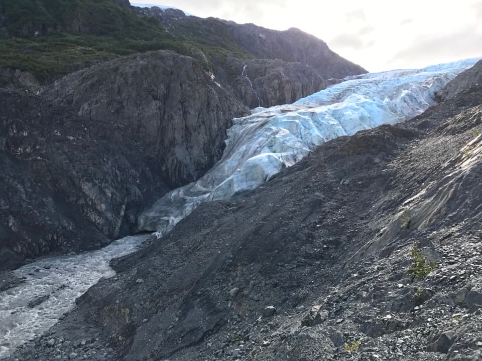
  • ClosureExit Glacier canyon closure: sudden outburst-flood riskMentions Exit Glacier, referenced in this guideThe canyon from Exit Glacier’s toe to where Exit Creek opens into the Outwash Plain is closed; stay on designated park trails.Official details
See all 5 alerts
A park ranger sits on a dash-mounted phone, talking, as Parkwolf’s Tour Guide plays “Army Cutworm Moths: A Grizzly Bear Buffet” on Grand Loop Road below Dunraven Pass in Yellowstone
Parkwolf Tour GuideThe highest, rockiest slopes around here are a summer buffet for grizzly bears.

Kenai Fjords Tour Guide

Your drive to Marmot Meadows, narrated.

Parkwolf is a GPS audio tour guide for Kenai Fjords National Park. As you drive, it chimes in with what’s ahead: hidden gems, upcoming stops, history, geology, and wildlife, right through your car’s speakers.

Recorded for this place

Harding Icefield Trail
0:00 / 0:25
“You're nearing the Exit Glacier area, where the hike to the Harding Icefield begins. This is a full-day climb to a view across ice and snow pierced by dark mountain peaks.”

Plays as you drive up to Marmot Meadows in the Parkwolf Kenai Fjords Tour Guide.

More stories near here in the app

  • Exit Glacier and the Nature Center
  • Exit Glacier Campground
  • Exit Glacier Roadside Viewpoint
  • An Orca Family’s Voice
  • 20 audio storiesacross Kenai Fjords’s roads, triggered by GPS as you drive
  • Wildlife heatmapsfor Orca, Humpback Whale, Black Bear, and 13 more
  • Works offlinemaps, 5 trails, 37 places, and audio download before you lose signal
  • CarPlay readysimple controls built for the drive
★★★★★
“Fantastic app with many points of information… It’s great to just turn on while you’re driving and it gives you an audio tour of the national Park. We love it!!!!”
JMJamesApp Store review
Download Parkwolf on the App StoreGet Parkwolf on Google Play

4.7 from 8,600+ ratings

Guide

More about Marmot Meadows

A steep first payoffMarmot Meadows is an open hillside on the Harding Icefield Trail, about a third of the way up…

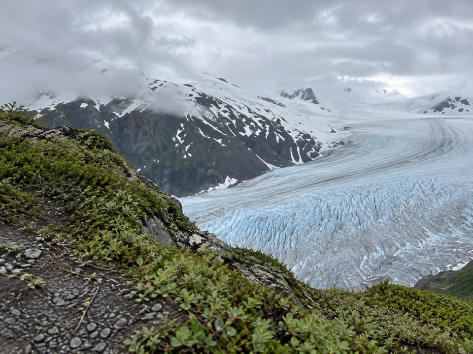
Marmot Meadows is an open hillside on the Harding Icefield Trail, about a third of the way up from the Exit Glacier area. The forest opens into shrubs, small trees and summer flowers, with an elevated view over Exit Glacier. It’s a worthwhile turnaround if you want a real uphill hike without committing to the full climb toward the icefield.

How far to goFrom the Harding Icefield trailhead, the meadows are about 1.3 miles uphill.

From the Harding Icefield trailhead, the meadows are about 1.3 miles uphill. The narrow trail climbs roughly 1,000 feet per mile, so expect about 1,300 feet of ascent before turning back and roughly 2.6 miles round trip. The full Harding Icefield route continues higher as a strenuous 7.8-mile round trip. Snow can linger on the upper trail into early July, and conditions change quickly, so check before heading above the meadows.

There are no toilets or garbage cans along the trail. Start with enough water; untreated stream water can contain Giardia and needs proper treatment. Pets aren’t allowed on park trails.

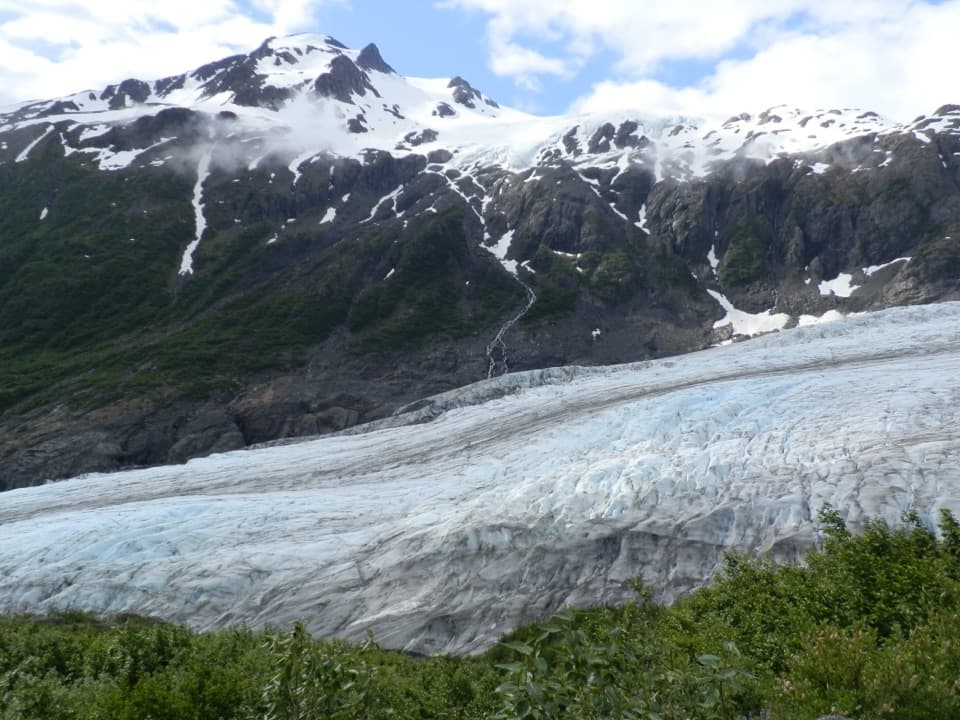
Look across the glacierExit Glacier lies below the meadow, with dark mountain slopes and snow-covered peaks beyond it.

Exit Glacier lies below the meadow, with dark mountain slopes and snow-covered peaks beyond it. For a photo, keep the glacier and mountain wall together in the frame and leave a strip of meadow shrubs along the bottom; that gives the view its hillside setting and a sense of depth.

Marmots and other trail wildlifeThe meadow is named for hoary marmots that were often seen here.

The meadow is named for hoary marmots that were often seen here. As vegetation has grown over the area, they’ve become less common, so treat a marmot as a lucky sighting rather than the reason to make the climb. Black bears are also regularly spotted along the Harding Icefield Trail, often around salmonberry thickets.

Wildlife

Wildlife in Kenai Fjords

All Kenai Fjords wildlife maps

Sighting maps show where each species has been reported across Kenai Fjords. Wildlife moves, so no sighting is guaranteed.

Keep exploring

Near Marmot Meadows

See it all on the map

Trails nearby

More stops nearby

Parkwolf’s Kenai Fjords ranking

Top sights in Kenai Fjords

All 37 places
  1. 1Exit Glacier OverlookSight
  2. 2Aialik GlacierSight
  3. 3Harding Icefield OverlookSight
  4. 4Glacier ViewSight
  5. 5Holgate GlacierSight
  6. 6Northwestern GlacierSight

Take Parkwolf to Kenai Fjords.

The audio tour guide for the drive, plus offline maps, trails, and wildlife heatmaps for when the signal drops.

4.7 from 8,600+ ratings

Download Parkwolf on the App StoreGet Parkwolf on Google Play