Pros & cons
PROS
- Hundreds of petroglyphs clustered close to the canyon mouth
- Short, easy walk from the trailhead through a sandy wash
- Seasonal waterfalls and wild grapevines deeper in the canyon
CONS
- No water or services beyond a basic vault toilet
- Intense heat; temperatures can hit 100°F by mid‑morning
- Graded dirt access road and typically no cell service
Overview
Tucked in the mouth of Grapevine Canyon near Laughlin, this rock art hotspot packs a remarkable amount of story into a compact space. The site is recognized for its prehistoric, artistic, and religious significance and is listed on the National Register of Historic Places (added December 15, 1984). Most of the panels sit right where the canyon narrows, so you don’t have to hike far to feel immersed.
What You’ll See
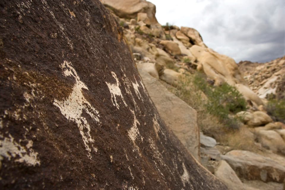
Expect hundreds of petroglyphs—geometric designs, anthropomorphic forms, and densely pecked boulders—etched by removing the dark rock surface to reveal lighter stone beneath. One motif noted here is a vertical line with three circles. Estimates place creation between about 1100 and 1900 AD; the meaning remains debated, though the broader area was inhabited by Mojave people. Panels begin almost immediately at the canyon mouth and continue inside the walls.
The Walk
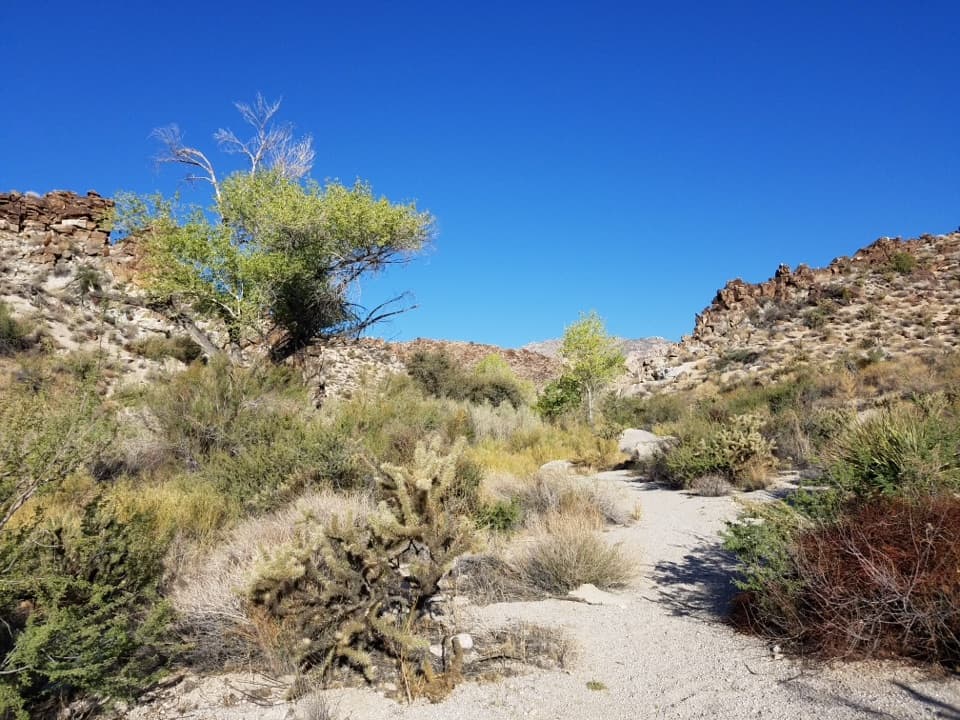
From the trailhead, it’s an easy sandy stroll in the wash—about 0.25–0.3 miles to the primary panels (roughly 0.5 miles round‑trip). If you keep going, the canyon offers light scrambling, seasonal waterfalls, natural “bathtubs” beyond the third fall, and a surprising patch of wild grapevines.
Getting There
Head west from Laughlin on NV‑163 for roughly 6 miles, turn right at Christmas Tree Pass, continue 1.9 miles on graded gravel, then a short left to the trailhead. There’s a parking area and a vault toilet; no water, no trash service.
Best Time to Visit
Go early or late for softer light on the panels and to dodge the heat—reports note temperatures topping 100°F by around 9 AM in warm months. After rains, you’re more likely to catch the waterfalls flowing. Weekdays are typically quieter.
Know Before You Go
- Dogs are allowed on the trail.
- Cell service is typically unavailable—plan ahead.
- The road is generally passable in a sedan when dry, but conditions can change quickly after storms.
Respect the Site
Look, photograph, and leave no trace. Don’t touch, chalk, or climb on the petroglyphs—damaging rock art is a federal offense, and vandalism has resulted in prosecutions here. Report any damage you see.
Where it is
35.2311, -114.6793Tips for Grapevine Canyon Petroglyphs
- 01Start scanning both canyon walls immediately—the densest panels sit near the mouth.
- 02Arrive at sunrise to beat the heat and get softer, raking light for photos.
- 03Bring plenty of water and pack out all trash—there are no services.
- 04Christmas Tree Pass Road is graded gravel; it’s usually fine when dry but rougher after storms.
- 05Expect no cell service; download maps and info before you drive in.
Amenities
Near Grapevine Canyon Petroglyphs
All places →All trails →
0.4 mi awayGrapevine Canyon TrailPetroglyph-rich desert wash to seasonal waterfalls and slickrock tubsModerate · 3.3 mi · 2 hr
3.9 mi awaySpirit MountainSacred Mojave summit with sweeping desert and Colorado River viewsTrailhead · Parking
5 mi awayTelephone CoveFree beach camping and easy lake access near LaughlinRestroom · Parking
5.1 mi awayHomestake Group MineGated historic gold-silver mine site, best viewed from a distance
5.3 mi awayTrout CoveQuiet, undeveloped cove off Lake Mohave’s Nevada shore
51.8 mi awayArizona Hot SpringsVolcanic slot hike to steamy pools via ladder and the riverChallenging · 4.9 mi · 3 hr
51.8 mi awayWhite Rock CanyonVolcanic canyon to riverside hot springs with a spicy ladder.Challenging · 5.8 mi · 4 hr
51.8 mi awayLiberty Bell Arch TrailDesert romp to a photogenic arch and big Colorado River viewsModerate · 5.5 mi · 3.5 hr