Grapevine Canyon Petroglyph Trail in Lake Mead National Recreation Area

#7 of 42 trails in Lake Mead

Lake Mead National Recreation Area, AZ · NV

Grapevine Canyon Petroglyph Trail

A short sandy wash walk ends among the canyon's rock art.

Photo: Wikimedia Commons
Length
0.6mi
Time
45min
Elev. change
121ft
Difficulty
Easy
  • Dogs allowed
  • High point 2,503 ft

Hear the audio tour

Grapevine Canyon: Rock Art at the Entrance

Overview

About Grapevine Canyon Petroglyph Trail

Why go

  • Many petroglyph panels within a short walk
  • Signed parking and a restroom at the trailhead

Heads up

  • Soft sand slows the approach
  • No drinking water at the lot or on the route

Map & elevation

The route

Loading the Lake Mead map
Full map
Elevation2,382–2,503 ft
TrailheadGrapevine Canyon Trailhead35.22586, -114.68186
Keep this map with you offline in the Parkwolf app

Plan your hike

Before you go

Parking

From US 163 west of Laughlin, turn north onto Christmas Tree Pass Road. After about two miles, follow the Grapevine Canyon sign left onto Grapevine Canyon Road and continue to the signed parking area at the end. Restrooms are available at the lot; no drinking-water supply was identified.

Safety

The sandy wash has no potable water, and summer heat can be dangerous. Do not touch, trace, or climb on the petroglyph panels. Pets are allowed but must remain on a leash no longer than six feet.

4 active Lake Mead alerts

  • CautionHarmful algae bloom at Nelson’s Landing and Cottonwood CoveA harmful algae bloom has been confirmed in recent samples from Nelson’s Landing and Cottonwood Cove; avoid contact with water where algae is visible.Official details
  • CautionArizona Hot Springs bacteria advisoryLimit body contact with Arizona Hot Springs water: fecal bacteria in samples frequently reach high levels and can transmit human diseases.Official details
See all 4 alerts
A park ranger sits on a dash-mounted phone, talking, as Parkwolf’s Tour Guide plays “Army Cutworm Moths: A Grizzly Bear Buffet” on Grand Loop Road below Dunraven Pass in Yellowstone
Parkwolf Tour GuideThe highest, rockiest slopes around here are a summer buffet for grizzly bears.

Lake Mead Tour Guide

Your drive to Grapevine Canyon Petroglyph Trail, narrated.

Parkwolf is a GPS audio tour guide for Lake Mead National Recreation Area. As you drive, it chimes in with what’s ahead: hidden gems, upcoming stops, history, geology, and wildlife, right through your car’s speakers.

See the Lake Mead audio tour

Recorded for this trailhead

Grapevine Canyon: Rock Art at the Entrance
0:00 / 0:34
“The access for Grapevine Canyon's petroglyphs is coming up. An unpaved road leads to the parking area, then it's about a third of a mile each way through soft sand to the first panels.”

Plays as you drive up to this trailhead in the Parkwolf Lake Mead Tour Guide.

More stories near here in the app

  • A Hummingbird's Nighttime Slowdown
  • Nevada Telephone Cove: A Sandy Lake Day
  • Why the River Needs Davis Dam
  • 153 audio storiesacross Lake Mead’s roads, triggered by GPS as you drive
  • Wildlife heatmapsfor Bighorn Sheep, Burro, Bald Eagle, and 13 more
  • Works offlinemaps, 42 trails, 70 places, and audio download before you lose signal
  • CarPlay readysimple controls built for the drive
★★★★★
“Fantastic app with many points of information… It’s great to just turn on while you’re driving and it gives you an audio tour of the national Park. We love it!!!!”
JMJamesApp Store review
Download Parkwolf on the App StoreGet Parkwolf on Google Play

4.7 from 8,600+ ratings

Trail guide

Hiking Grapevine Canyon Petroglyph Trail

A brief walk to the panelsGrapevine Canyon Petroglyph Trail is a short walk from the signed Grapevine Canyon Trailhead to…

Grapevine Canyon Petroglyph Trail is a short walk from the signed Grapevine Canyon Trailhead to the rock-art gap at the canyon mouth. It is about 0.3 mile each way, or roughly 0.6 mile round trip. Choose this route if you want the petroglyphs without continuing farther up-canyon. The sandy wash is nontechnical, but the soft footing slows the walk. I would allow about 30 to 45 minutes to walk out, look around, and return.

From parking to the canyon mouthThe path starts at the far end of the lot, drops into Grapevine Wash, then follows it upstream…

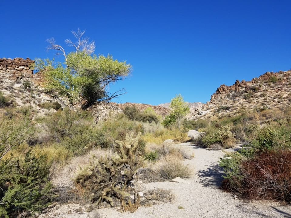
The path starts at the far end of the lot, drops into Grapevine Wash, then follows it upstream and uphill. The wash is broad and sandy near the beginning; granite walls close in as you reach the gap. There is no long climb, but expect loose sand underfoot rather than a hard-packed path.

Look on both sides of the gapPetroglyphs appear on granite walls on both sides of the gap.

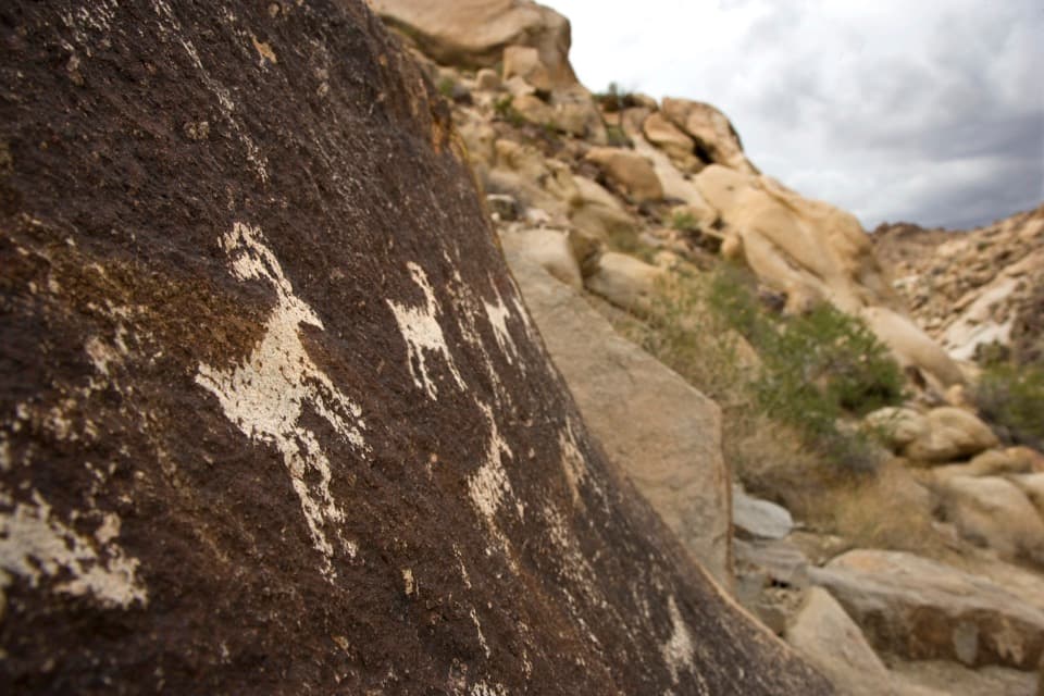
Petroglyphs appear on granite walls on both sides of the gap. Some are at eye level and others sit a little higher; many of the panels are within a minute's walk of the mouth. Look for animal forms, spirals, stars, and geometric designs. For a photo, keep the carved rock and surrounding granite in the same frame so the panels stay in their setting. Stay on the ground and do not touch or climb on the panels.

A culturally important canyonGrapevine Canyon is considered a spiritual gateway to Spirit Mountain, sacred to Native peoples…

Grapevine Canyon is considered a spiritual gateway to Spirit Mountain, sacred to Native peoples of the Mojave and Sonoran deserts. This short walk reaches a broader cultural landscape even if you only go a few hundred yards. Give the panels time and leave every marked rock undisturbed.

A spring in the washIn non-drought years, a natural spring supports cottonwoods, grapevines, cattails, and rushes…

In non-drought years, a natural spring supports cottonwoods, grapevines, cattails, and rushes in the canyon. That greener strip can attract desert bighorn sheep. After a wet winter, water may flow at the canyon mouth before disappearing into the sand; in drier periods, the wash is dry. The spring is not a visitor water source.

Stop at the gap or keep goingThe short petroglyph route ends at the gap.

The short petroglyph route ends at the gap. Continuing upstream toward Grapevine Falls is a separate, longer canyon hike. Farther in, soft sand gives way to slick, water-polished granite and boulder scrambling. That rougher continuation is not included in this trail's 0.6-mile round-trip distance, so turn back at the panels if you came for the short rock-art walk.

Access, water, and petsFrom Laughlin, take US 163 west and turn north onto Christmas Tree Pass Road.

From Laughlin, take US 163 west and turn north onto Christmas Tree Pass Road. After about two miles, turn left at the Grapevine Canyon sign onto Grapevine Canyon Road and continue to the trailhead lot. Restrooms are available at the lot, but no drinking-water supply was found there or on the route. Winter and spring are more comfortable seasons; summer desert heat can be dangerous. Pets are allowed on park hiking trails and must stay on a leash no longer than six feet.

Wildlife

Wildlife in Lake Mead

All Lake Mead wildlife maps

Sighting maps show where each species has been reported across Lake Mead. Wildlife moves, so no sighting is guaranteed.

Parkwolf’s Lake Mead ranking

Top-rated trails in Lake Mead

All 42 trails
  1. 1Historic Railroad TrailEasy · 7.5 mi
  2. 2Anniversary Narrows TrailModerate · 5.8 mi
  3. 3Liberty Bell Arch TrailChallenging · 5.5 mi
  4. 4Arizona Hot Spring TrailChallenging · 5 mi
  5. 5Owl Canyon TrailModerate · 2.2 mi
  6. 6Fortification Hill TrailChallenging · 4 mi

Take Parkwolf to Lake Mead.

The audio tour guide for the drive, plus offline maps, trails, and wildlife heatmaps for when the signal drops.

4.7 from 8,600+ ratings

Download Parkwolf on the App StoreGet Parkwolf on Google Play