Falls of Dochart in Loch Lomond & The Trossachs National Park

#4 of 41 sights in Loch Lomond & The Trossachs

Sight · Loch Lomond & The Trossachs National Park

Falls of Dochart

A village waterfall that roars beneath an old stone bridge.

Photo: Wikimedia Commons
Type
Sight
Nearest trail
0.1 km
Audio stories
6 nearby
  • Parking
  • Restrooms
  • Food
  • Restaurant

Hear the audio tour

Falls of Dochart in Killin

Overview

About Falls of Dochart

Why stop

  • Immediate, dramatic river views without a hike
  • Bridge, island burial ground and village history in one stop

Heads up

  • Traffic and slippery rocks make the closest views awkward

Map

Where it is

Loading the Loch Lomond & The Trossachs map
Full map
SightFalls of Dochart56.46254, -4.32022
Keep this map with you offline in the Parkwolf app

Plan your stop

Before you go

4 active Loch Lomond & The Trossachs alerts

  • CautionA82 restriction near Kings House HotelThe A82 is restricted in both directions near Kings House Hotel, Glencoe, because of planned roadworks. - Temporary traffic lights are in place; follow the traffic management.Official details
  • ClosureDaytime A827 closure at KillinThe A827 at Killin is closed during the day for roadworks from 28 September through 9 October 2026. - Closure hours: 9:30am to 3:30pm; avoid the route during those hours.Official details
See all 4 alerts
A park ranger sits on a dash-mounted phone, talking, as Parkwolf’s Tour Guide plays “Army Cutworm Moths: A Grizzly Bear Buffet” on Grand Loop Road below Dunraven Pass in Yellowstone
Parkwolf Tour GuideThe highest, rockiest slopes around here are a summer buffet for grizzly bears.

Loch Lomond & The Trossachs Tour Guide

Your drive to Falls of Dochart, narrated.

Parkwolf is a GPS audio tour guide for Loch Lomond & The Trossachs National Park. As you drive, it chimes in with what’s ahead: hidden gems, upcoming stops, history, geology, and wildlife, right through your car’s speakers.

Recorded for this place

Falls of Dochart in Killin
0:00 / 0:32
“Up ahead in Killin, the Falls of Dochart tumble through the village beneath an old stone road bridge.”

Plays as you drive up to Falls of Dochart in the Parkwolf Loch Lomond & The Trossachs Tour Guide.

More stories near here in the app

  • Six Stones in Kinnell Park
  • A Big View in Two Steep Miles
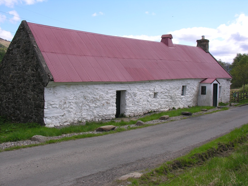
  • Moirlanich Longhouse in Glen Lochay
  • The Words on Killin’s Cross
  • 196 audio storiesacross Loch Lomond & The Trossachs’s roads, triggered by GPS as you drive
  • Wildlife heatmapsfor Golden Eagle, Red Deer, Mute Swan, and 13 more
  • Works offlinemaps, 93 trails, 73 places, and audio download before you lose signal
  • CarPlay readysimple controls built for the drive
★★★★★
“Fantastic app with many points of information… It’s great to just turn on while you’re driving and it gives you an audio tour of the national Park. We love it!!!!”
JMJamesApp Store review
Download Parkwolf on the App StoreGet Parkwolf on Google Play

4.7 from 8,600+ ratings

Guide

More about Falls of Dochart

A waterfall in the middle of KillinThe Falls of Dochart are a broad cascade of rapids on the River Dochart, running straight…

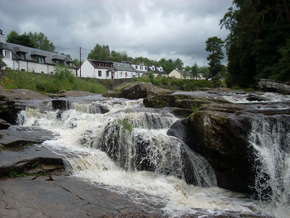
The Falls of Dochart are a broad cascade of rapids on the River Dochart, running straight through the village at the western end of Loch Tay. The river spreads across dark rock, then tightens into channels beneath the old stone Bridge of Dochart. This is an easy, worthwhile stop if you are passing through the Trossachs: you get the main view almost immediately, without committing to a hike, and the combination of white water, bridge, trees and Highland hills feels more like a wild river scene than a village centre.

Go when the river is livelyThe falls change more than you might expect.

The falls change more than you might expect. After rain, the Dochart becomes a loud, fast sheet of water that covers much of the rock bed. In drier weather, the exposed ledges and separate channels are easier to see, but the falls can lose some of their force. The National Park calls the access very easy, though the best close views are not the same as an easy walk: traffic crosses the narrow bridge, and the riverside rocks are slippery. Stay on the established viewpoints and treat the water as serious, especially when the river is high.

For photos, start from the bridge or its approaches, then look for a lower angle that keeps the rock shelves in the foreground. That shows how widely the water spreads. The bridge gives the scene its sense of scale; a tight shot of the foam alone could be almost anywhere.

The bridge and the islandBridge of Dochart is an 18th-century stone crossing, rebuilt after a flood.

Bridge of Dochart is an 18th-century stone crossing, rebuilt after a flood. The exact construction dates are reported differently, but the useful part of the story is clear: this is an old working bridge carrying the road across the same channels that make the falls. Downstream, the river runs around Innis Bhuidhe, also called Inchbuie or the Yellow Island. Its walled Clan MacNab burial ground contains fifteen graves, including the graves of nine clan chiefs and an older medieval grave slab. You can see the island from the falls, but do not assume that the burial ground is an open, casual riverside wander; access is a separate matter and may require a key.

The Gaelic name is Eas Dochart, traditionally explained as “the scourer.” That feels apt when the river is in spate. The falls sit beside the former St Fillan’s Mill and the Falls of Dochart Inn, so the scene is layered: working water, old stone, village buildings and a long local story in one view.

Making the stop workYou can view the falls from the level village bridge, which is accessible to most visitors, and…

You can view the falls from the level village bridge, which is accessible to most visitors, and the public toilet is at Dochart Falls on Main Street. Parking is available around Killin, but do not assume the inn’s car park is unrestricted free parking: customers use it under the inn’s registration system, while other vehicles are subject to its operator’s rules. The Falls of Dochart Inn is right beside the water and provides a practical food stop, with restaurant, café and smokehouse offerings including smoked salmon. If you want the classic view, allow time to cross or approach the bridge carefully rather than treating it as a drive-by photograph.

The falls are free to see and work well as a short stop on a Killin day, a longer break on the A827, or a starting point for exploring the surrounding park. Prioritize it after rain, but give yourself more distance from the river then.

Wildlife

Wildlife in Loch Lomond & The Trossachs

All Loch Lomond & The Trossachs wildlife maps

Sighting maps show where each species has been reported across Loch Lomond & The Trossachs. Wildlife moves, so no sighting is guaranteed.

Parkwolf’s Loch Lomond & The Trossachs ranking

Top sights in Loch Lomond & The Trossachs

All 73 places
  1. 1Ben LomondSight
  2. 2Trossachs PierSight
  3. 3Conic HillSight
  4. 5Ben A’anSight
  5. 6Bracklinn FallsSight
  6. 7Benmore Botanic GardenSight

Take Parkwolf to Loch Lomond & The Trossachs.

The audio tour guide for the drive, plus offline maps, trails, and wildlife heatmaps for when the signal drops.

4.7 from 8,600+ ratings

Download Parkwolf on the App StoreGet Parkwolf on Google Play