
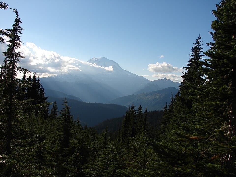
William O. Douglas Heritage Trail — Rainier Approach in Mount Rainier National Park

Mount Rainier National Park, WA

William O. Douglas Heritage Trail — Rainier Approach

A 26-mile one-way traverse linking lakes and Rainier views.

Photo: Public Domain
Length
26mi
Time
16hr
Elev. change
3,451ft
Difficulty
Challenging
  • No dogs
  • High point 5,673 ft
Parkwolf audio tour77 stories across Mount Rainier’s roads

Overview

About William O. Douglas Heritage Trail — Rainier Approach

Why go

  • A through-route links remote lakes, the PCT and a Rainier view.

Heads up

  • Requires a vehicle shuttle and a two- to three-day backpack.

Map & elevation

The route

Loading the Mount Rainier map
Full map
Elevation2,221–5,673 ft
TrailheadSand Ridge Trailhead46.65060, -121.27800
Keep this map with you offline in the Parkwolf app

Plan your hike

Before you go

Parking

Start at Sand Ridge Trailhead, north of US 12 about 0.6 mile west of milepost 158 on Forest Road 488. A recreation pass is required. Arrange a shuttle to Laughingwater Creek Trailhead, across SR 123 from its pullout, and confirm public parking at the finish before setting out.

Safety

This is a hard, remote 26-mile traverse with long climbs and descents. Fill out the free wilderness-entry permit at Sand Ridge Trailhead; overnight camping in Mount Rainier requires a separate park wilderness permit and designated campsites. Carry food, treat all natural water, and note that fires and pets are prohibited on the park section.

7 active Mount Rainier alerts

  • ClosureWildfire closures in the northern parkGrand Park 2 and Wonderland Complex fire closures affect trails, backcountry camps, and Sunrise access; stay out of closed areas.Official details
  • ClosureSR 165 bridge closed: no public access to Carbon River or Mowich LakeThe SR 165 Carbon River/Fairfax Bridge is closed to vehicles, bicycles, and pedestrians; there is no public access or alternate route to Carbon River or Mowich Lake.Official details
See all 7 alerts
A park ranger sits on a dash-mounted phone, talking, as Parkwolf’s Tour Guide plays “Army Cutworm Moths: A Grizzly Bear Buffet” on Grand Loop Road below Dunraven Pass in Yellowstone
Parkwolf Tour GuideThe highest, rockiest slopes around here are a summer buffet for grizzly bears.

Mount Rainier Tour Guide

Your drive to William O. Douglas Heritage Trail — Rainier Approach, narrated.

Parkwolf is a GPS audio tour guide for Mount Rainier National Park. As you drive, it chimes in with what’s ahead: hidden gems, upcoming stops, history, geology, and wildlife, right through your car’s speakers.

See the Mount Rainier audio tour
  • 77 audio storiesacross Mount Rainier’s roads, triggered by GPS as you drive
  • Wildlife heatmapsfor Mountain Goat, Black Bear, Wolverine, and 13 more
  • Works offlinemaps, 99 trails, 87 places, and audio download before you lose signal
  • CarPlay readysimple controls built for the drive
★★★★★
“Fantastic app with many points of information… It’s great to just turn on while you’re driving and it gives you an audio tour of the national Park. We love it!!!!”
JMJamesApp Store review
Download Parkwolf on the App StoreGet Parkwolf on Google Play

4.7 from 8,600+ ratings

Trail guide

Hiking William O. Douglas Heritage Trail — Rainier Approach

A long point-to-point traverseThe Rainier Approach is roughly 26 miles one way from Sand Ridge Trailhead on US 12 to…

The Rainier Approach is roughly 26 miles one way from Sand Ridge Trailhead on US 12 to Laughingwater Creek Trailhead at SR 123. It follows Sand Ridge and Shellrock Lake trails to the Pacific Crest Trail, passes Snow Lake and Fish Lake, climbs beyond Crag Lake to Laughingwater Creek, then descends past Three Lakes to the highway. Plan a two- to three-day backpack and a vehicle shuttle.

Distance, direction and effortThe mapped corridor is about 25 miles.

The mapped corridor is about 25 miles. A commonly cited 52-mile figure is labeled round trip even though its directions connect two different trailheads; we represent those directions as an approximately 26-mile one-way traverse. The route is rated hard, with long climbs and descents; allow about 16 hours of hiking time, generally spread over two or three days. Verify the shuttle and finish parking plan before starting.

Permits, water and campingAt Sand Ridge, fill out the free self-issue wilderness permit required to enter the William O.

At Sand Ridge, fill out the free self-issue wilderness permit required to enter the William O. Douglas Wilderness. Overnight camping inside Mount Rainier requires a separate park wilderness permit, and use is limited to designated sites. There are no food services along this remote route; carry food and treat natural water before drinking. Fires are prohibited in the park section, and pets are not allowed on park trails.

The route and its lakesSand Ridge climbs through the eastern wilderness to the Shellrock Lake junction and the PCT.

Sand Ridge climbs through the eastern wilderness to the Shellrock Lake junction and the PCT. The PCT rolls past Snow Lake and the Bumping River headwaters at Fish Lake, then gains about 1,500 feet beyond Fish Lake and Crag Lake before meeting Laughingwater Creek Trail. From the junction, the final descent is about eight miles to SR 123. At Three Lakes, the route passes a historic patrol cabin and designated backcountry camps; an open viewpoint beyond the third lake looks toward Rainier.

The Douglas connectionThe wilderness and trail honor William O.

The wilderness and trail honor William O. Douglas, a longtime Supreme Court justice who wrote about his Cascade hiking in Of Men and Mountains. The wilderness was established in his honor in 1984. The traverse moves from forested lake basins to high, open ridges, where clear-weather views can include Rainier, Goat Rocks and Mount Adams.

Wildlife

Wildlife in Mount Rainier

All Mount Rainier wildlife maps

Sighting maps show where each species has been reported across Mount Rainier. Wildlife moves, so no sighting is guaranteed.

Parkwolf’s Mount Rainier ranking

Top-rated trails in Mount Rainier

All 99 trails
  1. 1Wonderland TrailChallenging · 93 mi
  2. 2Skyline Trail LoopChallenging · 5.5 mi
  3. 3Mount Fremont Lookout TrailModerate · 5.6 mi
  4. 4Burroughs Mountain TrailModerate · 6.2 mi
  5. 5Summerland TrailModerate · 8.4 mi
  6. 6Naches Peak Loop TrailModerate · 3.5 mi

Take Parkwolf to Mount Rainier.

The audio tour guide for the drive, plus offline maps, trails, and wildlife heatmaps for when the signal drops.

4.7 from 8,600+ ratings

Download Parkwolf on the App StoreGet Parkwolf on Google Play





