Long Key State Park Day-Use Area in Overseas Highway

Picnic area · Overseas Highway

Long Key State Park Day-Use Area

A shaded picnic-and-paddle stop on Long Key’s shallow Florida Bay shore.

Type
Picnic area
Nearest trail
0.1 mi
Audio stories
4 nearby
  • Parking
  • Restrooms
  • Picnic tables

Hear the audio tour

Long Key: Picnic Shore and Golden Orb Trail

Overview

About Long Key State Park Day-Use Area

Why stop

  • Covered picnic tables right beside the water

Heads up

  • Shallow, seagrass-bottom water is a poor fit for a sandy-beach swim

Map

Where it is

Loading the Overseas Highway map
Full map
Picnic areaLong Key State Park Day-Use Area24.81550, -80.82340
Keep this map with you offline in the Parkwolf app

Plan your stop

Before you go

Access and amenities

The entrance is on Overseas Highway near mile marker 67.5. The main parking area is the best point to navigate to for this stop; parking is also available in other parts of the park. The day-use area has covered picnic tables, and public restrooms and bottle-refill stations are available in the park.

3 active Overseas Highway alerts

  • CautionCoastal flooding across the Florida KeysA Coastal Flood Warning remains in effect for the Upper Keys and Coastal Flood Advisories remain in effect for the Middle and Lower Keys until 5 a.m.Official details
  • CautionNighttime lane closures on Seven Mile BridgeExpect possible nighttime lane closures on Seven Mile Bridge for FDOT’s rehabilitation project to repair and strengthen the bridge.Official details
See all 3 alerts
A park ranger sits on a dash-mounted phone, talking, as Parkwolf’s Tour Guide plays “Army Cutworm Moths: A Grizzly Bear Buffet” on Grand Loop Road below Dunraven Pass in Yellowstone
Parkwolf Tour GuideThe highest, rockiest slopes around here are a summer buffet for grizzly bears.

Overseas Highway Tour Guide

Your drive to Long Key State Park Day-Use Area, narrated.

Parkwolf is a GPS audio tour guide for Overseas Highway. As you drive, it chimes in with what’s ahead: hidden gems, upcoming stops, history, geology, and wildlife, right through your car’s speakers.

See the Overseas Highway audio tour

Recorded for this place

Long Key: Picnic Shore and Golden Orb Trail
0:00 / 0:35
“Long Key State Park's day-use area is coming up, with covered picnic tables beside a shallow shoreline. Choose it for a shady lunch break or a paddle in your own kayak.”

Plays as you drive up to Long Key State Park Day-Use Area in the Parkwolf Overseas Highway Tour Guide.

More stories near here in the app

  • A Waterspout Starts Below
  • Zane Grey’s Other Frontier
  • A Fish That Breathes Air
  • A County Seat Offshore
  • 136 audio storiesacross Overseas Highway’s roads, triggered by GPS as you drive
  • Wildlife heatmapsfor Crocodile, Alligator, Manatee, and 13 more
  • Works offlinemaps, 26 trails, 88 places, and audio download before you lose signal
  • CarPlay readysimple controls built for the drive
★★★★★
“Fantastic app with many points of information… It’s great to just turn on while you’re driving and it gives you an audio tour of the national Park. We love it!!!!”
JMJamesApp Store review
Download Parkwolf on the App StoreGet Parkwolf on Google Play

4.7 from 8,600+ ratings

Guide

More about Long Key State Park Day-Use Area

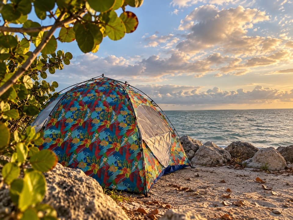
The day-use shorelineLong Key State Park’s day-use area is its waterside picnic-and-swim stop beside Florida Bay.

Long Key State Park’s day-use area is its waterside picnic-and-swim stop beside Florida Bay. Covered chickee pavilions and tables sit over a shallow shoreline. I’d choose it for a shady break, a picnic or a paddle; it’s a poor match if you want a wide sandy beach.

Water and paddlingSwimming and snorkeling are designated for specific areas.

Swimming and snorkeling are designated for specific areas. The water stays shallow over seagrass, and parts of the shore can feel soft or mucky underfoot, so think wading and shoreline exploring more than a deep-water swim. You can bring a kayak or canoe to explore the natural shoreline, but there’s no boat ramp.

Long Key’s fishing-camp pastLong Key was once a stop on Henry Flagler’s Over-Sea Railroad, completed to Key West in 1912.

Long Key was once a stop on Henry Flagler’s Over-Sea Railroad, completed to Key West in 1912. The island’s Long Key Fishing Camp grew into a luxury resort for anglers including Zane Grey, with a small railway carrying guests between the docks, hotel and bungalows. The 1935 Labor Day Hurricane destroyed the camp.

Birds and grass flatsHerons, egrets and ibis are common along the park’s shore.

Herons, egrets and ibis are common along the park’s shore. The shallow grass flats hold mullet and snapper, and kayakers sometimes spot loggerhead or green turtles.

Wildlife

Wildlife in Overseas Highway

All Overseas Highway wildlife maps

Sighting maps show where each species has been reported across Overseas Highway. Wildlife moves, so no sighting is guaranteed.

Parkwolf’s Overseas Highway ranking

Top sights in Overseas Highway

All 88 places
  1. 1Old Seven Mile BridgeSight
  2. 2Southernmost Point BuoySight
  3. 3Mallory SquareSight
  4. 4Calusa BeachBeach
  5. 5Ernest Hemingway Home and MuseumSight
  6. 6Robbie’s of IslamoradaSight

Take Parkwolf to Overseas Highway.

The audio tour guide for the drive, plus offline maps, trails, and wildlife heatmaps for when the signal drops.

4.7 from 8,600+ ratings

Download Parkwolf on the App StoreGet Parkwolf on Google Play