Old Seven Mile Bridge in Overseas Highway

#1 of 64 sights in Overseas Highway

Sight · Overseas Highway

Old Seven Mile Bridge

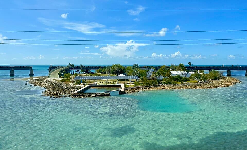
An exposed 2.2-mile walk above the water to Pigeon Key.

Photo: Wikimedia Commons
Type
Sight
Nearest trail
0.1 mi
Audio stories
3 nearby
  • Parking
  • Scenic viewpoint

Hear the audio tour

Old Seven Mile Bridge and Pigeon Key

Overview

About Old Seven Mile Bridge

Why stop

  • A long open-water view with two eras of bridge engineering in sight.

Heads up

  • Walking to Pigeon Key and back means 4.4 exposed miles.

Map

Where it is

Loading the Overseas Highway map
Full map
SightOld Seven Mile Bridge24.70716, -81.12360
Keep this map with you offline in the Parkwolf app

Plan your stop

Before you go

3 active Overseas Highway alerts

  • CautionNighttime lane closures on Seven Mile BridgeMentions Seven Mile Bridge, referenced in this guideExpect possible nighttime lane closures on Seven Mile Bridge for FDOT’s rehabilitation project to repair and strengthen the bridge.Official details
  • CautionCoastal flooding across the Florida KeysA Coastal Flood Warning remains in effect for the Upper Keys and Coastal Flood Advisories remain in effect for the Middle and Lower Keys until 5 a.m.Official details

See all 3 alerts
A park ranger sits on a dash-mounted phone, talking, as Parkwolf’s Tour Guide plays “Army Cutworm Moths: A Grizzly Bear Buffet” on Grand Loop Road below Dunraven Pass in Yellowstone
Parkwolf Tour GuideThe highest, rockiest slopes around here are a summer buffet for grizzly bears.

Overseas Highway Tour Guide

Your drive to Old Seven Mile Bridge, narrated.

Parkwolf is a GPS audio tour guide for Overseas Highway. As you drive, it chimes in with what’s ahead: hidden gems, upcoming stops, history, geology, and wildlife, right through your car’s speakers.

See the Overseas Highway audio tour

Recorded for this place

Old Seven Mile Bridge and Pigeon Key
0:00 / 0:36
“You're approaching the Marathon entrance to Old Seven Mile Bridge. Walk out for water on both sides and a view of the newer highway bridge alongside the old railroad span.”

Plays as you drive up to Old Seven Mile Bridge in the Parkwolf Overseas Highway Tour Guide.

More stories near here in the app

  • After the Pelican Splash
  • The Manatee’s Marching Molars
  • A Bridge Built in Pieces
  • Sombrero Beach: Sand and Picnic Shade
  • 136 audio storiesacross Overseas Highway’s roads, triggered by GPS as you drive
  • Wildlife heatmapsfor Crocodile, Alligator, Manatee, and 13 more
  • Works offlinemaps, 26 trails, 88 places, and audio download before you lose signal
  • CarPlay readysimple controls built for the drive
★★★★★
“Fantastic app with many points of information… It’s great to just turn on while you’re driving and it gives you an audio tour of the national Park. We love it!!!!”
JMJamesApp Store review
Download Parkwolf on the App StoreGet Parkwolf on Google Play

4.7 from 8,600+ ratings

Guide

More about Old Seven Mile Bridge

A bridge you walk, not just photographOld Seven Mile Bridge is the restored public section of Henry Flagler’s original Overseas…

Old Seven Mile Bridge is the restored public section of Henry Flagler’s original Overseas Railroad crossing, now a 2.2-mile route over open water from Marathon to Pigeon Key. The bridge itself is the draw: old piers and steelwork, wide water views, and the newer highway bridge running nearby. If you want to experience the crossing, make time to get out here; it’s much more than a quick roadside look.

Plan for the distancePigeon Key is 2.2 miles from the Marathon landing, so walking there and back is 4.4 miles.

Pigeon Key is 2.2 miles from the Marathon landing, so walking there and back is 4.4 miles. The paved span is for walking and cycling, and the Pigeon Key Express tram is another way to reach the island. Check its current service and return arrangements before you rely on it. Walking the bridge is free; entering Pigeon Key and its museum requires separate paid admission.

Start at the Marathon landingThe landing is beside Overseas Highway just past Knights Key Boulevard.

The landing is beside Overseas Highway just past Knights Key Boulevard. Its small lot holds up to 35 vehicles, so parking is limited. The route is fully exposed to sun and wind, with little shade; bring water and plan for the heat. No bridge-side food or water stop or public restroom is confirmed, so don’t count on facilities along the walk.

The island at the endPigeon Key is a small island at the far end of the restored span.

Pigeon Key is a small island at the far end of the restored span. Its museum occupies the former assistant bridge tender’s house, and other historic buildings have been restored for exhibits, classrooms, and bunkhouses. The island visit gives the walk a second purpose: you can see the place that supported the people who built and worked on this crossing.

Flagler’s railroad crossingThe original Knights Key Bridge was built for Henry Flagler’s Florida East Coast Railway…

The original Knights Key Bridge was built for Henry Flagler’s Florida East Coast Railway extension to Key West, completed in 1912. At the height of construction, about 400 workers lived on Pigeon Key. After the 1935 Labor Day hurricane ended the railroad, the Overseas Highway took over the route in 1938. The modern Seven Mile Bridge opened in 1982 and bypassed the old crossing; it’s the newer road bridge you see alongside the historic one.

Restored for visitorsThe old bridge closed for restoration in 2016 and reopened as a public walking and cycling…

The old bridge closed for restoration in 2016 and reopened as a public walking and cycling route in January 2022. Crews replaced thousands of corroded plates and rivets and the original 1936 I-beams, added aluminum railings, and returned the structure to its Federal Blue finish. The restored 2.2-mile section is open to visitors even though the broader historic bridge line includes unreconstructed remains.

Look both ways over the waterThe old and new bridges run nearly east–west, so sunrise and sunset are the best times to work…

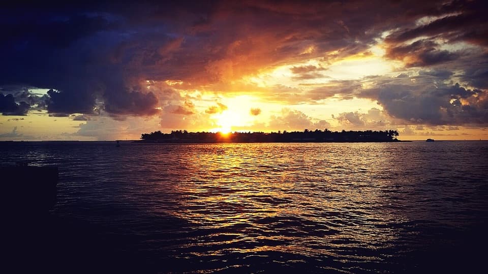
The old and new bridges run nearly east–west, so sunrise and sunset are the best times to work with the light. Frame the historic trusses with the water and newer bridge in view; the water shifts from turquoise to deep blue. Rays, sea turtles, dolphins, fish, and coastal birds are possible sights below, but wildlife is never guaranteed.

Wildlife

Wildlife in Overseas Highway

All Overseas Highway wildlife maps

Sighting maps show where each species has been reported across Overseas Highway. Wildlife moves, so no sighting is guaranteed.

Parkwolf’s Overseas Highway ranking

Top sights in Overseas Highway

All 88 places
  1. 2Southernmost Point BuoySight
  2. 3Mallory SquareSight
  3. 4Calusa BeachBeach
  4. 5Ernest Hemingway Home and MuseumSight
  5. 6Robbie’s of IslamoradaSight
  6. 7Pigeon KeySight

Take Parkwolf to Overseas Highway.

The audio tour guide for the drive, plus offline maps, trails, and wildlife heatmaps for when the signal drops.

4.7 from 8,600+ ratings

Download Parkwolf on the App StoreGet Parkwolf on Google Play