Calusa Beach in Overseas Highway

#4 of 64 sights in Overseas Highway

Beach · Overseas Highway

Calusa Beach

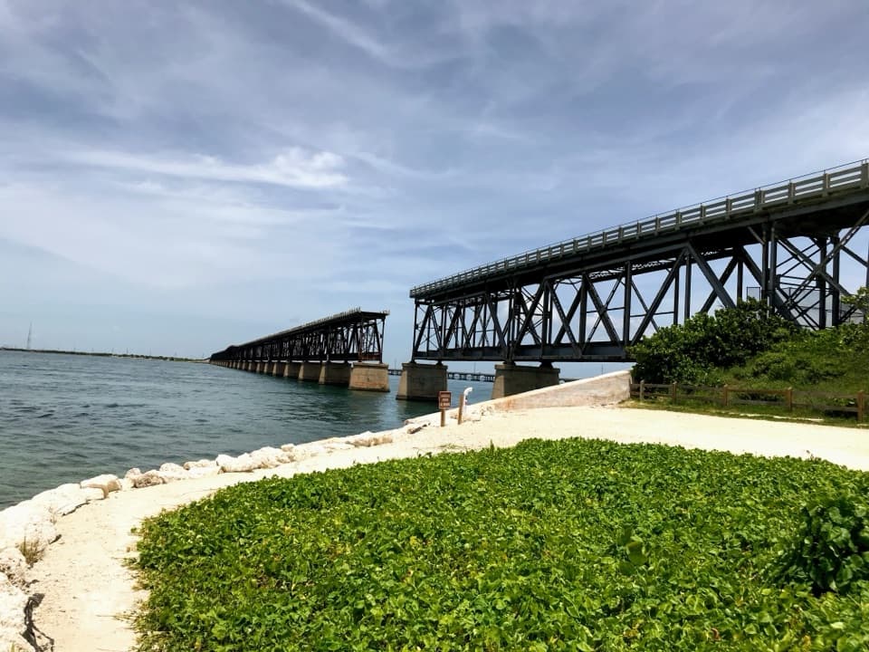
A shallow bay beach beside the broken railway bridge.

Type
Beach
Nearest trail
0.1 mi
Audio stories
4 nearby
  • Food
  • Parking
  • Picnic tables
  • Restrooms

Hear the audio tour

Bahia Honda’s Calusa Beach and Old Bridge

Overview

About Calusa Beach

Why stop

  • Shallow bay water and the old bridge make a distinctive stop
  • A picnic area and bridge walk are right in the day-use area

Heads up

  • Small strip of sand with little natural shade; it can fill early

Map

Where it is

Loading the Overseas Highway map
Full map
BeachCalusa Beach24.65584, -81.28004
Keep this map with you offline in the Parkwolf app

Plan your stop

Before you go

3 active Overseas Highway alerts

  • CautionCoastal flooding across the Florida KeysA Coastal Flood Warning remains in effect for the Upper Keys and Coastal Flood Advisories remain in effect for the Middle and Lower Keys until 5 a.m.Official details
  • CautionNighttime lane closures on Seven Mile BridgeExpect possible nighttime lane closures on Seven Mile Bridge for FDOT’s rehabilitation project to repair and strengthen the bridge.Official details

See all 3 alerts
A park ranger sits on a dash-mounted phone, talking, as Parkwolf’s Tour Guide plays “Army Cutworm Moths: A Grizzly Bear Buffet” on Grand Loop Road below Dunraven Pass in Yellowstone
Parkwolf Tour GuideThe highest, rockiest slopes around here are a summer buffet for grizzly bears.

Overseas Highway Tour Guide

Your drive to Calusa Beach, narrated.

Parkwolf is a GPS audio tour guide for Overseas Highway. As you drive, it chimes in with what’s ahead: hidden gems, upcoming stops, history, geology, and wildlife, right through your car’s speakers.

See the Overseas Highway audio tour

Recorded for this place

Bahia Honda’s Calusa Beach and Old Bridge
0:00 / 0:35
“Bahia Honda's Calusa area is coming up, with a small bay-facing beach beside the old steel bridge. Choose Calusa for a swim and a picnic with that view; nearby Loggerhead Beach faces the Atlantic instead.”

Plays as you drive up to Calusa Beach in the Parkwolf Overseas Highway Tour Guide.

More stories near here in the app

  • A Conch Grows a Thicker Lip
  • Sandspur Beach and Silver Palm Trail
  • The Turtle’s Magnetic Map
  • A Floating Nursery
  • 136 audio storiesacross Overseas Highway’s roads, triggered by GPS as you drive
  • Wildlife heatmapsfor Crocodile, Alligator, Manatee, and 13 more
  • Works offlinemaps, 26 trails, 88 places, and audio download before you lose signal
  • CarPlay readysimple controls built for the drive
★★★★★
“Fantastic app with many points of information… It’s great to just turn on while you’re driving and it gives you an audio tour of the national Park. We love it!!!!”
JMJamesApp Store review
Download Parkwolf on the App StoreGet Parkwolf on Google Play

4.7 from 8,600+ ratings

Guide

More about Calusa Beach

The bay-side beach with the bridge viewCalusa Beach is the small, Florida Bay-facing beach at the southwest end of Bahia Honda State…

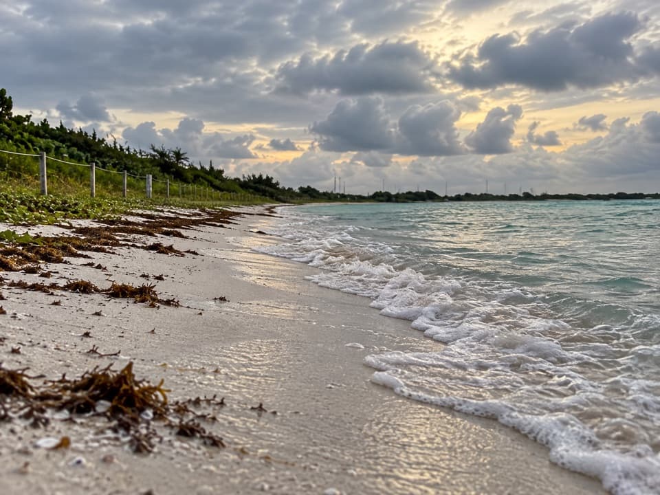
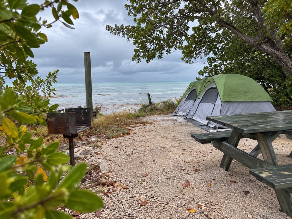
Calusa Beach is the small, Florida Bay-facing beach at the southwest end of Bahia Honda State Park. The old Bahia Honda Bridge stands beside the sand, with the Overseas Highway crossing farther out. It’s a compact cove for wading, a picnic, or a swim with a historic view, rather than a long stretch of open sand. There’s little natural shade and the beach can fill early. Arrive early on weekends and holidays: the park can stop admitting day visitors at capacity, and you need to pay park admission to get in.

Swimming and snorkelingThe nearshore snorkeling area is shallow, around four to six feet deep, and a few hundred feet…

The nearshore snorkeling area is shallow, around four to six feet deep, and a few hundred feet from shore. Water clarity depends on wind: wind-driven sand can cloud it, and visitors sometimes report seaweed, so don’t count on clear turquoise water every day. Some shoreline entries are rocky; water shoes can help. The park advises watching its beach flags, especially near the channel where currents can be stronger.

Picnic and rinse offThe Calusa day-use area has two covered picnic pavilions with grills, one of them accessible,…

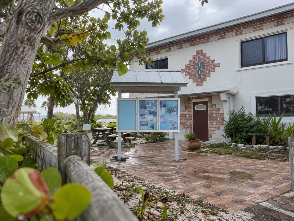
The Calusa day-use area has two covered picnic pavilions with grills, one of them accessible, plus tables and grills around the area. The pavilions have no water or power hookups. Day-use restrooms and accessible cold-water rinse showers are nearby; a free beach wheelchair is available first-come, first-served. Pets aren’t allowed on the beaches or in the water. The park concession sells sandwiches, snacks and ice, and rents snorkel gear, kayaks, umbrellas and beach chairs.

Walk up the old bridgeThe park’s nature trail starts in the Calusa area and follows the approach that used to carry U.

The park’s nature trail starts in the Calusa area and follows the approach that used to carry U.S. 1 up to the old bridge. From the top, you can look across the island and down into the water. When it’s calm, fish and sea turtles may be visible below; the park also notes rays and jumping fish.

Two crossings, one long storyThe old steel-truss bridge began as part of Henry Flagler’s Florida East Coast Railway, whose…

The old steel-truss bridge began as part of Henry Flagler’s Florida East Coast Railway, whose route to Key West opened in 1912. Engineers used trusses here because the channel was unusually deep. After the 1935 Labor Day Hurricane damaged the railroad, Florida bought the bridge for highway use and added a concrete road deck over the train structure. The broken span beside today’s highway makes that change easy to read from the beach.

Frame the shoreline and both bridgesFrom the sand, get low enough to keep the water and shore in the foreground, then line up the…

From the sand, get low enough to keep the water and shore in the foreground, then line up the old trusses with the newer highway crossing. That combination shows what makes Calusa different from an ordinary beach stop. For a higher view, take the trail to the old bridge top and look back across the island.

Wildlife

Wildlife in Overseas Highway

All Overseas Highway wildlife maps

Sighting maps show where each species has been reported across Overseas Highway. Wildlife moves, so no sighting is guaranteed.

Parkwolf’s Overseas Highway ranking

Top sights in Overseas Highway

All 88 places
  1. 1Old Seven Mile BridgeSight
  2. 2Southernmost Point BuoySight
  3. 3Mallory SquareSight
  4. 5Ernest Hemingway Home and MuseumSight
  5. 6Robbie’s of IslamoradaSight
  6. 7Pigeon KeySight

Take Parkwolf to Overseas Highway.

The audio tour guide for the drive, plus offline maps, trails, and wildlife heatmaps for when the signal drops.

4.7 from 8,600+ ratings

Download Parkwolf on the App StoreGet Parkwolf on Google Play