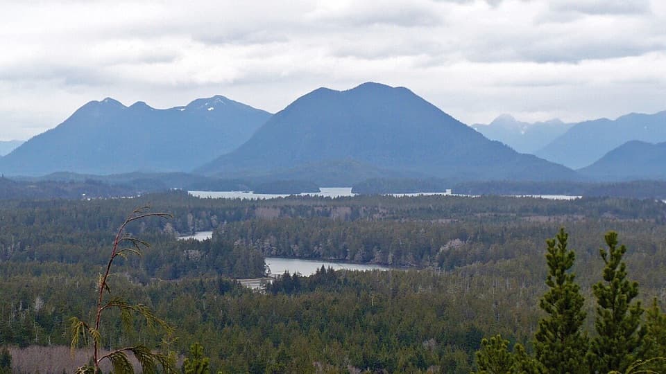
Nitinaht Crabshack in Pacific Rim National Park Reserve

Restaurant · Pacific Rim National Park Reserve

Nitinaht Crabshack

A family-run hot meal halfway along the West Coast Trail.

Overview

About Nitinaht Crabshack

Why stop

  • A cooked seafood meal in the middle of a strenuous hike.

Heads up

  • Reachable only on the remote West Coast Trail.

Map

Where it is

Loading the Pacific Rim map
Full map
RestaurantNitinaht Crabshack48.67578, -124.85154
Keep this map with you offline in the Parkwolf app

Plan your stop

Before you go

7 active Pacific Rim alerts

  • ClosureWest Coast Trail winter access restrictionMentions West Coast Trail, referenced in this guideFrom October 7 through April 30, only day use between Pachena Bay trailhead and km 8 is permitted; overnight use and the remainder of the West Coast Trail are closed.Official details
  • ClosureWest Coast Trail lightstations closedMentions West Coast Trail, referenced in this guideCarmanah Point and Pachena Point Lightstations and their surrounding grounds in the West Coast Trail Unit are closed to public use at all times; do not enter.Official details
See all 7 alerts
A park ranger sits on a dash-mounted phone, talking, as Parkwolf’s Tour Guide plays “Army Cutworm Moths: A Grizzly Bear Buffet” on Grand Loop Road below Dunraven Pass in Yellowstone
Parkwolf Tour GuideThe highest, rockiest slopes around here are a summer buffet for grizzly bears.

Pacific Rim Tour Guide

Your drive to Nitinaht Crabshack, narrated.

Parkwolf is a GPS audio tour guide for Pacific Rim National Park Reserve. As you drive, it chimes in with what’s ahead: hidden gems, upcoming stops, history, geology, and wildlife, right through your car’s speakers.

See the Pacific Rim audio tour
  • 34 audio storiesacross Pacific Rim’s roads, triggered by GPS as you drive
  • Wildlife heatmapsfor Orca, Humpback Whale, Black Bear, and 13 more
  • Works offlinemaps, 19 trails, 52 places, and audio download before you lose signal
  • CarPlay readysimple controls built for the drive
★★★★★
“Fantastic app with many points of information… It’s great to just turn on while you’re driving and it gives you an audio tour of the national Park. We love it!!!!”
JMJamesApp Store review
Download Parkwolf on the App StoreGet Parkwolf on Google Play

4.7 from 8,600+ ratings

Guide

More about Nitinaht Crabshack

A meal mid-hikeNitinaht Crabshack is a small floating dockside restaurant on the south side of Nitinaht…

Nitinaht Crabshack is a small floating dockside restaurant on the south side of Nitinaht Narrows, 32.5 km along the West Coast Trail. It is a cooked-meal stop for hikers, not somewhere you can drive to. If you are hiking the 75-km trail, this is a memorable break at the water; reaching it means taking on the remote, strenuous West Coast Trail, not a casual day visit.

Access is on foot and requires a West Coast Trail reservation. The trail and Crabshack operate seasonally, so confirm the restaurant's dates before setting out.

Food and a place to sleepThe kitchen serves breakfast, lunch and dinner in season, with seafood as the draw.

The kitchen serves breakfast, lunch and dinner in season, with seafood as the draw. The family menu has included crab and fish, some caught by the Edgars themselves. Menus can change, but meals are walk-in and cash is preferred.

Heated cabins and tent decks are rented nearby by the same operation. They are overnight accommodation, not general public indoor facilities.

At the NarrowsNitinaht Narrows is the tidal passage where Nitinat Lake meets the Pacific.

Nitinaht Narrows is the tidal passage where Nitinat Lake meets the Pacific. The West Coast Trail ferry crosses here, splitting the route between its north and south sections; the Crabshack is on the south side by the water. The floating docks bring the kitchen, boats and trail crossing together in one compact stop.

How the Crabshack beganCarl Edgar, a Ditidaht First Nation member who grew up at Clo-oose, has ferried West Coast…

Carl Edgar, a Ditidaht First Nation member who grew up at Clo-oose, has ferried West Coast Trail hikers here since 1975. His father upgraded the original dugout canoe with outboard motors. Carl built the dock in 1999 and began cooking crab or salmon for himself; hikers asked to buy meals, and the family kitchen grew from there. Hikers gave it the name Crabshack; Edgar had wanted to call it Sea Level. The West Coast Trail also crosses the traditional territories of the Huu-ay-aht, Ditidaht and Pacheedaht First Nations.

Wildlife

Wildlife in Pacific Rim

All Pacific Rim wildlife maps

Sighting maps show where each species has been reported across Pacific Rim. Wildlife moves, so no sighting is guaranteed.

Parkwolf’s Pacific Rim ranking

Top sights in Pacific Rim

All 52 places
  1. 1Long BeachBeach
  2. 2Wickaninnish BeachBeach
  3. 3Tsusiat FallsSight
  4. 4Incinerator RockSight
  5. 5Owen Point Sea CavesSight
  6. 6Radar HillSight

Take Parkwolf to Pacific Rim.

The audio tour guide for the drive, plus offline maps, trails, and wildlife heatmaps for when the signal drops.

4.7 from 8,600+ ratings

Download Parkwolf on the App StoreGet Parkwolf on Google Play