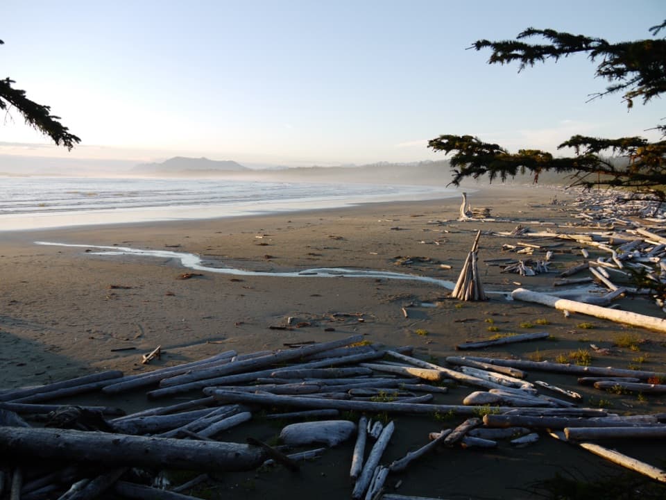
Incinerator Rock in Pacific Rim National Park Reserve

#4 of 21 sights in Pacific Rim

Sight · Pacific Rim National Park Reserve

Incinerator Rock

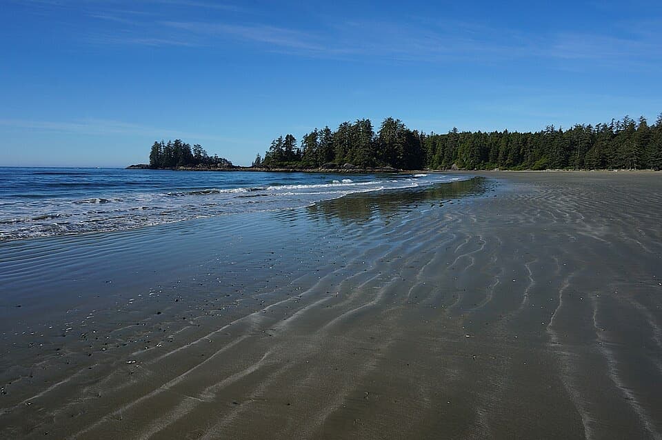
A tree-covered rock with Long Beach surf on both sides.

Photo: Flickr
Type
Sight
Nearest trail
1.4 km
Audio stories
6 nearby
  • Parking
  • Restrooms

Hear the audio tour

Long Beach and Incinerator Rock

Overview

About Incinerator Rock

Why stop

  • A distinctive surf landmark beside Long Beach's broad shoreline.

Heads up

  • High tide can hide the rock's western tip.

Map

Where it is

Loading the Pacific Rim map
Full map
SightIncinerator Rock49.07144, -125.76631
Keep this map with you offline in the Parkwolf app

Plan your stop

Before you go

7 active Pacific Rim alerts

  • CautionLong Beach trails: limited access and boardwalk hazardsMentions Long Beach, referenced in this guideShorepine Bog and Willowbrae trails have limited access, and Combers Beach Trail is rated Caution; use care and follow posted signs.Official details
  • CautionWolf warning in Long Beach UnitA wolf warning remains active in the Long Beach Unit; leave pets at home because dogs attract wolves. Check current trail conditions before travelling.Official details

See all 7 alerts
A park ranger sits on a dash-mounted phone, talking, as Parkwolf’s Tour Guide plays “Army Cutworm Moths: A Grizzly Bear Buffet” on Grand Loop Road below Dunraven Pass in Yellowstone
Parkwolf Tour GuideThe highest, rockiest slopes around here are a summer buffet for grizzly bears.

Pacific Rim Tour Guide

Your drive to Incinerator Rock, narrated.

Parkwolf is a GPS audio tour guide for Pacific Rim National Park Reserve. As you drive, it chimes in with what’s ahead: hidden gems, upcoming stops, history, geology, and wildlife, right through your car’s speakers.

See the Pacific Rim audio tour

Recorded for this place

Long Beach and Incinerator Rock
0:00 / 0:29
“You're coming up on Long Beach and the access to Incinerator Rock. Stop here for open sand, rolling surf, and a chance to watch surfers from shore.”

Plays as you drive up to Incinerator Rock in the Parkwolf Pacific Rim Tour Guide.

More stories near here in the app

  • The Living Sand Dollar
  • A Seabird in the Treetops
  • Schooner Cove
  • Four Sides from One Board
  • 34 audio storiesacross Pacific Rim’s roads, triggered by GPS as you drive
  • Wildlife heatmapsfor Orca, Humpback Whale, Black Bear, and 13 more
  • Works offlinemaps, 19 trails, 52 places, and audio download before you lose signal
  • CarPlay readysimple controls built for the drive
★★★★★
“Fantastic app with many points of information… It’s great to just turn on while you’re driving and it gives you an audio tour of the national Park. We love it!!!!”
JMJamesApp Store review
Download Parkwolf on the App StoreGet Parkwolf on Google Play

4.7 from 8,600+ ratings

Guide

More about Incinerator Rock

What it is and how to get thereIncinerator Rock is a group of rocky outcrops at the north end of Long Beach, with a…

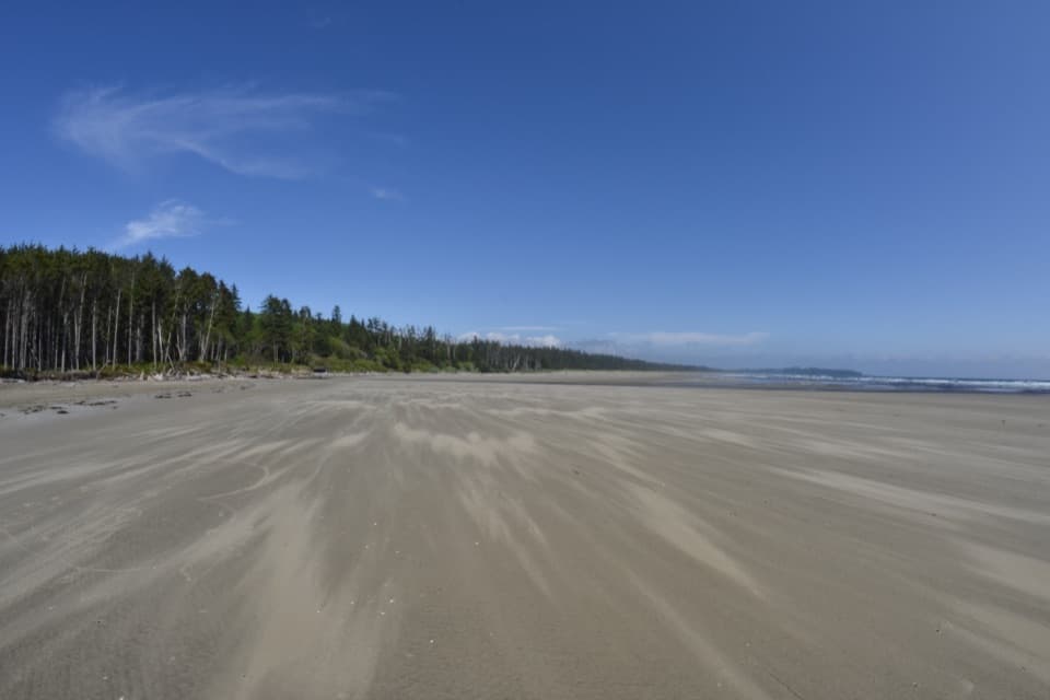
Incinerator Rock is a group of rocky outcrops at the north end of Long Beach, with a tree-covered mound at the water's edge and surf breaking around it. It's a quick stop from the Incinerator Rock parking lot off Pacific Rim Highway, followed by a short walk across the sand. Come for the landmark and the surf, not a hike. Display a Parks Canada pass while stopped in the reserve.

The surf and tideThe rock's west tip can be under water at high tide, so come at lower water if you want to see…

The rock's west tip can be under water at high tide, so come at lower water if you want to see its full outline. The north point blocks some swell, making this side more sheltered than Lovekin Rock farther south; left- and right-breaking peaks form along the beach. These are unsupervised Pacific beaches with powerful waves and rip currents. It's a good place to watch from shore, and check conditions before entering the water.

A wartime name, and an older historyThe name comes from an incinerator on Long Beach used during the Second World War to burn waste…

The name comes from an incinerator on Long Beach used during the Second World War to burn waste from Tofino's air base and nearby army camps; only its concrete foundation remains. The largest rock is also recorded as an old First Nations lookout and midden site, and as the location of a surfguard tower. That's a much longer human story than the quick beach-stop impression suggests.

Get the rock and the surf in one frameFrom the beach, include the dark rock with a strip of sand and breaking surf; looking south…

From the beach, include the dark rock with a strip of sand and breaking surf; looking south brings the separate rounded mound of Lovekin Rock into view. A few steps along the shore change how the two formations line up. Beach-access parking can fill during busy periods, so come early on a popular day.

Wildlife

Wildlife in Pacific Rim

All Pacific Rim wildlife maps

Sighting maps show where each species has been reported across Pacific Rim. Wildlife moves, so no sighting is guaranteed.

Keep exploring

Near Incinerator Rock

See it all on the map

Trails nearby

More stops nearby

Parkwolf’s Pacific Rim ranking

Top sights in Pacific Rim

All 52 places
  1. 1Long BeachBeach
  2. 2Wickaninnish BeachBeach
  3. 3Tsusiat FallsSight
  4. 5Owen Point Sea CavesSight
  5. 6Radar HillSight
  6. 7Combers BeachBeach

Take Parkwolf to Pacific Rim.

The audio tour guide for the drive, plus offline maps, trails, and wildlife heatmaps for when the signal drops.

4.7 from 8,600+ ratings

Download Parkwolf on the App StoreGet Parkwolf on Google Play