Fern Canyon in Redwood National Park

#1 of 26 sights in Redwood

Sight · Redwood National Park

Fern Canyon

A creek walk between steep walls draped in ferns.

Photo: Wikimedia Commons
Type
Sight
Nearest trail
0.2 mi
Audio stories
4 nearby
  • Trailhead
  • Parking
  • Restrooms
  • Picnic tables

Hear the audio tour

Fern Canyon

Overview

About Fern Canyon

Why stop

  • Home Creek winds through a rare corridor of steep, fern-covered walls.

Heads up

  • The long gravel approach and stream crossings make getting there a commitment.

Map

Where it is

Loading the Redwood map
Full map
SightFern Canyon41.40352, -124.06349
Keep this map with you offline in the Parkwolf app

Plan your stop

Before you go

6 active Redwood alerts

  • ClosureJames Irvine, Miners Ridge and Dolason Prairie trail restrictionsMentions this placeConstruction, downed trees and a bridge failure restrict three trails; plan alternate routes and obey closures.Official details
  • CautionU.S. 101 construction traffic controlsExpect construction-related traffic stops and one-way controlled traffic on U.S. 101; allow extra time and drive cautiously. - NPS reports multiple stops between Orick and Crescent City; delays vary.Official details
See all 6 alerts
A park ranger sits on a dash-mounted phone, talking, as Parkwolf’s Tour Guide plays “Army Cutworm Moths: A Grizzly Bear Buffet” on Grand Loop Road below Dunraven Pass in Yellowstone
Parkwolf Tour GuideThe highest, rockiest slopes around here are a summer buffet for grizzly bears.

Redwood Tour Guide

Your drive to Fern Canyon, narrated.

Parkwolf is a GPS audio tour guide for Redwood National Park. As you drive, it chimes in with what’s ahead: hidden gems, upcoming stops, history, geology, and wildlife, right through your car’s speakers.

See the Redwood audio tour

Recorded for this place

Fern Canyon
0:00 / 0:23
“You're approaching Fern Canyon, where Home Creek runs between steep walls covered in ferns.”

Plays as you drive up to Fern Canyon in the Parkwolf Redwood Tour Guide.

More stories near here in the app

  • Rhododendron Trail North
  • Moorman-Pond Trail
  • Gold Bluffs Beach
  • Brown Creek Trail
  • 85 audio storiesacross Redwood’s roads, triggered by GPS as you drive
  • Wildlife heatmapsfor Black Bear, Elk, California Condor, and 13 more
  • Works offlinemaps, 83 trails, 48 places, and audio download before you lose signal
  • CarPlay readysimple controls built for the drive
★★★★★
“Fantastic app with many points of information… It’s great to just turn on while you’re driving and it gives you an audio tour of the national Park. We love it!!!!”
JMJamesApp Store review
Download Parkwolf on the App StoreGet Parkwolf on Google Play

4.7 from 8,600+ ratings

Guide

More about Fern Canyon

A creek canyon, not a redwood groveFern Canyon is a narrow natural ravine at the north end of Gold Bluffs Beach in Prairie Creek…

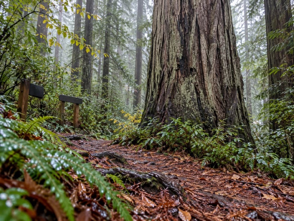
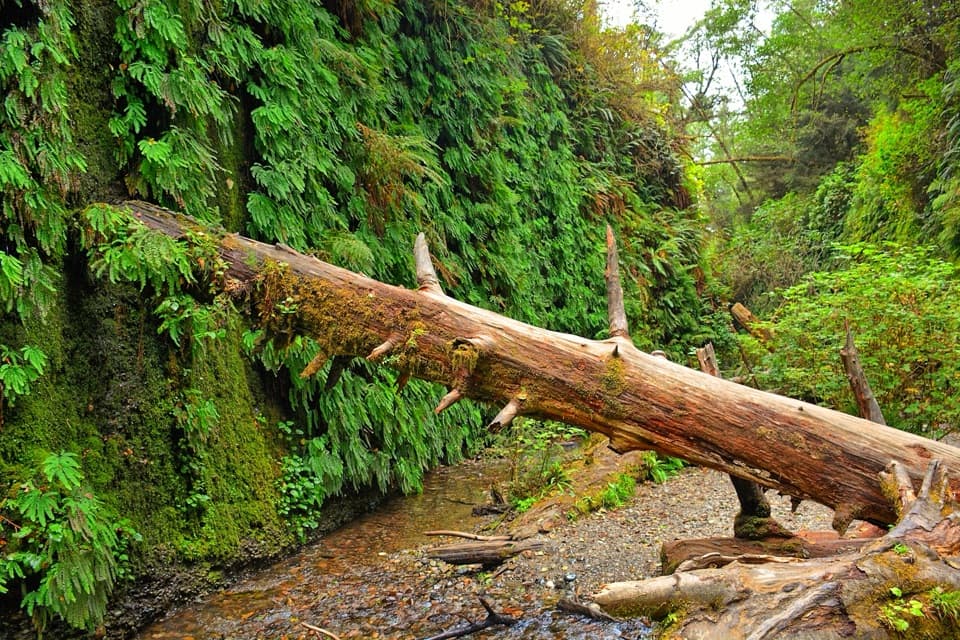
Fern Canyon is a narrow natural ravine at the north end of Gold Bluffs Beach in Prairie Creek Redwoods State Park. Home Creek runs over a cobbled floor between steep, leafy walls draped in ferns. The draw is the close, green corridor around the stream; giant redwoods do not grow in the canyon itself, though Sitka spruce and other conifers frame it.

The fern walls begin about a quarter-mile from the parking area. From there, you can follow the creek up and return the same way, or take the roughly one-mile loop, which climbs the left wall on stairs and gains about 150 feet. The creek walk changes elevation by only about 30 feet, so you can choose how much of the loop to do.

Expect wet feetCrossing Home Creek is part of the visit.

Crossing Home Creek is part of the visit. Water levels and flood-deposited log jams change the footing, and seasonal footbridges are not always in place. Waterproof shoes with good traction make more sense than trying to keep your feet dry. This is a creek bed and stairway walk, not a wheelchair-accessible path.

The drive and what to bringDavison Road from Highway 101 is about eight miles of single-lane gravel.

Davison Road from Highway 101 is about eight miles of single-lane gravel. It has two stream crossings that can be difficult after rain; a high-clearance vehicle is useful when water is up. Trailers and RVs over 24 feet are prohibited, as are vehicles more than 8 feet wide. A vehicle reservation is required for the day-use area from May 15 through September 15; it is not required outside that seasonal window. If you would rather hike in, the James Irvine Trail route from Prairie Creek Visitor Center is about 10.4 miles round trip.

The parking area has a vault toilet and picnic table, but no potable water or food service, so bring what you need. Dogs are not allowed in the canyon; leashed pets are allowed on Gold Bluffs Beach.

Ferns and elkThe canyon's moist walls hold a thick fern cover, while Sitka spruce and other conifers grow…

The canyon's moist walls hold a thick fern cover, while Sitka spruce and other conifers grow around it. Roosevelt elk are often in the wider area. Give them room, especially cows with calves in early summer and bulls in autumn.

A river's old gravelThe canyon walls expose gravel deposited about four million years ago by an ancestral Klamath…

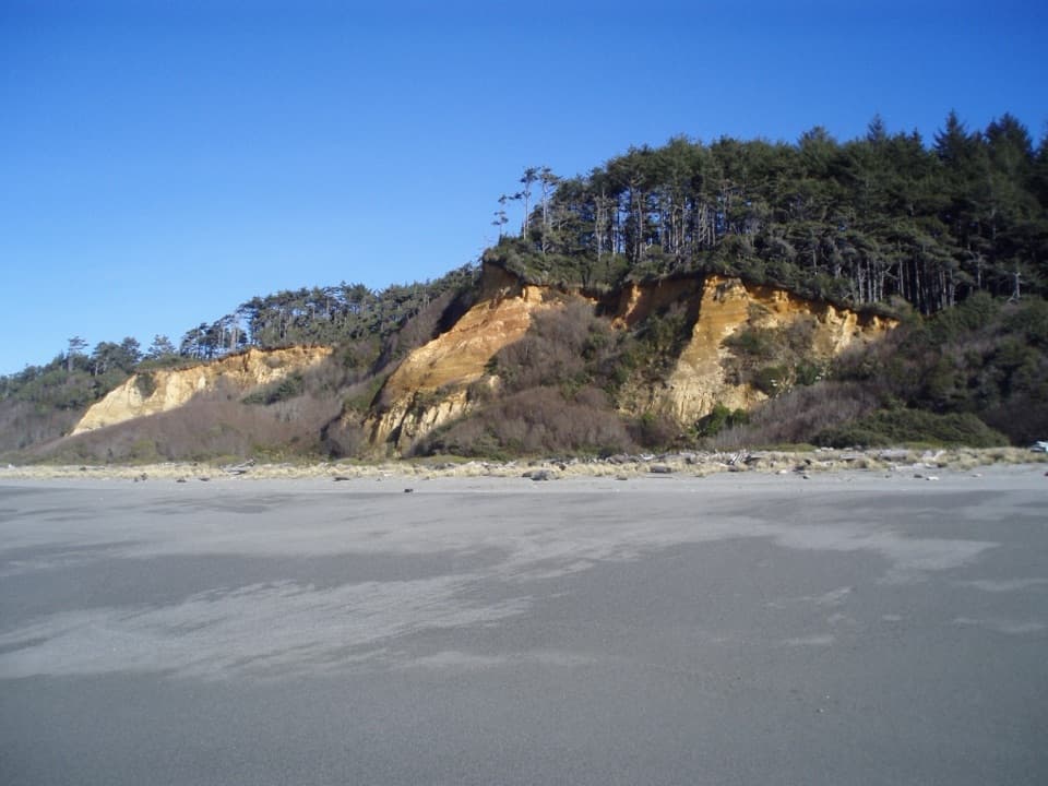
The canyon walls expose gravel deposited about four million years ago by an ancestral Klamath River that carried material west from the Klamath Mountains. Waves working the coast over many winters helped flatten the lower canyon floor, leaving the stream corridor visitors walk today.

Gold near the bluffsGold mining is part of the area's history.

Gold mining is part of the area's history. At the Pacific Mining Company's peak in the 1880s, about 300 people searched for gold nearby. Most of the mining had ended by the 1920s after proving unprofitable.

Photograph it from the creekThe signature view is from inside the channel, looking along the creek with the fern walls…

The signature view is from inside the channel, looking along the creek with the fern walls rising on both sides. Let the water or a fallen log lead the eye into the canyon; the strongest view is reached on foot, not from the parking area.

Wildlife

Wildlife in Redwood

All Redwood wildlife maps

Sighting maps show where each species has been reported across Redwood. Wildlife moves, so no sighting is guaranteed.

Keep exploring

Near Fern Canyon

See it all on the map

Trails nearby

More stops nearby

Parkwolf’s Redwood ranking

Top sights in Redwood

All 48 places
  1. 2Stout Memorial GroveSight
  2. 3Big Tree WaysideSight
  3. 4Lady Bird Johnson GroveSight
  4. 5Grove of TitansSight
  5. 6Tall Trees GroveSight
  6. 7Gold Bluffs Beach Day Use AreaBeach

Take Parkwolf to Redwood.

The audio tour guide for the drive, plus offline maps, trails, and wildlife heatmaps for when the signal drops.

4.7 from 8,600+ ratings

Download Parkwolf on the App StoreGet Parkwolf on Google Play