Friendship Ridge Trail in Redwood National Park

Redwood National Park, CA

Friendship Ridge Trail

A moderate redwood connector through fern-lined ravines.

Photo: Flickr
Length
3mi
Time
2hr
Elev. change
635ft
Difficulty
Moderate
  • No dogs
  • High point 805 ft
  • #29 of 83 in Redwood

Hear the audio tour

Moorman-Pond Trail

Overview

About Friendship Ridge Trail

Why go

  • Elk are regularly seen among bright redwoods and fern-filled ravines.
  • A useful connector in the park-described 12.5-mile loop.

Heads up

  • The three-mile segment is one way and needs a return plan.
  • Roots and large steps slow the descent toward James Irvine.

Map & elevation

The route

Loading the Redwood map
Full map
Elevation170–805 ft
TrailheadFriendship Ridge Trail junction on West Ridge Trail41.42368, -124.04946
Keep this map with you offline in the Parkwolf app

Plan your hike

Before you go

Parking

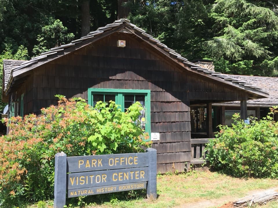
For the park-described loop, park at Prairie Creek Visitor Center, the marked trailhead for both West Ridge and James Irvine. Friendship Ridge itself is a connector with no road-side lot at either junction. Driving to Fern Canyon or Gold Bluffs Beach to park requires a day-use reservation May 15 through September 15.

Safety

Moderate trail with steep grades, switchbacks, and a rough, rooted descent with large steps toward James Irvine. Pets are prohibited on park trails. Driving to Fern Canyon or Gold Bluffs Beach for day-use parking requires a seasonal reservation May 15 through September 15.

6 active Redwood alerts

  • ClosureJames Irvine, Miners Ridge and Dolason Prairie trail restrictionsMentions James Irvine, referenced in this guideConstruction, downed trees and a bridge failure restrict three trails; plan alternate routes and obey closures.Official details
  • CautionU.S. 101 construction traffic controlsExpect construction-related traffic stops and one-way controlled traffic on U.S. 101; allow extra time and drive cautiously. - NPS reports multiple stops between Orick and Crescent City; delays vary.Official details
See all 6 alerts
A park ranger sits on a dash-mounted phone, talking, as Parkwolf’s Tour Guide plays “Army Cutworm Moths: A Grizzly Bear Buffet” on Grand Loop Road below Dunraven Pass in Yellowstone
Parkwolf Tour GuideThe highest, rockiest slopes around here are a summer buffet for grizzly bears.

Redwood Tour Guide

Your drive to Friendship Ridge Trail, narrated.

Parkwolf is a GPS audio tour guide for Redwood National Park. As you drive, it chimes in with what’s ahead: hidden gems, upcoming stops, history, geology, and wildlife, right through your car’s speakers.

See the Redwood audio tour

Recorded for this area

Moorman-Pond Trail
0:00 / 0:25
“You're nearing the Moorman-Pond trailhead, a good choice for a short redwood walk above Sweet Creek.”

Plays on the road 1.1 mi from the trailhead in the Parkwolf Redwood Tour Guide.

More stories near here in the app

  • Hope Creek and Ten Taypo Loop
  • Rhododendron Trail North
  • Fern Canyon
  • Ah-Pah Interpretive Trail
  • 85 audio storiesacross Redwood’s roads, triggered by GPS as you drive
  • Wildlife heatmapsfor Black Bear, Elk, California Condor, and 13 more
  • Works offlinemaps, 83 trails, 48 places, and audio download before you lose signal
  • CarPlay readysimple controls built for the drive
★★★★★
“Fantastic app with many points of information… It’s great to just turn on while you’re driving and it gives you an audio tour of the national Park. We love it!!!!”
JMJamesApp Store review
Download Parkwolf on the App StoreGet Parkwolf on Google Play

4.7 from 8,600+ ratings

Trail guide

Hiking Friendship Ridge Trail

How it fitsFriendship Ridge Trail is a three-mile, one-way segment linking West Ridge Trail to James…

Friendship Ridge Trail is a three-mile, one-way segment linking West Ridge Trail to James Irvine Trail in Prairie Creek Redwoods State Park. It’s best as part of the park’s 12.5-mile loop linking those trails; on its own, this segment ends at another trail junction, so plan your return before starting. Allow about two hours for this leg.

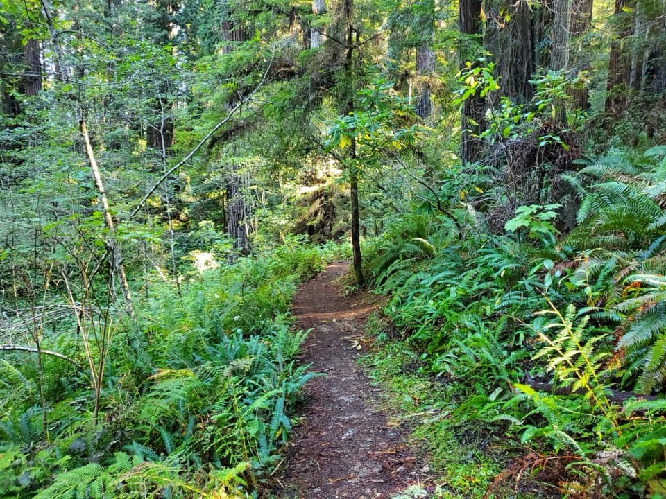
Through the redwood ravinesFrom West Ridge, the trail drops through bright redwood forest and fern-carpeted ravines,…

From West Ridge, the trail drops through bright redwood forest and fern-carpeted ravines, dipping into Boat Creek canyon before climbing back to the ridge. Elk are regularly seen. You can hear surf below the trees, but this is not an ocean-view hike. Signed spurs toward memorial groves and Boat Creek are reported nearly vanished; stick to the main route.

Steep grades and accessThe park describes the trail as moderate, with steep grades and switchbacks.

The park describes the trail as moderate, with steep grades and switchbacks. The roughest stretch is the descent toward James Irvine, where roots and big steps slow you down. Prairie Creek Visitor Center is the marked trailhead for James Irvine and West Ridge, making it the practical starting point for the full loop. Pets aren’t allowed on park trails. If you drive to Fern Canyon or Gold Bluffs Beach instead, a day-use reservation is required May 15 through September 15; walking to Fern Canyon from Prairie Creek Visitor Center is not restricted.

Wildlife

Wildlife in Redwood

All Redwood wildlife maps

Sighting maps show where each species has been reported across Redwood. Wildlife moves, so no sighting is guaranteed.

Keep exploring

Near Friendship Ridge Trail

See it all on the map

Trails that start nearby

Places near the trailhead

Parkwolf’s Redwood ranking

Top-rated trails in Redwood

All 83 trails
  1. 1Fern Canyon Loop TrailModerate · 1 mi
  2. 2Miners Ridge and James Irvine LoopChallenging · 12 mi
  3. 3Boy Scout Tree TrailModerate · 5.6 mi
  4. 4Stout Memorial Grove TrailEasy · 0.6 mi
  5. 5Grove of Titans TrailEasy · 1.8 mi
  6. 6Tall Trees TrailChallenging · 3.7 mi

Take Parkwolf to Redwood.

The audio tour guide for the drive, plus offline maps, trails, and wildlife heatmaps for when the signal drops.

4.7 from 8,600+ ratings

Download Parkwolf on the App StoreGet Parkwolf on Google Play