Gold Bluffs Beach Day Use Area in Redwood National Park

#7 of 26 sights in Redwood

Beach · Redwood National Park

Gold Bluffs Beach Day Use Area

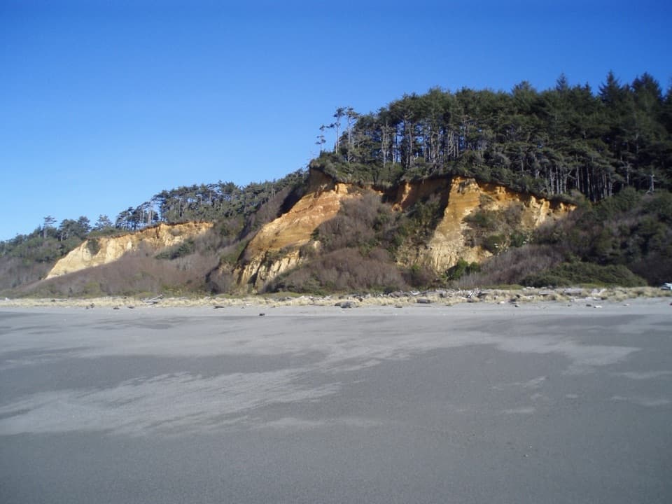
A long gray-sand beach below orange bluffs and coastal forest.

Photo: National Park Service
Type
Beach
Nearest trail
1.6 mi
Audio stories
4 nearby
  • Parking
  • Pullout
  • Picnic tables
  • Scenic viewpoint

Hear the audio tour

Gold Bluffs Beach

Overview

About Gold Bluffs Beach Day Use Area

Why stop

  • A broad, remote-feeling beach framed by orange bluffs, dunes and coastal forest.

Heads up

  • The narrow, unpaved drive is slow, and cold water with swift currents makes swimming unsafe.

Map

Where it is

Loading the Redwood map
Full map
BeachGold Bluffs Beach Day Use Area41.37749, -124.07026
Keep this map with you offline in the Parkwolf app

Plan your stop

Before you go

Give the road and permit some thought

Davison Road leaves near Orick and runs about seven miles to the beach area. It is mostly dirt, narrow and winding, so the drive takes patience. Recreational vehicles and trailers are not permitted, and vehicles over 8 feet wide or 24 feet long do not fit the road. From May 15 through September 15, an online vehicle permit is required; permits are first-come, first-served and can be reserved until 11:59 p.m. the day before. A separate day-use fee applies. Eligible federal and California State Parks passes are accepted, and credit cards are not accepted at the entrance. Check current permit, fee and road information before setting out.

6 active Redwood alerts

  • CautionU.S. 101 construction traffic controlsExpect construction-related traffic stops and one-way controlled traffic on U.S. 101; allow extra time and drive cautiously. - NPS reports multiple stops between Orick and Crescent City; delays vary.Official details
  • CautionU.S. 199 construction traffic controlsExpect 24/7 one-way controlled traffic on three U.S. 199 segments because of construction. - 6–6.2 miles north of Gasquet: through 6:00 p.m. December 15, 2026; delays up to 10 minutes. - 9.6–9.Official details
See all 6 alerts
A park ranger sits on a dash-mounted phone, talking, as Parkwolf’s Tour Guide plays “Army Cutworm Moths: A Grizzly Bear Buffet” on Grand Loop Road below Dunraven Pass in Yellowstone
Parkwolf Tour GuideThe highest, rockiest slopes around here are a summer buffet for grizzly bears.

Redwood Tour Guide

Your drive to Gold Bluffs Beach Day Use Area, narrated.

Parkwolf is a GPS audio tour guide for Redwood National Park. As you drive, it chimes in with what’s ahead: hidden gems, upcoming stops, history, geology, and wildlife, right through your car’s speakers.

See the Redwood audio tour

Recorded for this place

Gold Bluffs Beach
0:00 / 0:34
“You're nearing Gold Bluffs Beach, where gray sand stretches beneath orange bluffs and coastal forest. Stop for a beach walk or a picnic if you want open coast after the redwoods.”

Plays as you drive up to Gold Bluffs Beach Day Use Area in the Parkwolf Redwood Tour Guide.

More stories near here in the app

  • The Freeway That Missed the Beach
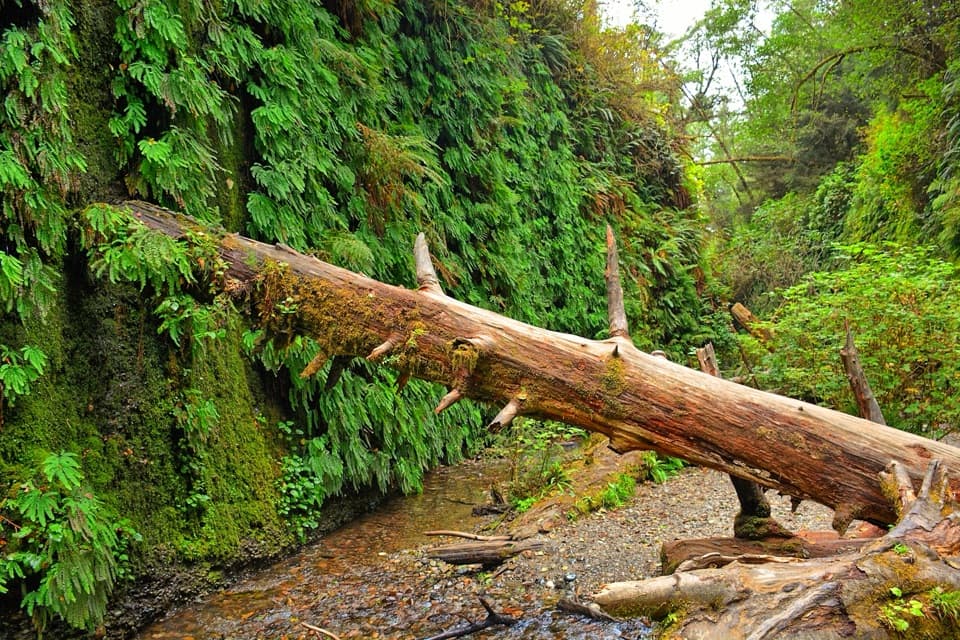
  • Fern Canyon
  • A New Set of Antlers
  • Prairie Creek Visitor Center and Elk Prairie
  • 85 audio storiesacross Redwood’s roads, triggered by GPS as you drive
  • Wildlife heatmapsfor Black Bear, Elk, California Condor, and 13 more
  • Works offlinemaps, 83 trails, 48 places, and audio download before you lose signal
  • CarPlay readysimple controls built for the drive
★★★★★
“Fantastic app with many points of information… It’s great to just turn on while you’re driving and it gives you an audio tour of the national Park. We love it!!!!”
JMJamesApp Store review
Download Parkwolf on the App StoreGet Parkwolf on Google Play

4.7 from 8,600+ ratings

Guide

More about Gold Bluffs Beach Day Use Area

A long, wild stretch of coastGold Bluffs Beach Day Use Area is a string of roadside pullouts and picnic spots beside Gold…

Gold Bluffs Beach Day Use Area is a string of roadside pullouts and picnic spots beside Gold Bluffs Beach, a roughly ten-mile stretch of gray sand in Prairie Creek Redwoods State Park. Orange bluffs and coastal forest rise behind it, while the ocean lies beyond soft dunes. Make time for a proper beach walk; this is not a step-out-of-the-car swim stop.

Walk from the pullout to the surfThe ocean is a few hundred yards west of the parking pullouts, across soft dune sand, so…

The ocean is a few hundred yards west of the parking pullouts, across soft dune sand, so reaching the water takes more effort than the short distance suggests. The payoff is a broad, remote-feeling shoreline with driftwood, gray sand, surf and the bluffs behind you. Fog and wind are part of this exposed coast. The water is very cold and currents are swift, so treat it as a walking and wildlife-viewing beach, not a swimming beach. For photos, keep gray sand or driftwood in the foreground and turn toward the orange bluff line; walk west for a surf view.

How the bluffs got their nameThe name comes from a brief gold rush.

The name comes from a brief gold rush. Miners crossing the beach in May 1850 noticed flecks of gold in the sand, but recovering them proved too laborious. The orange-colored bluffs along the road are sediment from the Klamath River, a reminder that the gold story belongs to this wider coast as much as to any single pullout.

A restored dune landscapeThe protected dunes are more than a backdrop.

The protected dunes are more than a backdrop. Restoration work has targeted invasive European beachgrass so native dune plants can return. Pink sand verbena grew from just five plants in one spot in 2012 to about 2,160 plants across 165 locations by 2016. The broader Prairie Creek area is also Yurok homeland; Yurok people have lived in and around the creek for generations, and the gold rush brought displacement, violence and disease to the region.

Picnic basics and wildlifeRoadside tables, pullouts, an information kiosk and trash receptacles make this a useful picnic…

Roadside tables, pullouts, an information kiosk and trash receptacles make this a useful picnic stop. Vault toilets are only at the north end beside Fern Canyon parking, not at every beach pullout; bring food and drinking water, as no food or water service is listed for the day-use area. Seals and nesting or resting shorebirds use the coast, including western snowy plovers. Dogs are allowed on the beach and roads on a leash no longer than six feet, but not in Fern Canyon or on park trails.

Wildlife

Wildlife in Redwood

All Redwood wildlife maps

Sighting maps show where each species has been reported across Redwood. Wildlife moves, so no sighting is guaranteed.

Keep exploring

Near Gold Bluffs Beach Day Use Area

See it all on the map

Trails nearby

More stops nearby

Parkwolf’s Redwood ranking

Top sights in Redwood

All 48 places
  1. 1Fern CanyonSight
  2. 2Stout Memorial GroveSight
  3. 3Big Tree WaysideSight
  4. 4Lady Bird Johnson GroveSight
  5. 5Grove of TitansSight
  6. 6Tall Trees GroveSight

Take Parkwolf to Redwood.

The audio tour guide for the drive, plus offline maps, trails, and wildlife heatmaps for when the signal drops.

4.7 from 8,600+ ratings

Download Parkwolf on the App StoreGet Parkwolf on Google Play