
Place · 2.3 mi away
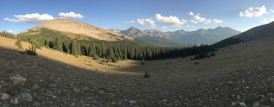
Saint Vrain Mountain delivers a big‑mountain day without the usual RMNP crowds. The standard east approach is an ~8.5‑mile out‑and‑back with roughly 3,250–3,500 feet of gain, starting near Allenspark. You’ll pass from aspen to mixed conifer, break treeline, cross briefly into Rocky Mountain National Park’s Wild Basin drainage, and finish on a use path to a broad 12,162‑foot summit ringed by wind shelters.
The route opens in aspen and mixed pine, parallels a creek, and climbs switchbacks to expansive vistas. Higher up, fir and spruce give way to tundra. As you crest toward the boundary (marked by flexible posts), the skyline explodes with Longs Peak, Mt. Meeker, Mount Copeland, Ouzel Peak, and Mahana Peak. From the east saddle, a short but rugged, unmaintained climb over talus leads to the top with unobstructed views across RMNP and the Indian Peaks.
You’ll traverse multiple life zones—aspens, mixed conifer, and alpine tundra—so keep an eye out for forest and tundra dwellers. Give any wildlife wide berth and protect fragile tundra by staying on durable surfaces.
You’re looking over classic glacial terrain—U‑shaped valleys, cirques, and moraines carved during the Pleistocene. Beneath your feet, ancient Precambrian schist, gneiss, and granites uplifted during the formation of the Rockies create the rugged backbone that frames Wild Basin and the Indian Peaks.
On calm days, consider tagging nearby Meadow Mountain from the saddle for another quick viewpoint.
Place · 2.3 mi away
Place · 2.3 mi away
Place · 2.7 mi away
Place · 2.8 mi away
Moderate · 3.4 mi away
Moderate · 3.4 mi away
Challenging · 3.4 mi away
Moderate · 3.4 mi away

Parkwolf Tour Guide
