Parking
Use Dunraven Trailhead at the end of Dunraven Glade Road. Its gravel lot holds 23 vehicles and has a vault toilet; there is no potable water or fee.
Rocky Mountain National Park, CO
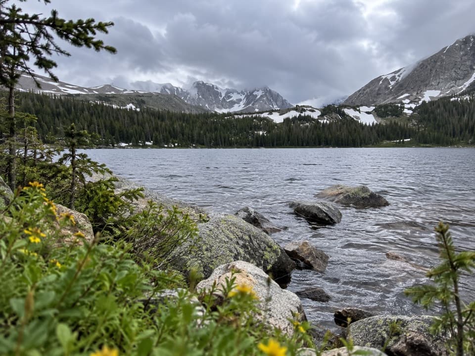
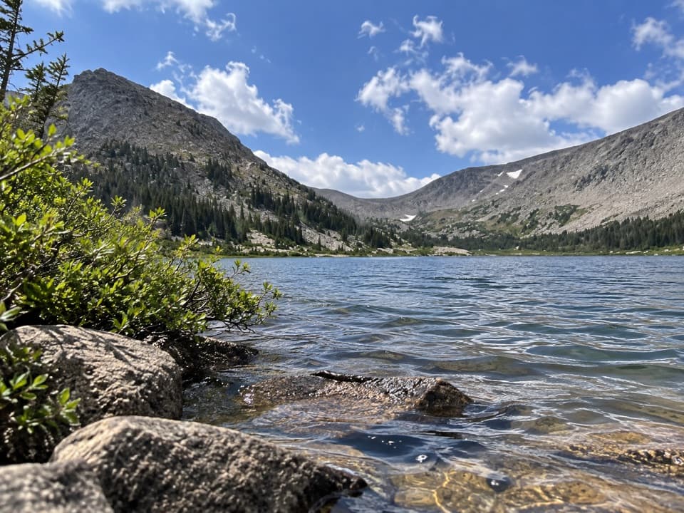
A high-country lake after a long river-and-meadow approach.
Overview
Lost Lake via North Fork Trail is a 19.4-mile out-and-back from Dunraven Trailhead to Lost Lake at 10,710 feet. It follows the North Fork of the Big Thompson River, opens across the historic Deserted Village meadow, then climbs into Rocky Mountain National Park. The destination is a backcountry lake, not a short walk to an overlook. This is a hard, full-day hike for people comfortable with long miles and altitude. If that does not fit your day, you can turn back before the park, but you will not reach Lost Lake.
 Parkwolf’s verdictIs this the hike for you?
Map & elevation
Plan your hike

The highest, rockiest slopes around here are a summer buffet for grizzly bears.
Rocky Mountain Tour Guide
Parkwolf is a GPS audio tour guide for Rocky Mountain National Park. As you drive, it chimes in with what’s ahead: hidden gems, upcoming stops, history, geology, and wildlife, right through your car’s speakers.
See the Rocky Mountain audio tourMore stories near here in the app
“…No cell service for majority of the day but had continuous access to the app - the maps, the tour guide as you drive is amazing. Highly recommend purchasing the subscription.”


Trail guide
From Dunraven, the trail drops into the canyon and follows the river for several miles. Bridges carry you across some stream crossings, while the footpath stays in the North Fork corridor. The route briefly crosses private Cheley Camp property; stay on the trail and do not enter the camp. The tread is a standard dirt trail, but the distance makes this a very different commitment from a quick river walk.
Near the end of the river stretch, the trees open around Deserted Village: broad meadows and historic cabins. This is a more exposed section before the route climbs toward the park boundary. Fred Sprague built a resort camp here in the 1890s. The 2013 flood washed away the remaining buildings, so expect an open historic site, not a preserved village.
Past the meadow, the route climbs to the Rocky Mountain National Park boundary and continues to Lost Lake, in spruce-fir forest at 10,710 feet. The park lists four backcountry campsites on the lake's east side, with no privy at the site. For a photo, keep rocks or the shore in the foreground, with the tree-lined bank and peaks beyond; that framing shows the lake's setting.
Plan on about 10–11 hours for the full out-and-back, including ordinary stops. The park's campsite listing pairs an 8–10-hour travel estimate with the 9.7-mile distance from Dunraven; it does not explicitly say whether the time is one-way. Read it as an approach-time estimate and plan your return separately. The listed elevation gain to the lake is about 2,750 feet. There is no food or potable water at the trailhead or along the route. Carry enough for a long day, and treat stream or lake water before drinking.
Start at Dunraven Trailhead, at the end of Dunraven Glade Road. Its gravel lot holds 23 vehicles and has a vault toilet; bring your own food and water. Dogs must be leashed on the Forest Service section but are prohibited on Rocky Mountain National Park trails, so they cannot accompany you all the way to Lost Lake. Overnight camping requires a backcountry permit; fires are prohibited, and bear-resistant food storage is required April 1 through October 31.
Wildlife
 3,124 sightingsElkMost seen around 6 PMSighting map
 1,601 sightingsMooseMost seen around 7 PMSighting map
 19 sightingsMountain GoatMost seen around 7 AMSighting map
 19 sightingsBald EagleMost seen around 8 AMSighting map
 30 sightingsGolden EagleMost seen around 10 AMSighting map
 270 sightingsBighorn SheepMost seen around 11 AMSighting map
Sighting maps show where each species has been reported across Rocky Mountain. Wildlife moves, so no sighting is guaranteed.
Keep exploring
 ModerateKettle Tarn via North Fork Trail10.1 mi · 5.5 hr · At the trailheadRiver canyon, old resort meadow, and a tucked-away tarn.
 ModerateBridal Veil Falls Trail6.2 mi · 4 hr · 3.7 mi awayA 6.2-mile round trip from meadows to a rocky waterfall
 ModerateWest Creek Falls Trail4.4 mi · 3.5 hr · 3.7 mi awayA steep ridge walk ends at two cascades in a rocky gorge.
 ChallengingNorth Boundary Trail5.9 mi · 5.5 hr · 3.7 mi awayA hard ridge traverse opens to views of the Mummy Range.
 ChallengingHusted Trail11 mi · 8.5 hr · 3.7 mi awayA historic West Creek track with a long approach and fading tread.
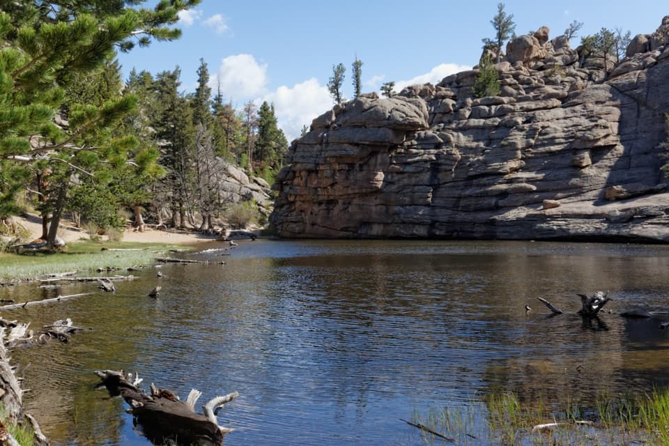 ChallengingLumpy Ridge Loop10.6 mi · 7 hr · 6.1 mi awayA full day around Lumpy Ridge, from ranch meadows to Gem Lake.ModerateBalanced Rock Trail7.3 mi · 4.5 hr · 6.1 mi awayA steep Gem Lake climb, then Balanced Rock and Estes Park views.ModerateGem Lake Trail3.2 mi · 2.5 hr · 6.1 mi awayRock steps climb to a small lake tucked beneath granite walls.Sight · 5 mi awayGem LakeA small granite-ringed lake worth the sustained uphill climb.
 Sight · 5.5 mi awayBridal Veil FallsA 20-foot waterfall beyond meadows, aspens and a steep rocky finish.
 Visitor center · 7.3 mi awayEstes Park Visitor CenterA town-side start for local advice and the seasonal RMNP shuttle.
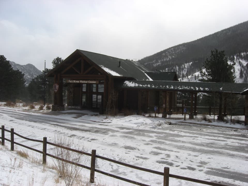 Visitor center · 8.4 mi awayFall River Visitor CenterGet hike and road advice before you enter the park.
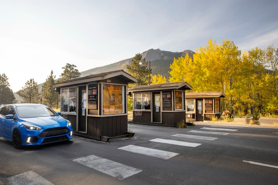 Entrance station · 8.5 mi awayFall River EntranceThe staffed eastern gateway to Rocky Mountain National Park.
 Campground · 8.7 mi awayAspenglen CampgroundWooded camping near Fall River Entrance, including five walk-to sites.
 Sight · 9 mi awayLawn LakeHigh alpine lake, long hike, and a sobering flood history.
 Visitor center · 9.2 mi awayBeaver Meadows Visitor CenterA National Historic Landmark that helps you plan the day.
Parkwolf’s Rocky Mountain ranking
The audio tour guide for the drive, plus offline maps, trails, and wildlife heatmaps for when the signal drops.




