Parking
Use the signed Cow Creek Trailhead lot on McGraw Ranch Road. Walk about 0.2 mile to the North Boundary turn, then another 2.4 miles on North Boundary to the cairned Husted branch.

Rocky Mountain National Park, CO
A historic West Creek track with a long approach and fading tread.
Overview
Map & elevation
Plan your hike

The highest, rockiest slopes around here are a summer buffet for grizzly bears.
Rocky Mountain Tour Guide
Parkwolf is a GPS audio tour guide for Rocky Mountain National Park. As you drive, it chimes in with what’s ahead: hidden gems, upcoming stops, history, geology, and wildlife, right through your car’s speakers.
See the Rocky Mountain audio tourRecorded for this trailhead
Cow Creek: The Hike to Bridal Veil Falls“Up ahead is Cow Creek Trailhead, the start of a half-day hike to Bridal Veil Falls. Allow about four hours for six point two miles round trip and roughly a thousand feet of climbing.”
Plays as you drive up to this trailhead in the Parkwolf Rocky Mountain Tour Guide.
More stories near here in the app
“…No cell service for majority of the day but had continuous access to the app - the maps, the tour guide as you drive is amazing. Highly recommend purchasing the subscription.”


Trail guide
Husted Trail is a historic, unmaintained out-and-back west from North Boundary into the West Creek drainage. From Cow Creek Trailhead, budget about 11 miles round trip: around 2.6 miles each way to the Husted junction, then about 3 miles each way on the old track. Allow about eight to ten hours. A sampled elevation profile suggests roughly 3,200 feet of cumulative climbing, including the North Boundary saddle and the return climb. This is a hard day for hikers comfortable navigating a faint trail without reliable signs.
From Cow Creek, follow North Boundary; the route turns onto it about 0.2 mile from the trailhead. Continue roughly 2.4 miles to a small drainage and a cairn on a broad, flat boulder. The Husted path leaves west from there. It's easy to walk past, so mark the spot for your return. North Boundary drops toward West Creek after the saddle, so the way back includes a climb you already did on the way in.
Husted climbs west. Mount Dickinson comes into view early, and a south-facing view opens higher up. The track enters the fire-affected West Creek area, where the old tread can become hard to distinguish and cairns give only a general direction. The mapped line runs about three miles from the junction, but it doesn't guarantee clear tread all the way. Turn back when the path stops being recognizable. Mount Dickinson summit outings continue off-trail beyond Husted and are not part of this hike.
The route enters the West Creek Research Natural Area. Daytime foot travel is allowed there, but the National Park Service discourages it; overnight use is not permitted. Pets are prohibited on all park trails. Park at the signed Cow Creek Trailhead lot on McGraw Ranch Road.
Wildlife
 3,124 sightingsElkMost seen around 6 PMSighting map
 1,601 sightingsMooseMost seen around 7 PMSighting map
 19 sightingsMountain GoatMost seen around 7 AMSighting map
 19 sightingsBald EagleMost seen around 8 AMSighting map
 30 sightingsGolden EagleMost seen around 10 AMSighting map
 270 sightingsBighorn SheepMost seen around 11 AMSighting map
Sighting maps show where each species has been reported across Rocky Mountain. Wildlife moves, so no sighting is guaranteed.
Keep exploring
 ModerateWest Creek Falls Trail4.4 mi · 3.5 hr · At the trailheadA steep ridge walk ends at two cascades in a rocky gorge.
 ChallengingNorth Boundary Trail5.9 mi · 5.5 hr · At the trailheadA hard ridge traverse opens to views of the Mummy Range.
 ModerateBridal Veil Falls Trail6.2 mi · 4 hr · At the trailheadA 6.2-mile round trip from meadows to a rocky waterfall
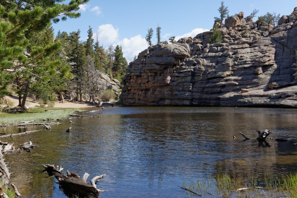 ChallengingLumpy Ridge Loop10.6 mi · 7 hr · 2.5 mi awayA full day around Lumpy Ridge, from ranch meadows to Gem Lake.ModerateBalanced Rock Trail7.3 mi · 4.5 hr · 2.5 mi awayA steep Gem Lake climb, then Balanced Rock and Estes Park views.ModerateGem Lake Trail3.2 mi · 2.5 hr · 2.5 mi awayRock steps climb to a small lake tucked beneath granite walls.
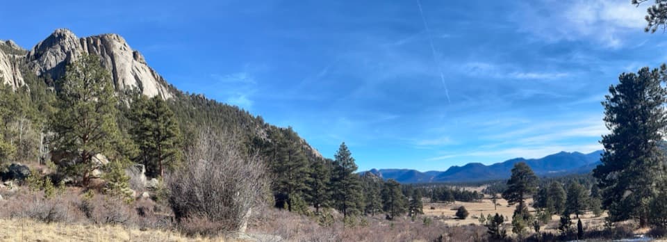 ModerateBlack Canyon Trail4.2 mi · 2.5 hr · 2.5 mi awayA 4.2-mile out-and-back beneath Twin Owls and Lumpy Ridge.
 ModerateMacGregor Falls Trail6.4 mi · 3.5 hr · 2.5 mi awayMeadows, granite creek cascades, and a slab waterfallSight · 1.4 mi awayGem LakeA small granite-ringed lake worth the sustained uphill climb.
 Sight · 2.7 mi awayBridal Veil FallsA 20-foot waterfall beyond meadows, aspens and a steep rocky finish.
 Visitor center · 3.7 mi awayEstes Park Visitor CenterA town-side start for local advice and the seasonal RMNP shuttle.
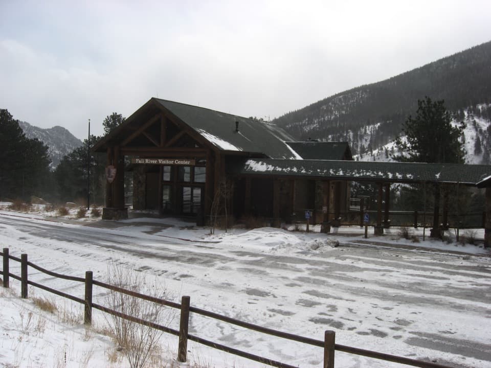 Visitor center · 4.9 mi awayFall River Visitor CenterGet hike and road advice before you enter the park.
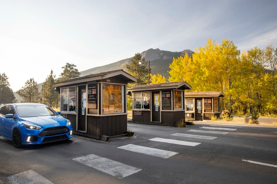 Entrance station · 5.1 mi awayFall River EntranceThe staffed eastern gateway to Rocky Mountain National Park.
 Campground · 5.3 mi awayAspenglen CampgroundWooded camping near Fall River Entrance, including five walk-to sites.
 Visitor center · 5.5 mi awayBeaver Meadows Visitor CenterA National Historic Landmark that helps you plan the day.
 Sight · 5.7 mi awayDeer MountainThe last steep steps open onto a wide Front Range panorama.
Parkwolf’s Rocky Mountain ranking

The audio tour guide for the drive, plus offline maps, trails, and wildlife heatmaps for when the signal drops.




