
Place
Easy
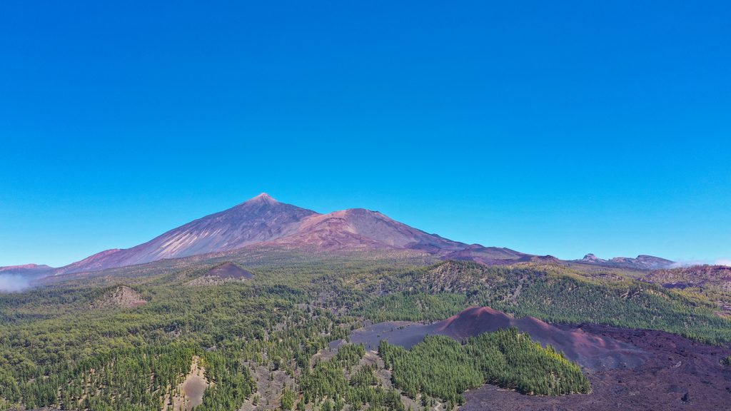
This mellow loop circles Montaña Chinyero—the youngest volcano on Tenerife—through the Chinyero Special Nature Reserve, just outside but often paired with Teide days. Expect a 4.1‑mile total loop (about 6.6 km) that most hikers cruise in 2–3 hours. Elevation gain sits roughly in the 150–230 m range depending on the variant, and the overall feel is easy if you’re used to uneven ground.
You’ll start among Canary pine, then break onto dark “malpaís” lava and soft cinder (picón). The red‑black cinder cone of Chinyero stays in view while rugged flows from the 1909 eruption frame the path—look for places where the lava froze mid‑advance. Underfoot alternates between firm dirt, loose cinder, and short rough patches of sharp basalt. On clear days, views toward Teide pop between pine corridors.
Chinyero’s last eruption kicked off on November 18, 1909 and ran about 10 days, laying down the fresh flows you’re walking beside. The reserve protects young lava fields, cinder cones, and pioneer flora—part of why staying on signed paths matters.
Access is off the TF‑38 (Boca Tauce–Chío road). Parking is limited at a small dirt pull‑out near km 15; arrive early. If spaces are full, park at Mirador de los Poleos and add roughly 1.5 km of pleasant approach. Wayfinding is straightforward: follow white‑yellow PR markings on PR‑TF 43 around the cone. Note some posts reference distances from the network’s main start elsewhere—stick with the circular signs. No permit is required for this loop.
You can also reach the loop via signed feeders: PR‑TF 43.1 from San José de los Llanos, 43.2 from Los Partidos/Pino Loro, or 43.3 from Santiago del Teide. Want more? Extend toward Arenas Negras for a longer day.
Year‑round works. Black lava means strong sun; pine forest brings cool, damp shade when trade‑wind clouds drift through (that “horizontal rain” effect). In summer, start early; in winter, clear air makes for big views. Carry water, sun protection, and a wind layer.
If you want big Canary‑Islands contrast—inky lava seas, bright cinder, pockets of pine, and Teide views—for little effort, this circuit delivers. The only real downsides are limited parking and abrasive lava underfoot. As a warm‑up or a half‑day paired with Teide viewpoints, it’s a winner.
Small dirt pull‑out on TF‑38 near km 15 marks the start; spaces are few. If full, park at Mirador de los Poleos and walk a short extra approach.
Stay on signed trails inside the Special Nature Reserve. Expect uneven, sharp lava and loose cinder; sturdy shoes (and poles if you like) recommended. Sun can be intense on open lava while wind and cloud‑drip make forest sections cool and damp. Waymarks are clear, but some posts reference distances from other PR‑TF 43 segments—watch the loop junctions.
Place
Place
Place
Place
Challenging
Moderate
Challenging
Challenging

Parkwolf Tour Guide
