Herðubreiðarlindir in Vatnajökull National Park

Campground · Vatnajökull National Park

Herðubreiðarlindir

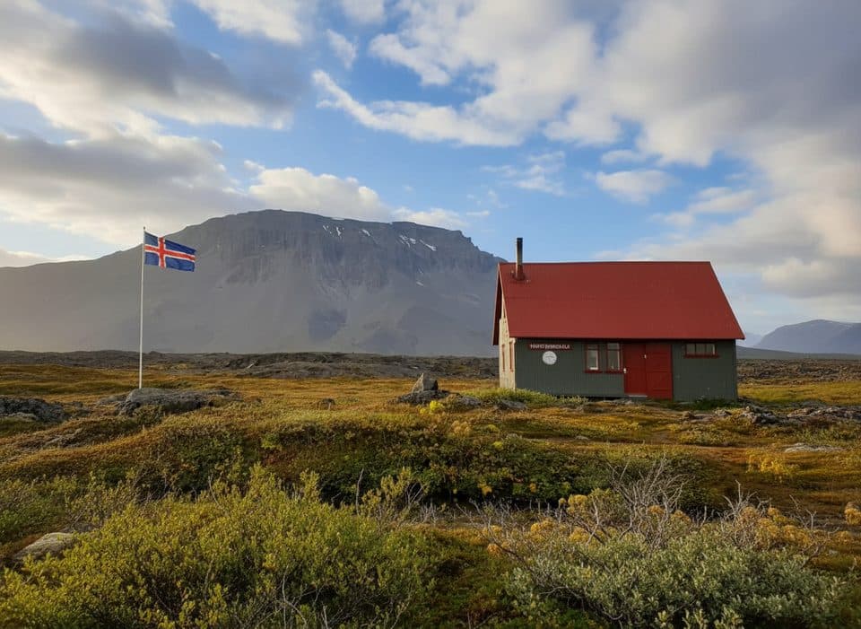
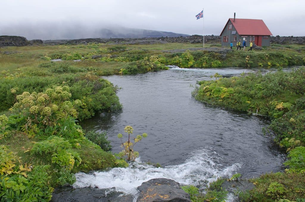
Spring-fed oasis camp beneath Herðubreið in the lava desert

Photo: Wikimedia Commons
Type
Campground
Audio stories
2 nearby
  • Restrooms
  • Ranger station
  • Trailhead

Hear the audio tour

Herðubreiðarlindir, Oasis in a Lava Desert

Overview

About Herðubreiðarlindir

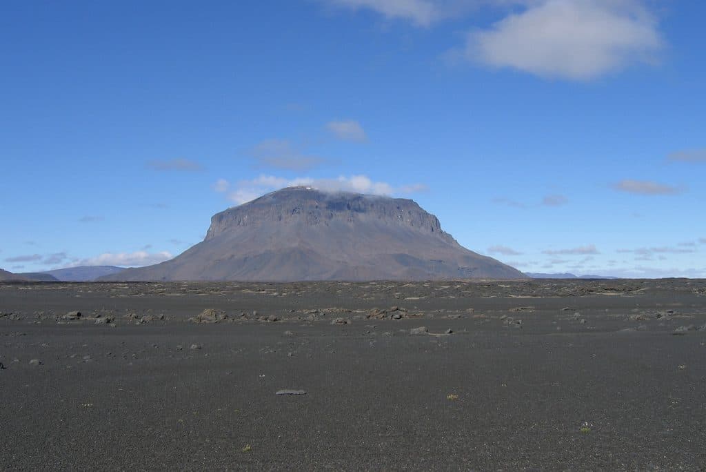
Herðubreiðarlindir is the rare green oasis on the edge of the Ódáðahraun lava desert, tucked beneath the table mountain Herðubreið. Springs feed lush patches of vegetation and birdlife in an otherwise stark, otherworldly plain. It’s peaceful, photogenic, and makes a smart base for both gentle walks and serious highland treks.

Why stop

  • Spring-fed oasis with short interpretive walks and wildlife
  • Managed campground and hut with summer ranger presence
  • Gateway to Herðubreið hikes and longer highland treks

Heads up

  • Remote highland access requires 4x4 and is summer-only
  • No fuel, shops, or restaurants—bring all supplies and water
  • Wind, midges, and stony tent pads can make camping rough
If you’re exploring Askja and the northern highlands, this is the calm counterpoint to all that black lava—shade, water, and soft greens. You can stretch your legs on short interpretive paths near the springs, wander along Lindaá, or set out toward the base of Herðubreið. Rangers are stationed here in summer, which is invaluable for current conditions and route advice.
Parkwolf’s verdictWhy it’s worth your time

Map

Where it is

Loading the Vatnajökull map
Full map
CampgroundHerðubreiðarlindir65.19272, -16.22262
Keep this map with you offline in the Parkwolf app

Local know-how

Tips for visiting Herðubreiðarlindir

  1. Fill up on fuel and bring all food; there are no services in Drekagil or Lindir.

  2. Access is summer-only and requires a proper 4x4; check F-road status before you go.

  3. Carry extra drinking water even though the oasis is spring-fed.

  4. Tell rangers your plan and get current route advice, especially for Herðubreið.

  5. Expect wind, cold nights, and midges—bring a headnet and rock-solid tent stakes.

Plan your stop

Before you go

Best time to visit

Summer only, when highland F-roads usually open from mid–late June. July–August offer the most reliable access; by August nights start to darken again, which matters for long outings. September brings colder, wetter conditions and potential closures. For photos, aim for early or late light; the hut and campground can book up on peak-season weekends, so reserve ahead if you need a bed.

Getting there and access notes

This is a remote highland location north of the Vatnajökull ice cap. Access typically requires summer conditions and a true 4x4 on F-roads. Distances across the lava can be deceptive and it’s easy to lose your bearings among similar-looking formations—carry offline maps/GPS and check in with rangers on arrival for current road and trail status.

1 active Vatnajökull alert

  • ClosureFosshvammur permanently closed at DettifossFosshvammur at Dettifoss is permanently closed to all traffic; do not enter.Official details
Vatnajökull alerts
A park ranger sits on a dash-mounted phone, talking, as Parkwolf’s Tour Guide plays “Army Cutworm Moths: A Grizzly Bear Buffet” on Grand Loop Road below Dunraven Pass in Yellowstone
Parkwolf Tour GuideThe highest, rockiest slopes around here are a summer buffet for grizzly bears.

Vatnajökull Tour Guide

Your drive to Herðubreiðarlindir, narrated.

Parkwolf is a GPS audio tour guide for Vatnajökull National Park. As you drive, it chimes in with what’s ahead: hidden gems, upcoming stops, history, geology, and wildlife, right through your car’s speakers.

Recorded for this place

Herðubreiðarlindir, Oasis in a Lava Desert
Listen
“You're coming up on Herðubreiðarlindir, and it's a pretty dramatic sight. It’s a green, spring-fed oasis popping up right in the middle of the Ódáðahraun lava desert.”

Plays as you drive up to Herðubreiðarlindir in the Parkwolf Vatnajökull Tour Guide.

More stories near here in the app

  • Herðubreið: Born Under Ice
  • 102 audio storiesacross Vatnajökull’s roads, triggered by GPS as you drive
  • Wildlife heatmapsfor Grey Seal, Harbor Seal, Caribou, and 13 more
  • Works offlinemaps, 16 trails, 72 places, and audio download before you lose signal
  • CarPlay readysimple controls built for the drive
★★★★★
“Fantastic app with many points of information… It’s great to just turn on while you’re driving and it gives you an audio tour of the national Park. We love it!!!!”
JMJamesApp Store review
Download Parkwolf on the App StoreGet Parkwolf on Google Play

4.7 from 8,600+ ratings

Guide

More about Herðubreiðarlindir

Trails and classic outingsShort walks: loops around Herðubreiðarvötn, along Lindaá, and an interpretive trail into the…
  • Short walks: loops around Herðubreiðarvötn, along Lindaá, and an interpretive trail into the lava.
  • To the base of Herðubreið: a marked footpath, about 2 hours total.
  • Toward the Herðubreið ascent point: roughly 3 hours each way from Lindir (the climb itself is a serious undertaking, about 12 hours roundtrip from Lindir via the standard gully).
  • Long trek: waymarked route via Flötudyngja to Bræðrafell (near Kollóttudyngja), 7–9 hours from Herðubreiðarlindir.
Camping, hut, and on-site servicesThere’s a designated campground beside an overnight hut operated by the Touring Club of…

There’s a designated campground beside an overnight hut operated by the Touring Club of Akureyri, tended by wardens in season. Facilities are basic but include restrooms; expect everything to be spread out a bit across the site. Book the hut in peak summer, and don’t count on buying anything here—there are no shops, restaurants, or fuel nearby.

Safety and highland smartsWater and supplies: Despite the springs, the wider Ódáðahraun region is water-scarce—bring…
  • Water and supplies: Despite the springs, the wider Ódáðahraun region is water-scarce—bring ample drinking water and all food.
  • Weather and footing: Expect rapid weather shifts, cold nights, wind, loose scree, and early-season snow/ice higher up.
  • Herðubreið ascent: Rockfall is a known hazard; avoid clustering under cliffs, start early, and discuss your plan with rangers.
History and nature notesLocal lore holds that the outlaw Fjalla-Eyvindur once wintered at Herðubreiðarlindir, adding a…

Local lore holds that the outlaw Fjalla-Eyvindur once wintered at Herðubreiðarlindir, adding a dash of highland legend to the landscape. Geologically, you’re standing where Iceland’s “fire and ice” forces shape the land—active volcanism and relentless erosion side by side.

Pair it withAskja to the south and the Jökulsárgljúfur area (Dettifoss–Ásbyrgi) to the north make a natural…

Askja to the south and the Jökulsárgljúfur area (Dettifoss–Ásbyrgi) to the north make a natural multi-day circuit when the highlands are open.

Wildlife

Wildlife in Vatnajökull

All Vatnajökull wildlife maps

Sighting maps show where each species has been reported across Vatnajökull. Wildlife moves, so no sighting is guaranteed.

Parkwolf’s Vatnajökull ranking

Top sights in Vatnajökull

All 72 places
  1. 1DettifossSight
  2. 2JökulsárlónSight
  3. 3Dettifoss West ViewpointSight
  4. 4Diamond Beach (Breiðamerkursandur)Beach
  5. 5MúlagljúfurSight
  6. 6Breidamerkurjökull GlacierSight

Take Parkwolf to Vatnajökull.

The audio tour guide for the drive, plus offline maps, trails, and wildlife heatmaps for when the signal drops.

4.7 from 8,600+ ratings

Download Parkwolf on the App StoreGet Parkwolf on Google Play