Best time to visit
Summer is the practical window, when F‑roads typically open. Check road, weather, and safety updates the day you travel; conditions change fast in the Highlands. There’s no crowd problem here—remoteness is the gatekeeper.
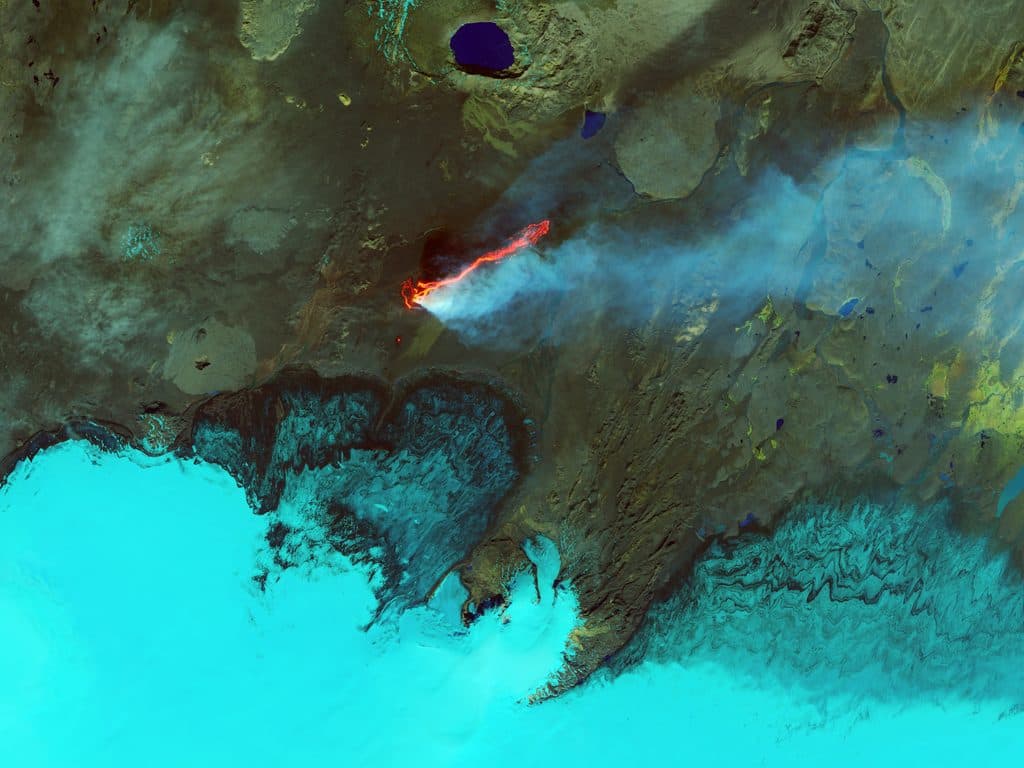
Sight · Vatnajökull National Park
Vast, fresh lava field from Iceland’s 2014–15 fissure eruption
Overview
Holuhraun is a vast, raw lava field born from a six‑month fissure eruption in 2014–2015—the largest effusive event in Iceland in over two centuries. It sits in the remote Highlands north of the Vatnajökull ice cap, within a UNESCO‑listed protected area. Expect a stark, otherworldly landscape of fresh basalt with jagged textures and endless forms.
Few places let you stand on a lava field this young. Holuhraun is a textbook example of Iceland’s living geology and even serves as an analogue for exploring young volcanic terrains on other planets.
 Parkwolf’s verdictWhy It’s Special
Map
Local know-how
Use a true 4x4 and verify F‑road status (e.g., F910) before departure.
There are zero services on site—bring all water, food, fuel, and pack out waste.
Stay on the waymarked trail from the Holuhraun parking area; the crust off‑trail can be unsafe.
Monitor park and meteorological advisories for gas alerts and potential closures.
If you’re unsure about Highland driving, book a qualified guided trip instead.
Plan your stop

The highest, rockiest slopes around here are a summer buffet for grizzly bears.
Vatnajökull Tour Guide
Parkwolf is a GPS audio tour guide for Vatnajökull National Park. As you drive, it chimes in with what’s ahead: hidden gems, upcoming stops, history, geology, and wildlife, right through your car’s speakers.
“Fantastic app with many points of information… It’s great to just turn on while you’re driving and it gives you an audio tour of the national Park. We love it!!!!”


Guide
The eruption produced a Hawaiian‑style basaltic lava flow that blanketed roughly 83–85+ km² with an estimated 1.4–1.6 km³ of lava—monumental by modern Icelandic standards. The crust here is young and fragile in places, with concealed voids beneath the surface. That combo makes Holuhraun both scientifically important and a place where staying on the designated route really matters.
Wildlife
 22 sightingsGrey SealMost seen around 5 AMSighting map
 258 sightingsHarbor SealMost seen around 11 AMSighting map
 184 sightingsCaribouMost seen around 7 PMSighting map
 62 sightingsArctic FoxMost seen around 8 PMSighting map
 168 sightingsWhooper SwanMost seen around 5 PMSighting map
 68 sightingsAtlantic PuffinMost seen around 7 PMSighting map
Sighting maps show where each species has been reported across Vatnajökull. Wildlife moves, so no sighting is guaranteed.
Parkwolf’s Vatnajökull ranking
The audio tour guide for the drive, plus offline maps, trails, and wildlife heatmaps for when the signal drops.