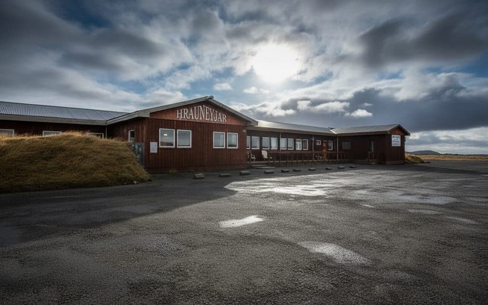
Pros & cons
PROS
- Up-to-date road, weather, and hike info for Nýidalur & Tungnaáröræfi
- Area-specific exhibit to orient you before heading into the highlands
- Adjacent Highland Center offers food, fuel, and lodging
CONS
- Hours vary seasonally; verify before you plan a long detour
- Highland access is highly seasonal and often requires 4x4 and river crossings
Overview
Hrauneyjar Information Centre is the park’s official hub for the Nýidalur and Tungnaáröræfi sectors—your briefing room before committing to Iceland’s remote highlands. Expect current updates on roads, river conditions, weather, hikes, services, and accommodation, plus an exhibit that explains the local landscape and how to approach it responsibly.
Why Stop Here
This is the smart place to sanity-check your plan before F-roads and long gravel stretches. Staff can point you toward feasible routes, recent closures, and realistic hiking options for the day. Right next door, the private Highland Center Hrauneyjar functions as the practical “last outpost,” with food, fuel, and rooms if plans change.
What You'll Find
- Park information tailored to Nýidalur & Tungnaáröræfi, including route and trail guidance.
- An area-focused exhibit to give context to the volcanic deserts, lava fields, and glacier-framed highlands you’re about to enter.
- Pointers on where to base, when huts open, and how to match your route to the day’s conditions.
Seasonality & Access
Highland travel here is summer-centric. Many F-roads typically open mid-to-late June and remain passable into early September, weather permitting. Outside that window, plans often need to pivot. Even in season, 4x4 is the norm and river crossings can be part of the equation—plan conservatively and confirm conditions at the desk.

Nearby Launch Points
From Hrauneyjar, drivers commonly stage for Landmannalaugar, Eldgjá/Langisjór, Sprengisandur, Veiðivötn, and Fjallabak—the classic “fire and ice” country framing Vatnajökull’s fringes. The centre helps you decide what’s realistic for your time, vehicle, and weather.
Best Time to Visit
- Late June to early July is the sweet spot for opening F-roads and calmer weather in the highlands.
- Aim to stop in the morning to get the latest conditions before you commit to a route.
- Expect reduced hours outside peak season; confirm ahead if you’re timing a long drive around a quick consult.
Bottom Line
If you’re tackling the highlands on the west side of the park, this is an essential pit stop—short, practical, and potentially trip-saving.
Where it is
64.1970, -19.2850Tips for Hrauneyjar Visitor Center
- 01Check F-road openings and river conditions here before setting a route.
- 02Confirm opening hours in shoulder seasons; they can be reduced.
- 03Top up fuel, food, and water at the adjacent Highland Center before heading out.
- 04Ask staff to match hikes and routes to your vehicle type and weather window.
- 05Have a backup plan; highland access can change quickly even in mid-summer.
Amenities
Near Hrauneyjar Visitor Center
All places →All trails →
25.8 mi awayÓfærufossTiered waterfall tucked inside a vast volcanic fissureTrailhead · Parking
25.9 mi awayEldgjáVast volcanic canyon with an easy walk to ÓfærufossTrailhead · Parking
26.9 mi awaySveinstindurShort, steep summit with sweeping views of Langisjór and glaciersTrailhead · Parking
31.4 mi awayTjarnargígurQuiet blue crater lake in the Laki lava fieldsParking · Scenic Viewpoint
71.1 mi awaySjónarnípa Viewpoint Trail (S6)Basalt falls plus a cliff-top glacier overlook in one tidy loop.Moderate · 4.6 mi · 2.5 hr
71.1 mi awayKristínartindar Trail (S4)Glacier panoramas with a steep, loose scree summit push.Challenging · 11.4 mi · 7 hr
71.1 mi awaySvartifoss Waterfall (Skaftafell)Basalt-column beauty via a short uphill walk from Skaftafell.Moderate · 2.1 mi · 1.5 hr
71.1 mi awaySvartifoss–Sjónarsker–Sel (S2)Basalt falls, big views, and turf houses in one tidy loopModerate · 3.6 mi · 2 hr